Saint-Yrieix-les-Bois
| Saint-Yrieix-les-Bois | |
|---|---|
|
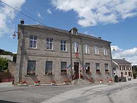
The town hall in Saint-Yrieix-les-Bois | |
 Saint-Yrieix-les-Bois | |
|
Location within Nouvelle-Aquitaine region  Saint-Yrieix-les-Bois | |
| Coordinates: 46°06′02″N 1°56′21″E / 46.1006°N 1.9392°ECoordinates: 46°06′02″N 1°56′21″E / 46.1006°N 1.9392°E | |
| Country | France |
| Region | Nouvelle-Aquitaine |
| Department | Creuse |
| Arrondissement | Guéret |
| Canton | Ahun |
| Intercommunality | Pays Creuse-Thaurion-Gartempe |
| Government | |
| • Mayor (2008–2014) | Sylvie Labar |
| Area1 | 15.7 km2 (6.1 sq mi) |
| Population (2008)2 | 324 |
| • Density | 21/km2 (53/sq mi) |
| Time zone | CET (UTC+1) |
| • Summer (DST) | CEST (UTC+2) |
| INSEE/Postal code | 23250 / 23150 |
| Elevation |
417–645 m (1,368–2,116 ft) (avg. 460 m or 1,510 ft) |
|
1 French Land Register data, which excludes lakes, ponds, glaciers > 1 km² (0.386 sq mi or 247 acres) and river estuaries. 2 Population without double counting: residents of multiple communes (e.g., students and military personnel) only counted once. | |
Saint-Yrieix-les-Bois (Occitan: Sent Iriès) is a commune in the Creuse department in central France.
Population
| Historical population | ||
|---|---|---|
| Year | Pop. | ±% |
| 1962 | 332 | — |
| 1968 | 385 | +16.0% |
| 1975 | 338 | −12.2% |
| 1982 | 307 | −9.2% |
| 1990 | 326 | +6.2% |
| 1999 | 311 | −4.6% |
| 2008 | 324 | +4.2% |
See also
References
| Wikimedia Commons has media related to Saint-Yrieix-les-Bois. |
This article is issued from Wikipedia - version of the 10/8/2016. The text is available under the Creative Commons Attribution/Share Alike but additional terms may apply for the media files.