Sainte-Feyre
| Sainte-Feyre | |
|---|---|
|
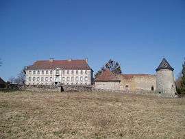
Chateau | |
 Sainte-Feyre | |
|
Location within Nouvelle-Aquitaine region  Sainte-Feyre | |
| Coordinates: 46°08′20″N 1°54′57″E / 46.1389°N 1.9158°ECoordinates: 46°08′20″N 1°54′57″E / 46.1389°N 1.9158°E | |
| Country | France |
| Region | Nouvelle-Aquitaine |
| Department | Creuse |
| Arrondissement | Guéret |
| Canton | Guéret-Sud-Est |
| Intercommunality | Guéret Saint-Vaury |
| Government | |
| • Mayor (2008–2014) | Michel Villard |
| Area1 | 29.99 km2 (11.58 sq mi) |
| Population (2008)2 | 2,241 |
| • Density | 75/km2 (190/sq mi) |
| Time zone | CET (UTC+1) |
| • Summer (DST) | CEST (UTC+2) |
| INSEE/Postal code | 23193 / 23000 |
| Elevation | 310–662 m (1,017–2,172 ft) |
|
1 French Land Register data, which excludes lakes, ponds, glaciers > 1 km² (0.386 sq mi or 247 acres) and river estuaries. 2 Population without double counting: residents of multiple communes (e.g., students and military personnel) only counted once. | |
Sainte-Feyre is a commune in the Creuse department in central France.
Population
| Historical population | ||
|---|---|---|
| Year | Pop. | ±% |
| 1793 | 1,374 | — |
| 1800 | 1,394 | +1.5% |
| 1806 | 1,432 | +2.7% |
| 1821 | 1,492 | +4.2% |
| 1831 | 1,508 | +1.1% |
| 1836 | 1,567 | +3.9% |
| 1841 | 1,623 | +3.6% |
| 1846 | 1,709 | +5.3% |
| 1851 | 1,741 | +1.9% |
| 1856 | 1,734 | −0.4% |
| 1861 | 1,648 | −5.0% |
| 1866 | 1,728 | +4.9% |
| 1872 | 1,788 | +3.5% |
| 1876 | 1,761 | −1.5% |
| 1881 | 1,701 | −3.4% |
| 1886 | 1,761 | +3.5% |
| 1891 | 1,702 | −3.4% |
| 1896 | 1,619 | −4.9% |
| 1901 | 1,668 | +3.0% |
| 1906 | 1,767 | +5.9% |
| 1911 | 1,743 | −1.4% |
| 1921 | 1,614 | −7.4% |
| 1926 | 1,617 | +0.2% |
| 1931 | 1,653 | +2.2% |
| 1936 | 1,686 | +2.0% |
| 1946 | 1,654 | −1.9% |
| 1954 | 1,703 | +3.0% |
| 1962 | 1,425 | −16.3% |
| 1968 | 1,457 | +2.2% |
| 1975 | 1,547 | +6.2% |
| 1982 | 1,889 | +22.1% |
| 1990 | 2,250 | +19.1% |
| 1999 | 2,251 | +0.0% |
| 2008 | 2,241 | −0.4% |
See also
References
| Wikimedia Commons has media related to Sainte-Feyre. |
This article is issued from Wikipedia - version of the 10/8/2016. The text is available under the Creative Commons Attribution/Share Alike but additional terms may apply for the media files.