Sahla Tahtania
| Sahla Tahtania | |
|---|---|
| Village | |
 Sahla Tahtania | |
| Coordinates: DZ 27°16′39″N 2°29′25″E / 27.27750°N 2.49028°ECoordinates: DZ 27°16′39″N 2°29′25″E / 27.27750°N 2.49028°E | |
| Country |
|
| Province | Tamanrasset Province |
| District | In Salah District |
| Commune | In Salah[1] |
| Elevation | 275 m (902 ft) |
| Time zone | CET (UTC+1) |
Sahla Tahtania (also written Sahela Tahtania) is a village in the commune of In Salah,[1] in In Salah District, Tamanrasset Province, Algeria. It is located just to the west of the N1 national highway, 9 kilometres (5.6 mi) north of the town of In Salah.[2]
References
- 1 2 "Décret n° 84-365, fixant la composition, la consistance et les limites territoriale des communes. Wilaya d'El Oued" (PDF) (in French). Journal officiel de la République Algérienne,. 19 December 1984. p. 1495. Archived from the original (PDF) on 2 March 2013 or before. Retrieved 6 June 2013. Check date values in:
|archive-date=(help) - ↑ "Sahela Tahtania, Algeria". Geonames.org. Retrieved 20 June 2013.
Neighbouring towns and cities
 |
Timimoun (Adrar) | Ghardaïa El Goléa (Ghardaïa) |
Foggaret Ezzaouia | |
| Adrar In Ghar |
|
Sahla Fougania Bordj Omar Driss (Illizi) Illizi | ||
| ||||
| | ||||
| El Barka | In Salah Tamanrasset |
Amguid Idlès |
| Tamanrasset District | 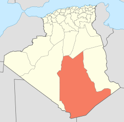 | |||||||
|---|---|---|---|---|---|---|---|---|
| In Salah District | ||||||||
| Tazrouk District | ||||||||
| Abalessa District | ||||||||
| In Ghar District | ||||||||
| Tin Zaouatine District | ||||||||
| In Guezzam District | ||||||||
This article is issued from Wikipedia - version of the 6/20/2013. The text is available under the Creative Commons Attribution/Share Alike but additional terms may apply for the media files.