Rushford (CDP), New York
| Rushford, New York | |
|---|---|
| Census-designated place | |
 Rushford Location within the state of New York | |
| Coordinates: 42°23′31″N 78°15′12″W / 42.39194°N 78.25333°WCoordinates: 42°23′31″N 78°15′12″W / 42.39194°N 78.25333°W | |
| Country | United States |
| State | New York |
| County | Allegany |
| Town | Rushford |
| Area | |
| • Total | 0.5 sq mi (1.4 km2) |
| • Land | 0.5 sq mi (1.4 km2) |
| • Water | 0.0 sq mi (0.0 km2) |
| Elevation | 1,500 ft (500 m) |
| Population (2010) | |
| • Total | 363 |
| • Density | 670/sq mi (260/km2) |
| Time zone | Eastern (EST) (UTC-5) |
| • Summer (DST) | EDT (UTC-4) |
| ZIP code | 14777 |
| Area code(s) | 585 |
| FIPS code | 36-64155 |
| GNIS feature ID | 0963104 |
Rushford is a census-designated place comprising the central settlement in the town of Rushford, Allegany County, New York, United States. As of the 2010 census it had a population of 363,[1] out of a total population of 1,150 in the town.
Geography
The Rushford CDP is located near the center of the town of Rushford, north of Caneadea Creek, a tributary of the Genesee River. New York State Route 243 bypasses the center of the community, forming the northeast edge of the CDP. It leads east 6 miles (10 km) to Route 19 in the Genesee River valley and northwest into Cattaraugus County.
According to the United States Census Bureau, the Rushford CDP has a total area of 0.54 square miles (1.4 km2).[1]
References
- 1 2 "Geographic Identifiers: 2010 Demographic Profile Data (G001): Rushford CDP, New York". U.S. Census Bureau, American Factfinder. Retrieved June 28, 2013.
Municipalities and communities of Allegany County, New York, United States | ||
|---|---|---|
| Towns | 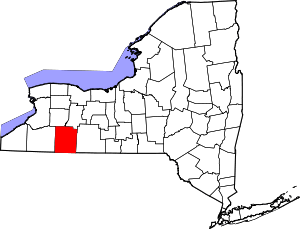 | |
| Villages | ||
| CDPs | ||
| Hamlets | ||
| Indian reservation | ||
| Footnotes | ‡This populated place also has portions in an adjacent county or counties | |
This article is issued from Wikipedia - version of the 9/8/2016. The text is available under the Creative Commons Attribution/Share Alike but additional terms may apply for the media files.