Cuba (village), New York
| Cuba, New York | |
|---|---|
| Village | |
 Cuba Location within the state of New York | |
| Coordinates: 42°13′4″N 78°16′31″W / 42.21778°N 78.27528°WCoordinates: 42°13′4″N 78°16′31″W / 42.21778°N 78.27528°W | |
| Country | United States |
| State | New York |
| County | Allegany |
| Town | Cuba |
| Area | |
| • Total | 1.22 sq mi (3.15 km2) |
| • Land | 1.22 sq mi (3.15 km2) |
| • Water | 0.0 sq mi (0.0 km2) |
| Elevation | 1,496 ft (456 m) |
| Population (2010) | |
| • Total | 1,575 |
| • Density | 1,295/sq mi (499.9/km2) |
| Time zone | Eastern (EST) (UTC-5) |
| • Summer (DST) | EDT (UTC-4) |
| ZIP code | 14727 |
| Area code(s) | 585 |
| FIPS code | 36-19356 |
| GNIS feature ID | 0947911 |
| Website |
www |
Cuba is a village in Allegany County, New York, United States. The population was 1,575 at the 2010 census.[1] The village is in the western part of the town of Cuba at the junction of Routes 305 and 446 on Oil Creek.
History
An early missionary mentioned a native oil spring at this location. The village of Cuba was incorporated in 1850.
The Cuba Cemetery, Main Street Historic District, and South Street Historic District are listed on the National Register of Historic Places.[2][3]
Geography
Cuba is located at 42°13′3″N 78°16′30″W / 42.21750°N 78.27500°W (42.217743, -78.275261).[4]
According to the United States Census Bureau, the village has a total area of 1.22 square miles (3.15 km2). None of the area is covered with water, except for several narrow streams which pass through the village. Cuba Lake, a large water body, is 2 miles (3 km) north of the village.
The Southern Tier Expressway (Interstate 86 and New York State Highway 17) passes through the north side of the village, with access from Exit 28. NY Route 305 is an important north-south trunk road passing through the village. NY Route 446 runs parallel to the Southern Tier Expressway. Cuba is located on the Main Line of the Western New York and Pennsylvania Railroad.
The village is just east of the border of Cattaraugus County.
North Cuba and South Cuba are small communities respectively north and south of the village on Route 305.
Demographics
| Historical population | |||
|---|---|---|---|
| Census | Pop. | %± | |
| 1880 | 1,251 | — | |
| 1890 | 1,386 | 10.8% | |
| 1900 | 1,502 | 8.4% | |
| 1910 | 1,556 | 3.6% | |
| 1920 | 1,611 | 3.5% | |
| 1930 | 1,422 | −11.7% | |
| 1940 | 1,699 | 19.5% | |
| 1950 | 1,783 | 4.9% | |
| 1960 | 1,949 | 9.3% | |
| 1970 | 1,735 | −11.0% | |
| 1980 | 1,739 | 0.2% | |
| 1990 | 1,690 | −2.8% | |
| 2000 | 1,633 | −3.4% | |
| 2010 | 1,575 | −3.6% | |
| Est. 2015 | 1,529 | [5] | −2.9% |
As of the census[7] of 2000, there were 1,633 people, 636 households, and 410 families residing in the village. The population density was 1,369.0 people per square mile (529.8/km²). There were 698 housing units at an average density of 585.1 per square mile (226.5/km²). The racial makeup of the village was 97.31% White, 0.55% Black or African American, 0.24% Native American, 0.55% Asian, 0.31% from other races, and 1.04% from two or more races. Hispanic or Latino of any race were 1.78% of the population.
There were 636 households out of which 33.6% had children under the age of 18 living with them, 44.7% were married couples living together, 14.2% had a female householder with no husband present, and 35.4% were non-families. 28.1% of all households were made up of individuals and 13.4% had someone living alone who was 65 years of age or older. The average household size was 2.47 and the average family size was 3.02.
In the village the population was spread out with 27.1% under the age of 18, 8.4% from 18 to 24, 25.5% from 25 to 44, 21.7% from 45 to 64, and 17.3% who were 65 years of age or older. The median age was 38 years. For every 100 females there were 83.9 males. For every 100 females age 18 and over, there were 76.8 males.
The median income for a household in the village was $30,682, and the median income for a family was $34,879. Males had a median income of $30,682 versus $22,083 for females. The per capita income for the village was $14,594. About 9.6% of families and 12.9% of the population were below the poverty line, including 12.0% of those under age 18 and 10.4% of those age 65 or over.
References
- ↑ "Geographic Identifiers: 2010 Demographic Profile Data (G001): Cuba village, New York". U.S. Census Bureau, American Factfinder. Retrieved October 27, 2014.
- ↑ National Park Service (2009-03-13). "National Register Information System". National Register of Historic Places. National Park Service.
- ↑ "National Register of Historic Places Listings". Weekly List of Actions Taken on Properties: 2/09/15 through 2/13/15. National Park Service. 2015-02-20.
- ↑ "US Gazetteer files: 2010, 2000, and 1990". United States Census Bureau. 2011-02-12. Retrieved 2011-04-23.
- ↑ "Annual Estimates of the Resident Population for Incorporated Places: April 1, 2010 to July 1, 2015". Retrieved July 2, 2016.
- ↑ "Census of Population and Housing". Census.gov. Archived from the original on May 11, 2015. Retrieved June 4, 2015.
- ↑ "American FactFinder". United States Census Bureau. Archived from the original on 2013-09-11. Retrieved 2008-01-31.
External links
Municipalities and communities of Allegany County, New York, United States | ||
|---|---|---|
| Towns | 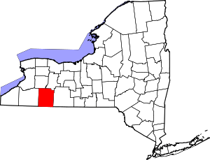 | |
| Villages | ||
| CDPs | ||
| Hamlets | ||
| Indian reservation | ||
| Footnotes | ‡This populated place also has portions in an adjacent county or counties | |