Rumsey, California
Coordinates: 38°53′18″N 122°14′15″W / 38.88833°N 122.23750°W
| Rumsey | |
|---|---|
| Unincorporated community | |
 Rumsey  Rumsey Location in California | |
| Coordinates: 38°53′18″N 122°14′15″W / 38.88833°N 122.23750°W | |
| Country | United States |
| State | California |
| County | Yolo County |
| Elevation[1] | 420 ft (128 m) |
Rumsey is an unincorporated community in Yolo County, California. It is located 18 miles (29 km) northwest of Esparto,[2] in the Capay Valley, in the northwestern part of the county. Rumsey's ZIP Code is 95679 and its area code 530. It lies at an elevation of 420 feet (128 m).
History
A post office was erected in 1878 near the Rumsey community, but it was named "Rock". In 1888 it was moved two miles north to the terminus of the Vaca Valley and Clear Lake Railroad, and the name was changed to "Rumsey". The name "Rock" was after a rock landmark, and the name "Rumsey" was given after Captain D.C. Rumsey who owned the land at the time.[2]
References
- ↑ U.S. Geological Survey Geographic Names Information System: Rumsey, California
- 1 2 Durham, David L. (1998). California's Geographic Names: A Gazetteer of Historic and Modern Names of the State. Clovis, Calif.: Word Dancer Press. p. 548. ISBN 1-884995-14-4.
Municipalities and communities of Yolo County, California, United States | ||
|---|---|---|
| Cities | 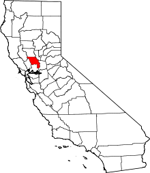 | |
| CDPs | ||
| Unincorporated communities |
| |
| Ghost towns | ||
| Footnotes | ‡This populated place also has portions in an adjacent county or counties | |
This article is issued from Wikipedia - version of the 7/5/2016. The text is available under the Creative Commons Attribution/Share Alike but additional terms may apply for the media files.