Esparto, California
| Esparto Ezperanza (former) | |
|---|---|
| census-designated place | |
|
The Esparto Fire Department station in downtown. | |
| Nickname(s): E-Town | |
 Location in Yolo County and the state of California | |
| Coordinates: 38°41′35″N 122°1′8″W / 38.69306°N 122.01889°WCoordinates: 38°41′35″N 122°1′8″W / 38.69306°N 122.01889°W | |
| Country |
|
| State |
|
| County | Yolo |
| Government | |
| • Senate | Lois Wolk (D) |
| • Assembly | Bill Dodd (D[1]) |
| • U. S. Congress | John Garamendi (D)[2] |
| Area | |
| • Total | 11.917 km2 (4.601 sq mi) |
| • Land | 11.917 km2 (4.601 sq mi) |
| • Water | 0 km2 (0 sq mi) |
| Elevation | 58 m (190 ft) |
| Population (2010) | |
| • Total | 3,108 |
| • Density | 260/km2 (680/sq mi) |
| Time zone | PST (UTC-8) |
| • Summer (DST) | PDT (UTC-7) |
| ZIP codes | 95627 |
| Area code(s) | 530 |
| FIPS code | 06-22846 |
| GNIS feature ID | 0277508 |

Esparto (formerly Esperanza) is a census-designated place (CDP) in Yolo County, California, United States. It is part of the Sacramento–Arden-Arcade–Roseville Metropolitan Statistical Area. The population was 3,108 at the 2010 census.
History
Vaca Valley Railroad officials gave the name Esperanza ("hope" in Spanish) to their new townsite in 1888, but when the post office was established in 1890 the name had to be changed because there was already an Esperanza in Tulare County. The name Esparto was chosen as the new name, and it means "feather grass" in Spanish.[3][4] In 1888 Esparto was laid with track from the Vaca Valley Railroad (later consolidated into the Southern Pacific Railroad) that trailed to Rumsey.[5] In 1893, Yolo County's second high school was established in the town of Esparto, Esparto High School, but a building for it was not built until 1918.[5]
The Vaca Valley Railroad began in 1937 to remove track from Rumsey to Esparto, stopping train service northwest of Esparto in 1941. The passenger service from Esparto to Elmira was officially discontinued in 1957.[5] Voters approved the formation of a school district in 1959-60 that encompass the Capay Valley. Another major win for the community was the successful fundraising for the Esparto Regional Library Branch of the Yolo County Library in 1999.[5]
A local quarry was used in 2009 by the MythBusters to test the "Knock Your Socks off" myth. A large ANFO explosion was detonated which caused damage and much local complaint as described in the episode "Location, Location, Location".
Schools
Esparto currently has 4 schools, Esparto Elementary School, Esparto Middle School, Esparto High School, and Madison High School.
Geography
Esparto is located at 38°41′35″N 122°01′08″W / 38.69306°N 122.01889°W.[6]
According to the United States Census Bureau, the CDP has a total area of 4.6 square miles (12 km2), all of it land.
Demographics
2010
The 2010 United States Census[7] reported that Esparto had a population of 3,108. The population density was 675.5 people per square mile (260.8/km²). The racial makeup of Esparto was 1,855 (59.7%) White, 45 (1.4%) African American, 50 (1.6%) Native American, 129 (4.2%) Asian, 6 (0.2%) Pacific Islander, 904 (29.1%) from other races, and 119 (3.8%) from two or more races. Hispanic or Latino of any race were 1,538 persons (49.5%).
The Census reported that 3,108 people (100% of the population) lived in households, 0 (0%) lived in non-institutionalized group quarters, and 0 (0%) were institutionalized.
There were 974 households, out of which 421 (43.2%) had children under the age of 18 living in them, 560 (57.5%) were opposite-sex married couples living together, 121 (12.4%) had a female householder with no husband present, 66 (6.8%) had a male householder with no wife present. There were 62 (6.4%) unmarried opposite-sex partnerships, and 4 (0.4%) same-sex married couples or partnerships. 172 households (17.7%) were made up of individuals and 76 (7.8%) had someone living alone who was 65 years of age or older. The average household size was 3.19. There were 747 families (76.7% of all households); the average family size was 3.63.
The population was spread out with 888 people (28.6%) under the age of 18, 322 people (10.4%) aged 18 to 24, 817 people (26.3%) aged 25 to 44, 763 people (24.5%) aged 45 to 64, and 318 people (10.2%) who were 65 years of age or older. The median age was 33.1 years. For every 100 females there were 100.5 males. For every 100 females age 18 and over, there were 102.2 males.
There were 1,055 housing units at an average density of 229.3 per square mile (88.5/km²), of which 689 (70.7%) were owner-occupied, and 285 (29.3%) were occupied by renters. The homeowner vacancy rate was 2.3%; the rental vacancy rate was 5.0%. 2,149 people (69.1% of the population) lived in owner-occupied housing units and 959 people (30.9%) lived in rental housing units.
2000
As of the census[8] of 2000, there were 1,858 people, 589 households, and 447 families residing in the CDP. The population density was 2,252.0 people per square mile (864.3/km²). There were 612 housing units at an average density of 741.8 per square mile (284.7/km²). The racial makeup of the CDP was 62.33% White, 0.59% African American, 1.51% Native American, 1.83% Asian, 29.06% from other races, and 4.68% from two or more races. Hispanic or Latino of any race were 42.09% of the population.
There were 589 households out of which 42.6% had children under the age of 18 living with them, 59.9% were married couples living together, 9.8% had a female householder with no husband present, and 24.1% were non-families. 20.4% of all households were made up of individuals and 10.7% had someone living alone who was 65 years of age or older. The average household size was 3.15 and the average family size was 3.68.
In the CDP the population was spread out with 33.2% under the age of 18, 8.5% from 18 to 24, 27.9% from 25 to 44, 19.3% from 45 to 64, and 11.1% who were 65 years of age or older. The median age was 32 years. For every 100 females there were 102.4 males. For every 100 females age 18 and over, there were 101 males.
The median income for a household in the CDP was $41,389, and the median income for a family was $41,037. Males had a median income of $29,737 versus $26,150 for females. The per capita income for the CDP was $13,407. About 12.3% of families and 14.7% of the population were below the poverty line, including 15.1% of those under age 18 and 12.7% of those age 65 or over.
References
- ↑ http://asmdc.org/members/a04/
- ↑ "California's 3rd Congressional District - Representatives & District Map". Civic Impulse, LLC. Retrieved March 1, 2013.
- ↑ Gannett, Henry (1905). The Origin of Certain Place Names in the United States. Govt. Print. Off. p. 121.
- ↑ Durham, David L. (1998). California's Geographic Names: A Gazetteer of Historic and Modern Names of the State. Quill Driver Books. p. 483. ISBN 978-1-884995-14-9.
- 1 2 3 4 "Capay Valley Historical Timeline". Capay Valley Vision. Retrieved 2008-12-28.
- ↑ "US Gazetteer files: 2010, 2000, and 1990". United States Census Bureau. 2011-02-12. Retrieved 2011-04-23.
- ↑ "2010 Census Interactive Population Search: CA - Esparto CDP". U.S. Census Bureau. Retrieved July 12, 2014.
- ↑ "American FactFinder". United States Census Bureau. Retrieved 2008-01-31.
Municipalities and communities of Yolo County, California, United States | ||
|---|---|---|
| Cities | 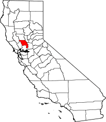 | |
| CDPs | ||
| Unincorporated communities |
| |
| Ghost towns | ||
| Footnotes | ‡This populated place also has portions in an adjacent county or counties | |