Rockham, South Dakota
| Rockham, South Dakota | |
|---|---|
| Town | |
 Location in Faulk County and the state of South Dakota | |
| Coordinates: 44°54′13″N 98°49′32″W / 44.90361°N 98.82556°WCoordinates: 44°54′13″N 98°49′32″W / 44.90361°N 98.82556°W | |
| Country | United States |
| State | South Dakota |
| County | Faulk |
| Platted | 1886[1] |
| Area[2] | |
| • Total | 0.50 sq mi (1.29 km2) |
| • Land | 0.50 sq mi (1.29 km2) |
| • Water | 0 sq mi (0 km2) |
| Elevation | 1,394 ft (425 m) |
| Population (2010)[3] | |
| • Total | 33 |
| • Estimate (2012[4]) | 33 |
| • Density | 66.0/sq mi (25.5/km2) |
| Time zone | Central (CST) (UTC-6) |
| • Summer (DST) | CDT (UTC-5) |
| ZIP code | 57470 |
| Area code(s) | 605 |
| FIPS code | 46-55540[5] |
| GNIS feature ID | 1257439[6] |
Rockham is a town in Faulk County, South Dakota, United States. The population was 33 at the 2010 census.
History
Rockham was platted in 1886.[7] It was named after Rockhampton, in Australia.[7] A post office has been in operation in Rockham since 1887.[8]
Geography
Rockham is located at 44°54′13″N 98°49′32″W / 44.90361°N 98.82556°W (44.903491, -98.825602).[9]
According to the United States Census Bureau, the town has a total area of 0.50 square miles (1.29 km2), all of it land.[2]
Rockham has been assigned the ZIP code 57470 and the FIPS place code 55540.
Demographics
| Historical population | |||
|---|---|---|---|
| Census | Pop. | %± | |
| 1910 | 286 | — | |
| 1920 | 347 | 21.3% | |
| 1930 | 288 | −17.0% | |
| 1940 | 220 | −23.6% | |
| 1950 | 113 | −48.6% | |
| 1960 | 197 | 74.3% | |
| 1970 | 60 | −69.5% | |
| 1980 | 52 | −13.3% | |
| 1990 | 48 | −7.7% | |
| 2000 | 53 | 10.4% | |
| 2010 | 33 | −37.7% | |
| Est. 2015 | 32 | [10] | −3.0% |
2010 census
As of the census[3] of 2010, there were 33 people, 13 households, and 6 families residing in the town. The population density was 66.0 inhabitants per square mile (25.5/km2). There were 28 housing units at an average density of 56.0 per square mile (21.6/km2). The racial makeup of the town was 100.0% White.
There were 13 households of which 23.1% had children under the age of 18 living with them, 46.2% were married couples living together, and 53.8% were non-families. 38.5% of all households were made up of individuals and 15.4% had someone living alone who was 65 years of age or older. The average household size was 2.54 and the average family size was 4.00.
The median age in the town was 34.5 years. 36.4% of residents were under the age of 18; 0.0% were between the ages of 18 and 24; 15.2% were from 25 to 44; 27.4% were from 45 to 64; and 21.2% were 65 years of age or older. The gender makeup of the town was 60.6% male and 39.4% female.
2000 census
As of the census[5] of 2000, there were 53 people, 18 households, and 14 families residing in the town. The population density was 107.2 people per square mile (41.8/km²). There were 27 housing units at an average density of 54.6 per square mile (21.3/km²). The racial makeup of the town was 98.11% White, and 1.89% from two or more races.
There were 18 households out of which 38.9% have children under the age of 18 living with them, 77.8% were married couples living together, and 22.2% were non-families. 22.2% of all households were made up of individuals and 5.6% had someone living alone who was 65 years of age or older. The average household size was 2.94 and the average family size was 3.43.
In the town the population was spread out with 30.2% under the age of 18, 1.9% from 18 to 24, 35.8% from 25 to 44, 15.1% from 45 to 64, and 17.0% who were 65 years of age or older. The median age was 36 years. For every 100 females there were 112.0 males. For every 100 females age 18 and over, there were 105.6 males.
The median income for a household in the town was $35,625, and the median income for a family was $68,750. Males had a median income of $23,750 versus $16,667 for females. The per capita income for the town was $19,511. None of the population and none of the families were below the poverty line.
References
- ↑ "SD Towns" (PDF). South Dakota State Historical Society. Retrieved 2010-02-15.
- 1 2 "US Gazetteer files 2010". United States Census Bureau. Retrieved 2012-06-21.
- 1 2 "American FactFinder". United States Census Bureau. Retrieved 2012-06-21.
- ↑ "Population Estimates". United States Census Bureau. Retrieved 2013-05-29.
- 1 2 "American FactFinder". United States Census Bureau. Retrieved 2008-01-31.
- ↑ "US Board on Geographic Names". United States Geological Survey. 2007-10-25. Retrieved 2008-01-31.
- 1 2 Chicago and North Western Railway Company (1908). A History of the Origin of the Place Names Connected with the Chicago & North Western and Chicago, St. Paul, Minneapolis & Omaha Railways. p. 119.
- ↑ "Faulk County". Jim Forte Postal History. Retrieved 26 March 2015.
- ↑ "US Gazetteer files: 2010, 2000, and 1990". United States Census Bureau. 2011-02-12. Retrieved 2011-04-23.
- ↑ "Annual Estimates of the Resident Population for Incorporated Places: April 1, 2010 to July 1, 2015". Retrieved July 2, 2016.
- ↑ "Census of Population and Housing". Census.gov. Retrieved June 4, 2015.
Municipalities and communities of Faulk County, South Dakota, United States | ||
|---|---|---|
| City | 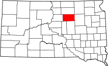 | |
| Towns | ||
| Unincorporated communities | ||