Faulkton, South Dakota
| Faulkton, South Dakota | |
|---|---|
| City | |
| Motto: "The Carousel City"[1] | |
 Location in Faulk County and the state of South Dakota | |
| Coordinates: 45°2′0″N 99°7′41″W / 45.03333°N 99.12806°WCoordinates: 45°2′0″N 99°7′41″W / 45.03333°N 99.12806°W | |
| Country | United States |
| State | South Dakota |
| County | Faulk |
| Platted | 1886[2] |
| Area[3] | |
| • Total | 1.01 sq mi (2.62 km2) |
| • Land | 1.01 sq mi (2.62 km2) |
| • Water | 0 sq mi (0 km2) |
| Elevation | 1,581 ft (482 m) |
| Population (2010)[4] | |
| • Total | 736 |
| • Estimate (2015)[5] | 740 |
| • Density | 728.7/sq mi (281.4/km2) |
| Time zone | Central (CST) (UTC-6) |
| • Summer (DST) | CDT (UTC-5) |
| ZIP code | 57438 |
| Area code(s) | 605 |
| FIPS code | 46-21260[6] |
| GNIS feature ID | 1255021[7] |
| Website | http://www.faulktoncity.org/ |
Faulkton is a city in and the county seat of Faulk County, South Dakota, United States.[8][9] The population was 736 at the 2010 census. The city's nickname is "The Carousel City".[10]
History
Faulkton was platted in 1886.[11] It was named for Andrew Jackson Faulk, the third Governor of Dakota Territory.[9][12] The city was incorporated in 1886.[2]
Geography
Faulkton is located at 45°2′0″N 99°7′41″W / 45.03333°N 99.12806°W (45.033209, -99.128067).[13]
According to the United States Census Bureau, the city has a total area of 1.01 square miles (2.62 km2), all of it land.[3]
Demographics
| Historical population | |||
|---|---|---|---|
| Census | Pop. | %± | |
| 1890 | 462 | — | |
| 1900 | 539 | 16.7% | |
| 1910 | 802 | 48.8% | |
| 1920 | 709 | −11.6% | |
| 1930 | 739 | 4.2% | |
| 1940 | 747 | 1.1% | |
| 1950 | 837 | 12.0% | |
| 1960 | 1,051 | 25.6% | |
| 1970 | 955 | −9.1% | |
| 1980 | 981 | 2.7% | |
| 1990 | 809 | −17.5% | |
| 2000 | 785 | −3.0% | |
| 2010 | 736 | −6.2% | |
| Est. 2015 | 740 | [14] | 0.5% |
| U.S. Decennial Census[15] 2015 Estimate[5] | |||
2010 census
As of the census[4] of 2010, there were 736 people, 355 households, and 182 families residing in the city. The population density was 728.7 inhabitants per square mile (281.4/km2). There were 418 housing units at an average density of 413.9 per square mile (159.8/km2). The racial makeup of the city was 97.1% White, 0.4% African American, 0.4% Native American, 0.1% Asian, 0.1% from other races, and 1.8% from two or more races. Hispanic or Latino of any race were 1.8% of the population.
There were 355 households of which 18.9% had children under the age of 18 living with them, 42.8% were married couples living together, 6.2% had a female householder with no husband present, 2.3% had a male householder with no wife present, and 48.7% were non-families. 45.6% of all households were made up of individuals and 29% had someone living alone who was 65 years of age or older. The average household size was 1.97 and the average family size was 2.74.
The median age in the city was 53.4 years. 18.5% of residents were under the age of 18; 5% were between the ages of 18 and 24; 16.1% were from 25 to 44; 26.3% were from 45 to 64; and 34.1% were 65 years of age or older. The gender makeup of the city was 43.8% male and 56.3% female.
2000 census
As of the census[6] of 2000, there were 785 people, 369 households, and 208 families residing in the city. The population density was 749.4 people per square mile (288.7/km²). There were 413 housing units at an average density of 394.3 per square mile (151.9/km²). The racial makeup of the city was 99.62% White, and 0.38% from two or more races. Hispanic or Latino of any race were 0.13% of the population.
There were 369 households out of which 21.1% had children under the age of 18 living with them, 48.0% were married couples living together, 5.4% had a female householder with no husband present, and 43.6% were non-families. 42.5% of all households were made up of individuals and 26.0% had someone living alone who was 65 years of age or older. The average household size was 2.00 and the average family size was 2.72.
In the city the population was spread out with 18.9% under the age of 18, 4.2% from 18 to 24, 19.1% from 25 to 44, 22.3% from 45 to 64, and 35.5% who were 65 years of age or older. The median age was 51 years. For every 100 females there were 83.4 males. For every 100 females age 18 and over, there were 80.5 males.
The median income for a household in the city was $29,853, and the median income for a family was $37,750. Males had a median income of $27,344 versus $16,538 for females. The per capita income for the city was $19,504. About 2.4% of families and 5.6% of the population were below the poverty line, including 3.3% of those under age 18 and 8.5% of those age 65 or over.
Notable people
- Joseph H. Bottum, 27th Lieutenant Governor of South Dakota and a member of the United States Senate; born in Faulkton.[16]
- John Pickler- United States House of Representatives from South Dakota and South Dakota's First Congressman; resident of Faulkton.[17]
- Frank M. Byrne- eighth Governor of South Dakota; resident of Faulkton.[18]
- Jarvis Webster Brown, attorney at law, state House of Representatives, states attorney Faulk county.
- Verne Hansen, former multi-term mayor, businessman, founder of Faulkton Area Medical Center.
References
- ↑ "Faulkton South Dakota". Faulkton South Dakota. Retrieved October 3, 2012.
- 1 2 "SD Towns" (PDF). South Dakota State Historical Society. Retrieved 2010-02-12.
- 1 2 "US Gazetteer files 2010". United States Census Bureau. Retrieved 2012-06-21.
- 1 2 "American FactFinder". United States Census Bureau. Retrieved 2012-06-21.
- 1 2 "Population Estimates". United States Census Bureau. Retrieved June 12, 2016.
- 1 2 "American FactFinder". United States Census Bureau. Retrieved 2008-01-31.
- ↑ "US Board on Geographic Names". United States Geological Survey. 2007-10-25. Retrieved 2008-01-31.
- ↑ "Find a County". National Association of Counties. Retrieved 2011-06-07.
- 1 2 "Profile for Faulkton, South Dakota, SD". ePodunk. Retrieved October 3, 2012.
- ↑ [South Dakota Office of Tourism http://www.travelsd.com]
- ↑ Chicago and North Western Railway Company (1908). A History of the Origin of the Place Names Connected with the Chicago & North Western and Chicago, St. Paul, Minneapolis & Omaha Railways. p. 70.
- ↑ Gannett, Henry (1905). The Origin of Certain Place Names in the United States. Govt. Print. Off. p. 124.
- ↑ "US Gazetteer files: 2010, 2000, and 1990". United States Census Bureau. 2011-02-12. Retrieved 2011-04-23.
- ↑ "Annual Estimates of the Resident Population for Incorporated Places: April 1, 2010 to July 1, 2015". Retrieved July 2, 2016.
- ↑ United States Census Bureau. "Census of Population and Housing". Retrieved June 12, 2016.
- ↑ "BOTTUM, Joseph H., (1903 - 1984)". Biographical Directory of the United States Congress. Retrieved October 3, 2012.
- ↑ "PICKLER, John Alfred, (1844 - 1910)". Biographical Directory of the United States Congress. Retrieved October 3, 2012.
- ↑ "Les Goodman". South Dakota Governor Frank M. Byrne. Retrieved October 3, 2012.
External links
| Wikimedia Commons has media related to Faulkton, South Dakota. |
Municipalities and communities of Faulk County, South Dakota, United States | ||
|---|---|---|
| City | 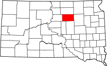 | |
| Towns | ||
| Unincorporated communities | ||