Rockbridge Township, Greene County, Illinois
| Rockbridge Township | |
|---|---|
| Township | |
 Location in Greene County | |
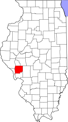 Greene County's location in Illinois | |
| Coordinates: 39°17′18″N 90°12′50″W / 39.28833°N 90.21389°WCoordinates: 39°17′18″N 90°12′50″W / 39.28833°N 90.21389°W | |
| Country | United States |
| State | Illinois |
| County | Greene |
| Established | November 4, 1884 |
| Area | |
| • Total | 47.77 sq mi (123.7 km2) |
| • Land | 47.66 sq mi (123.4 km2) |
| • Water | 0.12 sq mi (0.3 km2) 0.25% |
| Elevation | 515 ft (157 m) |
| Population (2010) | |
| • Total | 1,633 |
| • Density | 34.3/sq mi (13.2/km2) |
| Time zone | CST (UTC-6) |
| • Summer (DST) | CDT (UTC-5) |
| ZIP codes | 62016, 62044, 62081, 62630 |
| GNIS feature ID | 0429653 |
Rockbridge Township is one of thirteen townships in Greene County, Illinois, USA. As of the 2010 census, its population was 1,633 and it contained 761 housing units.[1]
Geography
According to the 2010 census, the township has a total area of 47.77 square miles (123.7 km2), of which 47.66 square miles (123.4 km2) (or 99.77%) is land and 0.12 square miles (0.31 km2) (or 0.25%) is water.[1]
Cities, towns, villages
- Greenfield (vast majority)
- Rockbridge
Unincorporated towns
(This list is based on USGS data and may include former settlements.)
Cemeteries
The township contains these ten cemeteries: Cannedy, Freer, Hudson, Mitchell, Rives, Taylor Creek, Weisner, Whitlock, Witt and Witt Number 1.
Major highways
Airports and landing strips
- Sunset Landing Strip
School districts
- Greenfield Community Unit School District 10
Political districts
- Illinois' 19th congressional district
- State House District 97
- State Senate District 49
References
- "Rockbridge Township, Greene County, Illinois". Geographic Names Information System. United States Geological Survey. Retrieved 2010-01-17.
- United States Census Bureau 2007 TIGER/Line Shapefiles
- United States National Atlas
- 1 2 "Population, Housing Units, Area, and Density: 2010 - County -- County Subdivision and Place -- 2010 Census Summary File 1". United States Census. Retrieved 2013-05-28.
External links

Municipalities and communities of Greene County, Illinois, United States | ||
|---|---|---|
| Cities | ||
| Villages | ||
| Townships | ||
| Unincorporated communities | ||
This article is issued from Wikipedia - version of the 11/29/2013. The text is available under the Creative Commons Attribution/Share Alike but additional terms may apply for the media files.