Linder Township, Greene County, Illinois
| Linder Township | |
|---|---|
| Township | |
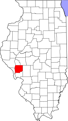
 Location in Greene County | |
 Greene County's location in Illinois | |
| Coordinates: 39°17′57″N 90°18′44″W / 39.29917°N 90.31222°WCoordinates: 39°17′57″N 90°18′44″W / 39.29917°N 90.31222°W | |
| Country | United States |
| State | Illinois |
| County | Greene |
| Established | November 4, 1884 |
| Area | |
| • Total | 34.6 sq mi (90 km2) |
| • Land | 34.58 sq mi (89.6 km2) |
| • Water | 0.02 sq mi (0.05 km2) 0.06% |
| Elevation | 597 ft (182 m) |
| Population (2010) | |
| • Total | 345 |
| • Density | 10/sq mi (4/km2) |
| Time zone | CST (UTC-6) |
| • Summer (DST) | CDT (UTC-5) |
| ZIP codes | 62016, 62044, 62081 |
| GNIS feature ID | 0429261 |
Linder Township is one of thirteen townships in Greene County, Illinois, USA. As of the 2010 census, its population was 345 and it contained 135 housing units.[1]
Geography
According to the 2010 census, the township has a total area of 34.6 square miles (90 km2), of which 34.58 square miles (89.6 km2) (or 99.94%) is land and 0.02 square miles (0.052 km2) (or 0.06%) is water.[1]
Unincorporated towns
- Baum at 39°19′39″N 90°18′56″W / 39.327547°N 90.315673°W
- Kahm at 39°19′40″N 90°15′39″W / 39.327824°N 90.260949°W
(This list is based on USGS data and may include former settlements.)
Cemeteries
The township contains these two cemeteries: Hardcastle and Hardin.
Major highways
School districts
- Carrollton Community Unit School District 1
- Greenfield Community Unit School District 10
Political districts
- Illinois' 19th congressional district
- State House District 97
- State Senate District 49
References
- "Linder Township, Greene County, Illinois". Geographic Names Information System. United States Geological Survey. Retrieved 2010-01-17.
- United States Census Bureau 2007 TIGER/Line Shapefiles
- United States National Atlas
- 1 2 "Population, Housing Units, Area, and Density: 2010 - County -- County Subdivision and Place -- 2010 Census Summary File 1". United States Census. Retrieved 2013-05-28.
External links
 |
Wrights Township | Rubicon Township | | |
| Carrollton Township | |
Rockbridge Township | ||
| ||||
| | ||||
| Kane Township | |
Municipalities and communities of Greene County, Illinois, United States | ||
|---|---|---|
| Cities | ||
| Villages | ||
| Townships | ||
| Unincorporated communities | ||
This article is issued from Wikipedia - version of the 12/4/2013. The text is available under the Creative Commons Attribution/Share Alike but additional terms may apply for the media files.