Reihan
| Reihan רֵיחָן | |
|---|---|
|
Welcoming sign at entrance to the village | |
 Reihan | |
| Coordinates: 32°28′8.03″N 35°8′5.99″E / 32.4688972°N 35.1349972°ECoordinates: 32°28′8.03″N 35°8′5.99″E / 32.4688972°N 35.1349972°E | |
| District | Judea and Samaria Area |
| Council | Shomron |
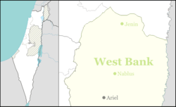
| Region | West Bank |
| Affiliation | HaOved HaTzioni |
| Founded | 1977 |
| Founded by | Jewish Agency |
| Population (2015)[1] | 213 |

Reihan (Hebrew: רֵיחָן) is a moshav ovdim and Israeli settlement in the northwest edge of the West Bank. Located close to the Green Line, it falls under the jurisdiction of -Shomron Regional Council. In 2015 it had a population of 213.
The international community considers Israeli settlements in the West Bank illegal under international law, but the Israeli government disputes this.[2]
Geography
The settlement is located on a west-facing hillside at 387 metres above sea level, south of the Ta'anakh and the biblical city of the same name, and east of Barta'a. Reihan is today home to 200, including 52 families, and it operates a tree nursery and poultry farm.
History
The moshav was established in 1977 as a Nahal outpost and populated in 1981 by civilian members of a Labour Zionist group. It is located in the "Shaked bloc", meant to ensure contiguous Israeli presence between the strategic Highway 65 and Palestinian population centres.
References
- ↑ "List of localities, in Alphabetical order" (PDF). Israel Central Bureau of Statistics. Retrieved 16 October 2016.
- ↑ "The Geneva Convention". BBC News. 10 December 2009. Retrieved 27 November 2010.