Kiryat Netafim
| Kiryat Netafim קִרְיַת נְטָפִים | |
|---|---|
 Kiryat Netafim | |
| Coordinates: 32°6′57.59″N 35°6′48.6″E / 32.1159972°N 35.113500°ECoordinates: 32°6′57.59″N 35°6′48.6″E / 32.1159972°N 35.113500°E | |
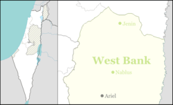
| District | Judea and Samaria Area |
| Council | Shomron |
| Region | West Bank |
| Affiliation | Hapoel HaMizrachi |
| Founded | 1984 |
| Founded by | Nahal |
| Population (2015)[1] | 865 |
| Name meaning | 'Towers' |
Kiryat Netafim (Hebrew: קִרְיַת נְטָפִים, Arabic: كريات نتافيم) is a communal Israeli settlement in the northern West Bank. Located about 30 km east of Tel Aviv, it falls under the jurisdiction of Shomron Regional Council. In 2015 it had a population of 865.
The international community considers Israeli settlements in the West Bank illegal under international law, but the Israeli government disputes this.[2]
History
Kiryat Netafim was founded in June 1984, on Palestinian land from the villages of Qarawat Bani Hassan and Deir Istiya,[3] by a group of Orthodox Yemenite Jews as another link in a chain of settlements built along the Trans-Samaria Highway and adjacent to the Barkan Industrial Park. Since then, Kiryat Netafim has lost its homogeneous nature while accepting families from many different backgrounds.
In 2009 Peace Now petitioned the Israeli High Court, and laid a complaint against the then Defence Minister Ehud Barak, to order the demolition of 14 illegal structures built without authorization on public and private Palestinian land. The Defence ministry replied given approval to construction plans that would legalize the 14 structures. An interim injunction from the High Court on October 1 prohibited construction until the legal issues were settled. A further request was made on December 29 to find the settlers guilty of contempt for breaching the injunction to stop building. The state admitted the fact but requested the breach be ignored because the state had limited resources to regulate settlements and different priorities.[4][5][6]
In November 2014 Netafim began bulldozing and clearing further Qarawat Bani Hassan territory, under the protecting of IDF troops, in a measure apparently designed to extend the settlement.[3]
The community is located in the vicinity of several archaeological sites.
Education
The settlement has two kindergartens and one nursery.
References
- ↑ "List of localities, in Alphabetical order" (PDF). Israel Central Bureau of Statistics. Retrieved 16 October 2016.
- ↑ "The Geneva Convention". BBC News. 10 December 2009. Retrieved 27 November 2010.
- 1 2 'Israeli settlers level Palestinian land west of Salfit,' Ma'an News Agency 9 November 2014.
- ↑ Aviad Glickman, 'Petition: Raze 15 structures in Kiryat Netafim settlement,' Ynet 27 August 2009.
- ↑ 'Israel approves new building plan for West Bank settlement,'Haaretz December 28 2009.
- ↑ 'Suspect violation of interim injunction against construction, residency in settlement,' Jerusalem Post 13 July 2010.