Raniganj, Nepal
| Ranigunj रानीगञ्ज | |
|---|---|
| Village Development Committee | |
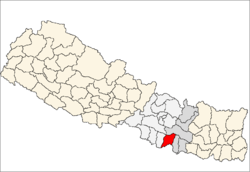
 Ranigunj Location in Nepal | |
| Coordinates: 27°2′30″N 85°39′0″E / 27.04167°N 85.65000°ECoordinates: 27°2′30″N 85°39′0″E / 27.04167°N 85.65000°E | |
| Country |
|
| Zone | Janakpur Zone |
| District | Sarlahi District |
| Population (1991) | |
| • Total | 4,192 |
| Time zone | Nepal Time (UTC+5:45) |
Ranigunj is a village development committee in Sarlahi District in the Janakpur Zone of south-eastern Nepal. At the time of the 1991 Nepal census it had a population of 4192 people living in 767 individual households.[1]
RANIGUNJ is one of the 99 Villages Development Committee in Sarlahi District in the Janakpur Zone of south-eastern Nepal. It has a population of 6150 people living in 1026 individual households. Area of the Village Development Committee is 4 km* 2.5 km square kilometers and density of the Village is 348.0. This village lies between two river, Phuljor and Kalinjor.
Total population of the village has 6150 male 3383 and female 2767. Ratio of the VDC is 80% farmers, 10% business men, 5% job holder, and rest of the population is other. This located at 38 km North from Malangwa, the district headquarter of Sarlahi.
RANIGUNJ has 5 villages i.e. Danda Tol, Bhattarai Tol, Pratap Tol, Sahevagunj and Tikuliya. RANIGUNJ is nearly 0.1 km from Danda Tol and 0.5 km from Bhattarai tole, 1 km from Pratap Tol, 1 km from Shahevagunj and 3 km from Tikuliya. This village is well known for wheat, sugarcane, tomato, and paddy crop. Ranigunj does not have proper irrigation. Farmers are more depend on rain water for cultivation. It has only one deepboring for irrigation.
Since last few years youths have been working in Gulf and many other countries like Malaysia, Korea, India and other countries. Hence the VDC’s economical condition has been started booming up, which in turn has created positive impact on public awareness, education and general lifestyle. Some of youth are gone to abroad study in Japan, Australia and Korea.
Neighboring Villages East –Ishworpur VDC, 3 km West – Lalbandi VDC and Jabdi VDC, 3 km North – Parwanipur VDC, 4 km South –Ishworpur VDC and Jabdi VDC 3 km
Former President and vice-president
Mr. Chudamani Timalsina, former president of Ranigunj-VDC, ward no – 2 Mobile – 9807641821
Mr. Ramhari Adhikari, former vice-president of Ranigunj-VDC, ward no – 7 Mobile - 9844075167
Secretary
Mr. Secretary, Kulnath Ghimire Mobile - 9844076761
Mr. Assistant Secretary, Bashudev Paudel Mobile - 9844059490
Familiar Personality and Social Worker
Mr. Ramprasad Bhattarai, ward no – 3 (Ex-Campus Chief, Ratna Rajya Laxmi Campus, Kathmandu)
Mr. Dhurba Gautam, ward no – 9 (District Committee Member of UML)
Mr. Shambhu Lal Shrestha, ward no – 1 (Constituent Assembly Member, UCPN Maoist Leader)
Mr. Surendra Mainali, ward no - 7 (Chairman, Nepali Congress Village Committee)
Mrs. Rudra Kumari Baral, ward no – 3 (ANM, Primary Health Post Ranigunj, Social Worker)
Mr. Shalikram Bhandari, ward no – 6 (Secretary, Free Student Union, Patan Multipul Campus, Patan, Lalitpur)
Mr. Bishwamitra Rijal, ward no - 5 ( Chairperson, Nepal Student Union, Sarlahi)
List of Professional Mr. Santosh Paudel, ward no – 2 (ANM, Sub Health Post, Shankhuwashava District)
Mrs. Rudra Kumari Baral, ward no – 3 (ANM, Sub Health Post, Ranigunj)
Ms. Binita Bhattarai, ward no – 3 (Under Secretary, Ministry of Women, Children and Social Welfare)
Mr. Ishwori Prasad Bhattarai, ward no – 3 (Officer, Nepal Rastra Bank)
Mr. Basant Prasad Bhattarai, Ward no - 3 (Local Development Expert)
Mr. Gopi Krishna Bhattarai, ward no – 3 ( Member, Nepal Student Union, Youth Human Rights Defender, associated with Youth Action Nepal, Association of Youth Organizations Nepal, Informal Sector Service Center)
School
Ranigunj VDC has 4 Government school, one community school, and 3 private school. Among them one is higher secondary, one is high school and rest is primary school.
References
- ↑ "Nepal Census 2001". Nepal's Village Development Committees. Digital Himalaya. Retrieved 2 November 2008.