Røra
| Røra herred | |
|---|---|
| Former Municipality | |
| Municipality ID | NO-1730 |
| Adm. Center | Røra |
| Area[1] | |
| • Total | 29 km2 (11 sq mi) |
| Created from | Inderøy in 1907 |
| Merged into | Inderøy in 1962 |
| Røra | |
|---|---|
| Village | |
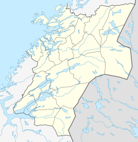 Røra  Røra Location in Nord-Trøndelag | |
| Coordinates: 63°51′27″N 11°24′00″E / 63.85750°N 11.40000°ECoordinates: 63°51′27″N 11°24′00″E / 63.85750°N 11.40000°E | |
| Country | Norway |
| Region | Trøndelag |
| County | Nord-Trøndelag |
| District | Innherred |
| Municipality | Inderøy |
| Area[2] | |
| • Total | 0.42 km2 (0.16 sq mi) |
| Elevation[3] | 50 m (160 ft) |
| Population (2013)[2] | |
| • Total | 419 |
| • Density | 998/km2 (2,580/sq mi) |
| Time zone | CET (UTC+01:00) |
| • Summer (DST) | CEST (UTC+02:00) |
| Post Code | 7670 |
Røra is a village and former municipality in Nord-Trøndelag county, Norway. It is located in the present-day municipality of Inderøy in the part of the municipality east of the Børgin fjord. The former municipality existed from 1907 until 1962 and it bordered the municipality of Verdal to the south, Sparbu in Steinkjer municipality to the north, and Inderøy to the west.
The name Røra can have come from a variety of sources. One suggestion is that it comes from the ancient fertility cult, another is due to the shape of the coastline. Røyri is the Old Norse name for the scrotum.[1]
Village
The village of Røra sits along the main north-south European route E6 highway and the Nordlandsbanen rail line which stops at Røra Station. Norwegian County Road 755 begins in Røra and continues to toward Leksvik. The 0.42-square-kilometre (100-acre) village has a population (2013) of 419. The population density of Røra is 998 inhabitants per square kilometre (2,580/sq mi).[2] Salberg Church is located in the village.
Municipality
The municipality of Røra was established on 1 January 1907 when it was separated from Inderøy to form a municipality of its own. In 1950, Røra had 947 residents and an area of about 29 square kilometres (11 sq mi). On 1 January 1962, the municipality of Røra was merged with Sandvollan and Inderøy to form a new, larger municipality of Inderøy. Prior to the merger, Røra had 1,003 residents.[4]
History
Røra lies between Stiklestad and Mære, and is in an area of rich historical monuments. An early highway, The King's Road, was at a higher elevation than the current highway. Along this route there are several minor finds from earlier habitation. On the boundary between Nedre Vådal and Røflo remains have been found from a very old habitation, probably from the Iron Age. Defense works indicate that the habitation must have been over a long period and been substantial.
The entire landscape has been changed after a major landslide in the 14th century. Most of the disturbed mass slid into Hylla fjord, but some was diverted to Borgen fjord. The source of the slide is thought to be in the area near the Øvre Vådal farms near the border with Sparbu. Much of the agricultural area lies in the disturbed area.
The coastal settlement at Hylla which had steamship connections was the original centre of the area, but when the railway arrived in 1905 a new centre grew up around the station that took over most of the functions.
Economy
Traditionally, agriculture has been the most important industry in the area, but Røra has two important industrial of major importance. Hylla limestone quarry is immediately west of Hylla and has been an important place of employment in the municipality. In addition Røra Fabrikker, owned by the coop NKL, the Norwegian retailers' co-operative association produces an assortment of jams, juices, and other processed agricultural products are made in the factory. The company currently employs about 59 people.
References
| Wikimedia Commons has media related to Røra. |
- 1 2 Store norske leksikon. "Røra. – kommune" (in Norwegian). Retrieved 2011-06-13.
- 1 2 3 Statistisk sentralbyrå (1 January 2013). "Urban settlements. Population and area, by municipality.".
- ↑ "Røra" (in Norwegian). yr.no. Retrieved 2011-06-13.
- ↑ Jukvam, Dag (1999). "Historisk oversikt over endringer i kommune- og fylkesinndelingen" (PDF) (in Norwegian). Statistisk sentralbyrå.