Foldereid
| Foldereid herred | |
|---|---|
| Former Municipality | |
| Municipality ID | NO-1743 |
| Adm. Center | Foldereid |
| Created from | Kolvereid in 1886 |
| Merged into | Nærøy and Høylandet in 1964 |
| Foldereid | |
|---|---|
| Village | |
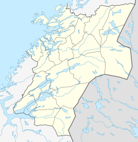 Foldereid  Foldereid Location in Nord-Trøndelag | |
| Coordinates: 64°57′40″N 12°10′46″E / 64.96111°N 12.17944°ECoordinates: 64°57′40″N 12°10′46″E / 64.96111°N 12.17944°E | |
| Country | Norway |
| Region | Trøndelag |
| County | Nord-Trøndelag |
| District | Namdalen |
| Municipality | Nærøy |
| Elevation[1] | 38 m (125 ft) |
| Time zone | CET (UTC+01:00) |
| • Summer (DST) | CEST (UTC+02:00) |
| Post Code | 7985 Foldereid |
Foldereid is a village and a former municipality in the northern part of Nord-Trøndelag county, Norway. The municipality encompassed the area surrounding the inner part of the Folda fjord, the Innerfolda. The village of Foldereid is located along the fjord in the present-day municipality of Nærøy, just a short distance from the border with Nordland county.[2]
History
The municipality of Foldereid was established on 1 October 1886 when it was separated from Kolvereid. Initially, the new municipality had 948 residents. On 1 January 1964, the municipality was dissolved. The eastern Kongsmoen area (population: 221) was merged into Høylandet and the remainder of the municipality (population: 817) was merged into Nærøy.[3]
References
- ↑ "Foldereid" (in Norwegian). yr.no. Retrieved 2011-09-19.
- ↑ Store norske leksikon. "Foldereid. – tidl. kommune i Nord-Trøndelag" (in Norwegian). Retrieved 2011-09-19.
- ↑ Jukvam, Dag (1999). "Historisk oversikt over endringer i kommune- og fylkesinndelingen" (PDF) (in Norwegian). Statistisk sentralbyrå.
External links
This article is issued from Wikipedia - version of the 8/1/2016. The text is available under the Creative Commons Attribution/Share Alike but additional terms may apply for the media files.