Portvoller
| Portvoller | |
| Scottish Gaelic: Port Mholair | |
 Loch an t-Siumpain is in the centre of the picture, with the houses of Portvoller beyond |
|
 Portvoller |
|
| Language | Scottish Gaelic |
|---|---|
| English | |
| OS grid reference | NB561366 |
| Civil parish | Stornoway |
| Council area | Na h-Eileanan Siar |
| Lieutenancy area | Western Isles |
| Country | Scotland |
| Sovereign state | United Kingdom |
| Post town | ISLE OF LEWIS |
| Postcode district | HS2 |
| Dialling code | 01851 |
| Police | Scottish |
| Fire | Scottish |
| Ambulance | Scottish |
| EU Parliament | Scotland |
| UK Parliament | Na h-Eileanan an Iar |
| Scottish Parliament | Na h-Eileanan an Iar |
Coordinates: 58°15′04″N 6°09′25″W / 58.251°N 6.157°W
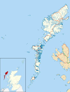
Portvoller (Scottish Gaelic: Port Mholair) is a small village on the north tip of the Eye Peninsula (also known as Point), on the Isle of Lewis in northwestern Scotland. It is 9 miles (14 km) from the Outer Hebrides' only town, Stornoway Portvoller is situated on the A866.[1] Portvoller is within the parish of Stornoway.[2]
About the village
Portvoller contains a butcher[3] and a nursery, but its most prominent feature is the Tiumpan Head Lighthouse, which is located at the northernmost tip of the village.[4] The village also has two churches, one practicing the Free Church faith and the other Church of Scotland (although the latter has now been decommissioned).
Portvoller is also near some of the Western Isles' best fishing waters, especially rock fishing or beach casting. The headlands that are most popular for these pursuits are known locally as Billy Mor (Bilidh Mhor)[5] and Foitelair (Foitealar).[5] These two fishing hotspots are found about five minutes' walk from the now ruined Portvoller slipway—a walk that can be a treacherous clamber after a squall or downpour. The Portvoller slipway is also near to small and secluded Shinega (Sinigeadh)[6] beach.
.jpg)
Etymology
The village name probably originates from the Old Norse word voller (the plural of vollen, still used in some dialects of Norwegian, which denotes a hill that slants upwards gradually). Indeed, this is a quite appropriate description of the village of Portvoller.
In the period from the ninth to the twelfth century, Viking raids on the island would have been commonplace. When Norway occupied Lewis before the Treaty of Perth and the Battle of Largs, Portvoller would have been a principal landing place for arrivals from Norway.
Surrounding villages
The village has several others surrounding it, including Portnaguran, Aird, Broker and Flesherin, all of which are served by the one post office, off-licence and shop. All the aforenamed villages are served by the Western Isles Council in terms of public transport and other services.
References
- ↑ "A866". Sabre. Retrieved 19 December 2014.
- ↑ "Lewis, Portvoller". Royal Commission on the Ancient and Historical Monuments of Scotland. Retrieved 19 December 2014.
- ↑ "Butchers in the Hebrides". Virtual Hebrides. Retrieved 19 December 2014.
- ↑ "Lewis, Tiumpan head Lighthouse". ScotlandsPlaces. Retrieved 19 December 2014.
- 1 2 "Canmore". Royal Commission on the Ancient and Historical Monuments of Scotland. Retrieved 19 December 2014.
- ↑ "More Background Information". Point Online. Retrieved 19 December 2014.
External links
| Wikimedia Commons has media related to Portvoller. |
| Inhabited islands | ||
|---|---|---|
| Other islands | ||
| Settlements |
| |
| Districts | ||
| Geographical features | ||
| Historical sites | ||