Killegray
Killegray is an island in the Sound of Harris in the Outer Hebrides of Scotland.
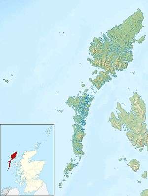
Geography
Situated in the Sound of Harris, a channel of water between North Uist and the Isle of Harris, Killegray is approximately 1 1⁄2 miles long.
The south end of the island is nearly all deep uncultivated moss. There is better cultivated land at the north.[5]
History
Rubha Claidhe in the north is the site of a ruined chapel, Teampull na h-Annait, which may be the origin of the island's name.[4]
Currently uninhabited, the island was occupied by a family of around three to five people from 1861 to 1931. Two people were temporarily living on the island when the 1971 census was taken.
The 19th-century Killegray House, the only house on the island was renovated as holiday accommodation in 1991.[5]
Wildlife
The shallow waters and reefs are a rich breeding ground for velvet crabs and lobsters.[4]
Possible development
Jacobs Babtie has investigated building a combination of bridges and causeways across the Sound of Harris.[6] Wind turbines and tidal generators could be incorporated in the scheme from Berneray via Killegray and Ensay to Harris.[7] The estimated cost of £75 million could rise to £145 million with the renewable energy devices.
Coordinates: 57°44.4′N 7°4.9′W / 57.7400°N 7.0817°W / 57.7400; -7.0817
|
|---|
|
|
|
| Inhabited islands | | |
|---|
|
| Other islands | |
|---|
|
| Settlements | |
|---|
|
| Districts | |
|---|
|
| Geographical features | |
|---|
|
| Historical sites | |
|---|
|
|---|
|
| |
|
|
|
|
|
|
|
|
|
| Culture |
|---|
| | Shetland | |
|---|
| | Orkney | |
|---|
| | Outer Hebrides | |
|---|
| | Inner Hebrides | |
|---|
|
|
|
| Politics |
|---|
| | Local authorities | |
|---|
| | Serving MSPs | |
|---|
| | Serving MPs | |
|---|
| | Other | |
|---|
|
|
|
| Wildlife |
|---|
| | Fauna | |
|---|
| | Flora | |
|---|
| | Domesticated animals | |
|---|
|
|
|
|