Port Heiden, Alaska
| Port Heiden | |
|---|---|
| City | |
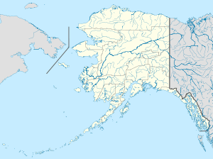 Port Heiden Location in Alaska | |
| Coordinates: 56°56′56″N 158°39′21″W / 56.94889°N 158.65583°WCoordinates: 56°56′56″N 158°39′21″W / 56.94889°N 158.65583°W | |
| Country | United States |
| State | Alaska |
| Borough | Lake and Peninsula |
| Incorporated | November 20, 1972[1] |
| Government | |
| • Mayor | Toni Christensen |
| • State senator | Lyman Hoffman (D) |
| • State rep. | Bryce Edgmon (D) |
| Area | |
| • Total | 51.4 sq mi (133.0 km2) |
| • Land | 50.7 sq mi (131.3 km2) |
| • Water | 0.7 sq mi (1.7 km2) |
| Elevation | 95 ft (29 m) |
| Population (2010) | |
| • Total | 102 |
| • Density | 2.0/sq mi (0.77/km2) |
| Time zone | Alaska (AKST) (UTC-9) |
| • Summer (DST) | AKDT (UTC-8) |
| ZIP code | 99549 |
| Area code | 907 |
| FIPS code | 02-63390 |
Port Heiden (Alutiiq: Massriq) is a city in Lake and Peninsula Borough, Alaska, United States. As of the 2010 census, the population of the city is 102.
Geography
Port Heiden is located at 56°56′56″N 158°39′21″W / 56.94889°N 158.65583°W (56.948949, -158.655745).[2]
According to the United States Census Bureau, the city has a total area of 51.4 square miles (133 km2), of which, 50.7 square miles (131 km2) of it is land and 0.7 square miles (1.8 km2) of it (1.28%) is water.
Demographics
| Historical population | |||
|---|---|---|---|
| Census | Pop. | %± | |
| 1920 | 30 | — | |
| 1930 | 51 | 70.0% | |
| 1960 | 74 | — | |
| 1970 | 66 | −10.8% | |
| 1980 | 92 | 39.4% | |
| 1990 | 119 | 29.3% | |
| 2000 | 119 | 0.0% | |
| 2010 | 102 | −14.3% | |
| Est. 2015 | 98 | [3] | −3.9% |
As of the census[5] of 2000, there were 119 people, 41 households, and 23 families residing in the city. The population density was 2.3 people per square mile (0.9/km²). There were 56 housing units at an average density of 1.1 per square mile (0.4/km²). The racial makeup of the city was 19.33% White, 65.55% Native American, 2.52% from other races, and 12.61% from two or more races. 2.52% of the population were Hispanic or Latino of any race.
There were 41 households out of which 39.0% had children under the age of 18 living with them, 46.3% were married couples living together, 2.4% had a female householder with no husband present, and 41.5% were non-families. 39.0% of all households were made up of individuals and 7.3% had someone living alone who was 65 years of age or older. The average household size was 2.90 and the average family size was 3.79.
In the city the age distribution of the population shows 39.5% under the age of 18, 5.0% from 18 to 24, 26.9% from 25 to 44, 22.7% from 45 to 64, and 5.9% who were 65 years of age or older. The median age was 33 years. For every 100 females there were 105.2 males. For every 100 females age 18 and over, there were 125.0 males.
The median income for a household in the city was $31,875, and the median income for a family was $70,000. Males had a median income of $53,750 versus $21,667 for females. The per capita income for the city was $20,532. There were no families and 5.6% of the population living below the poverty line, including no under eighteens and 25.0% of those over 64.
References
- ↑ "Directory of Borough and City Officials 1974". Alaska Local Government. Juneau: Alaska Department of Community and Regional Affairs. XIII (2): 67. January 1974.
- ↑ "US Gazetteer files: 2010, 2000, and 1990". United States Census Bureau. 2011-02-12. Retrieved 2011-04-23.
- ↑ "Annual Estimates of the Resident Population for Incorporated Places: April 1, 2010 to July 1, 2015". Retrieved July 2, 2016.
- ↑ "Census of Population and Housing". Census.gov. Retrieved June 4, 2015.
- ↑ "American FactFinder". United States Census Bureau. Retrieved 2008-01-31.
Municipalities and communities of Lake and Peninsula Borough, Alaska, United States | ||
|---|---|---|
| Cities | 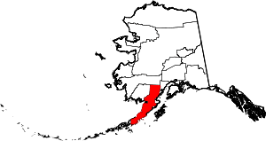 | |
| CDPs | ||
| Ghost town | ||