Chignik Lake, Alaska
| Chignik Lake, Alaska | |
|---|---|
| CDP | |
 Location of Chignik Lake, Alaska | |
| Coordinates: 56°16′10″N 158°46′54″W / 56.26944°N 158.78167°WCoordinates: 56°16′10″N 158°46′54″W / 56.26944°N 158.78167°W | |
| Country | United States |
| State | Alaska |
| Borough | Lake and Peninsula |
| Government | |
| • Borough mayor | Glen Alsworth, Sr.[1] |
| • State senator | Lyman Hoffman (D) |
| • State rep. | Bryce Edgmon (D) |
| Area | |
| • Total | 21.9 sq mi (56.8 km2) |
| • Land | 12.3 sq mi (31.8 km2) |
| • Water | 9.6 sq mi (24.9 km2) |
| Population (2010) | |
| • Total | 73 |
| Time zone | Alaska (AKST) (UTC-9) |
| • Summer (DST) | AKDT (UTC-8) |
| ZIP code | 99548 |
| Area code(s) | 907 |
| FIPS code | 02-13780 |
Chignik Lake (Alutiiq: Igyaraq) is a census-designated place (CDP) in Lake and Peninsula Borough, Alaska, United States. It is two hundred and sixty-five miles southwest of Kodiak. At the 2010 census the population was 73.
Geography
Chignik Lake is located at 56°16′10″N 158°46′54″W / 56.269340°N 158.781714°W.[2]
According to the United States Census Bureau, the CDP has a total area of 21.9 square miles (57 km2), of which, 12.3 square miles (32 km2) of it is land and 9.6 square miles (25 km2) of it (43.93%) is water.
In 2009 the Marines of 4th Combat Engineer Battalion, 4th Marine Division, began work on an inter-village road system linking Chignik Lake to Chignik Lagoon.[3] This is the first phase of potentially creating road links between Chignik Lake, Chignik Lagoon and Chignik.[4]
Demographics
As of the census[5] of 2000, there were 145 people, 40 households, and 34 families residing in the CDP. The population density was 11.8 people per square mile (4.6/km²). There were 50 housing units at an average density of 4.1/sq mi (1.6/km²). The racial makeup of the CDP was 11.72% White, 86.90% Native American, 0.69% Asian, and 0.69% from two or more races. 1.38% of the population were Hispanic or Latino of any race.
There were 40 households out of which 65.0% had children under the age of 18 living with them, 60.0% were married couples living together, 12.5% had a female householder with no husband present, and 15.0% were non-families. 15.0% of all households were made up of individuals and 7.5% consisted of a sole occupant 65 years of age or older. The average household size was 3.63 and the average family size was 3.97.
In the CDP the population was spread out with 44.8% under the age of 18, 8.3% from 18 to 24, 24.8% from 25 to 44, 17.9% from 45 to 64, and 4.1% who were 65 years of age or older. The median age was 21 years. For every 100 females there were 93.3 males. For every 100 females age 18 and over, there were 116.2 males.
The median income for a household in the CDP was $41,458, and the median income for a family was $40,938. Males had a median income of $0 versus $38,750 for females. The per capita income for the CDP was $13,842. There were 21.2% of families and 22.0% of the population living below the poverty line, including 31.4% of under eighteens and none of those over 64.
References
- ↑ 2015 Alaska Municipal Officials Directory. Juneau: Alaska Municipal League. 2015. p. 12.
- ↑ "US Gazetteer files: 2010, 2000, and 1990". United States Census Bureau. 2011-02-12. Retrieved 2011-04-23.
- ↑ Sgt. Johnson, Luke (2009). "Marines Build a Road to Somewhere" Retrieved 2010-06-17
- ↑ "Chignik Lagoon Village Council Road Project" Retrieved 2010-06-17
- ↑ "American FactFinder". United States Census Bureau. Archived from the original on 2013-09-11. Retrieved 2008-01-31.
Municipalities and communities of Lake and Peninsula Borough, Alaska, United States | ||
|---|---|---|
| Cities | 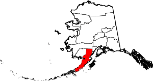 | |
| CDPs | ||
| Ghost town | ||