Pomabamba District
| Pomabamba Pumapampa | |
|---|---|
| District | |
|
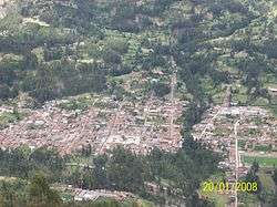
Pomabamba | |
 Location of Pomabamba in the Pomabamba province | |
| Country |
|
| Region | Ancash |
| Province | Pomabamba |
| Founded | February 21, 1861 |
| Capital | Pomabamba |
| Government | |
| • Mayor | Julian Watson Cirilo Diestra (2007) |
| Area | |
| • Total | 347.92 km2 (134.33 sq mi) |
| Elevation | 2,948 m (9,672 ft) |
| Population (2005 census) | |
| • Total | 14,780 |
| • Density | 42/km2 (110/sq mi) |
| Time zone | PET (UTC-5) |
| UBIGEO | 021601 |
| Website | munipomabamba.gob.pe |
Pomabamba (Quechua Pumapampa, puma cougar, pampa large plain,[1] "cougar plain") is the largest of 4 districts in the Pomabamba Province of the Ancash Region in Peru.[2]
Ethnic groups
The people in the district are mainly indigenous citizens of Quechua descent. Quechua is the language which the majority of the population (76.16%) learnt to speak in childhood, 23.62% of the residents started speaking using the Spanish language (2007 Peru Census).[3]
See also
See also
External links
References
- ↑ Teofilo Laime Ajacopa, Diccionario Bilingüe Iskay simipi yuyayk'ancha, La Paz, 2007 (Quechua-Spanish dictionary)
- ↑ INEI
- ↑ inei.gob.pe INEI, Peru, Censos Nacionales 2007, Frequencias: Preguntas de Población: Idioma o lengua con el que apredió hablar (in Spanish)
| Aija | |
|---|---|
| Antonio Raymondi | |
| Asunción | |
| Bolognesi | |
| Carhuaz | |
| Carlos Fermín Fitzcarrald | |
| Casma | |
| Corongo | |
| Huaraz | |
| Huari | |
| Huarmey | |
| Huaylas | |
| Mariscal Luzuriaga | |
| Ocros | |
| Pallasca | |
| Pomabamba | |
| Recuay | |
| Santa | |
| Sihuas | |
| Yungay | |
Coordinates: 8°49′59″S 77°28′01″W / 8.83306°S 77.46694°W
This article is issued from Wikipedia - version of the 9/28/2015. The text is available under the Creative Commons Attribution/Share Alike but additional terms may apply for the media files.