Polo Township, Carroll County, Arkansas
| Polo Township | |
|---|---|
| Township | |
| Nickname(s): Gu | |
 Polo Township Location in Arkansas | |
| Coordinates: 36°26′36.67″N 93°32′40.15″W / 36.4435194°N 93.5444861°WCoordinates: 36°26′36.67″N 93°32′40.15″W / 36.4435194°N 93.5444861°W | |
| Country |
|
| State |
|
| County | Carroll |
| Area | |
| • Total | 40.932 sq mi (106.01 km2) |
| • Land | 40.938 sq mi (106.03 km2) |
| • Water | 0.006 sq mi (0.02 km2) |
| Population (2010) | |
| • Total | 1,224 |
| • Density | 29.90/sq mi (11.54/km2) |
| Time zone | CST (UTC-6) |
| • Summer (DST) | CDT (UTC-5) |
| Zip Code | 72616 (Berryville) |
| Area code(s) | 870 |
Polo Township is one of twenty-one current townships in Carroll County, Arkansas, USA.[1] As of the 2010 census, its total population was 1,224.
Geography
According to the United States Census Bureau, Polo Township covers an area of 40.938 square miles (106.03 km2); 40.932 square miles (106.01 km2) of land and 0.006 square miles (0.016 km2) of water.
Cities, towns, villages, and CDPs
- Berryville (part)
References
- United States Census Bureau 2008 TIGER/Line Shapefiles
- United States Board on Geographic Names (GNIS)
- United States National Atlas
- ↑ "Polo Township, Carroll County, Arkansas." U.S. Census Bureau. Breakdown. Retrieved June 8, 2012.
External links
Municipalities and communities of Carroll County, Arkansas, United States | ||
|---|---|---|
| Cities | 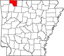 | |
| Towns | ||
| CDP | ||
| Unincorporated communities |
| |
| Ghost towns |
| |
| Townships | ||
| Footnotes | ‡This populated place also has portions in an adjacent county or counties | |
This article is issued from Wikipedia - version of the 9/10/2013. The text is available under the Creative Commons Attribution/Share Alike but additional terms may apply for the media files.