Phutunqu
| Phutunqu | |
|---|---|
 Phutunqu Location within Bolivia | |
| Highest point | |
| Elevation | 3,090 m (10,140 ft) [1] |
| Coordinates | 19°55′48″S 64°35′34″W / 19.93000°S 64.59278°WCoordinates: 19°55′48″S 64°35′34″W / 19.93000°S 64.59278°W |
| Geography | |
| Location |
Bolivia, Chuquisaca Department |
| Parent range | Andes |
Phutunqu (Aymara for a small vessel or a hole, pit, crater,[2] also spelled Phutunkhu) is a 3,090 m (10,140 ft) high mountain in the Bolivian Andes. It is located in the Chuquisaca Department, Azurduy Province, Tarvita Municipality. It lies west of the San Antonio River which is a left tributary of the Pillku Mayu (Quechua for "red river").[1][3]
References
- 1 2 Bolivian IGM map 1:50,000 Mariscal Braun 6634-II
- ↑ Radio San Gabriel, "Instituto Radiofonico de Promoción Aymara" (IRPA) 1993, Republicado por Instituto de las Lenguas y Literaturas Andinas-Amazónicas (ILLLA-A) 2011, Transcripción del Vocabulario de la Lengua Aymara, P. Ludovico Bertonio 1612 (Spanish-Aymara-Aymara-Spanish dictionary)
- ↑ "Tarvita". INE, Bolivia. Retrieved April 25, 2016.
Capital: Sucre | ||
| Provinces | 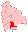 | |
| Municipalities and seats |
| |
This article is issued from Wikipedia - version of the 4/25/2016. The text is available under the Creative Commons Attribution/Share Alike but additional terms may apply for the media files.