Parklands, Tasmania
| Parklands Burnie, Tasmania | |||||||||||||
|---|---|---|---|---|---|---|---|---|---|---|---|---|---|
 Coast and Bass Highway | |||||||||||||
| Coordinates | 41°02′49″S 145°53′31″E / 41.047°S 145.892°ECoordinates: 41°02′49″S 145°53′31″E / 41.047°S 145.892°E | ||||||||||||
| Population | 815 (2011 Census[1]) | ||||||||||||
| Postcode(s) | 7320 | ||||||||||||
| LGA(s) | City of Burnie | ||||||||||||
| Federal Division(s) | Braddon | ||||||||||||
| |||||||||||||
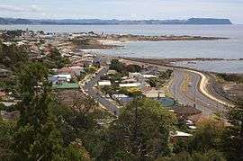
Parklands is a suburb of the City of Burnie in north-west Tasmania, Australia.
The visitor information centre for Burnie is called The Makers’ Workshop and is a place that honours Burnie’s history, makers, innovators and artists. It highlights paper making and cheese making through workshops and has a gallery and cafe.
The Burnie War Memorial[2] commemorates the fallen soldiers of the Great War.
Burnie Park has plenty of lush green lawns and ideal for picnics. It has a children' playground, waterfall and a music shell as some of its features.
The North West Regional Hospital is located on Brickport Road, Parklands.
Education
- Marist Regional College Est. 1972
References
- ↑ "2011 Census QuickStats". Commonwealth of Australia. Retrieved 28 July 2015.
- ↑ "Burnie War Memorial". Monuments Australia. Retrieved 28 July 2015.
External links
| City of Burnie |
|
|---|---|
This article is issued from Wikipedia - version of the 11/23/2016. The text is available under the Creative Commons Attribution/Share Alike but additional terms may apply for the media files.