Pará
| State of Pará | |||
|---|---|---|---|
| State | |||
| |||
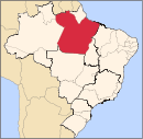
 Location of State of Pará in Brazil | |||
| Coordinates: 5°40′S 52°44′W / 5.667°S 52.733°WCoordinates: 5°40′S 52°44′W / 5.667°S 52.733°W | |||
| Country |
| ||
| Capital and largest city | Belém | ||
| Government | |||
| • Governor | Simão Jatene | ||
| • Vice Governor | Helenilson Pontes | ||
| Area | |||
| • Total | 1,247,689.5 km2 (481,735.6 sq mi) | ||
| Area rank | 2nd | ||
| Population (2012)[1] | |||
| • Total | 7,792,561 | ||
| • Rank | 9th | ||
| • Density | 6.2/km2 (16/sq mi) | ||
| • Density rank | 21st | ||
| Demonym(s) | Paraense | ||
| GDP | |||
| • Year | 2006 estimate | ||
| • Total | R$ 44,376,000,000 (13th) | ||
| • Per capita | R$ 6,241 (22nd) | ||
| HDI | |||
| • Year | 2010 | ||
| • Category | 0.646 – medium (24th) | ||
| Time zone | BRT (UTC-3) | ||
| Postal Code | 66000-000 to 68890-000 | ||
| ISO 3166 code | BR-PA | ||
| Website | pa.gov.br | ||


Pará (Portuguese pronunciation: [paˈɾa]) is a state in northern Brazil traversed by the lower Amazon River. It borders the Brazilian states of (clockwise from north) Amapá, Maranhão, Tocantins, Mato Grosso, Amazonas and Roraima. To the northwest it also borders Guyana and Suriname, and to the northeast it borders the Atlantic Ocean. The capital and largest city is Belém, located at the mouth of the Amazon at the Atlantic Ocean and the 11th most populous city in the country.
Pará is the most populous state of the northern region, with a population of over 7.5 million, being the ninth-most populous state in Brazil.[2] It is the second-largest state of Brazil in area, with 1,2 million km², second only to Amazonas upriver. Its most famous icons are the Amazon River and the Amazon Rainforest. Pará produces rubber (extracted from natural rubber tree groves), tropical hardwoods such as mahogany, and minerals such as iron ore and bauxite. A new commodity crop is soy, cultivated in the region of Santarém.
Every October, Belém receives tens of thousands of tourists for the year's most important religious celebration, the procession of the Círio de Nazaré. Another important attraction of the capital is the Marajó-style ceramics, based on pottery from the extinct Marajó indigenous culture, which was located on an island in the Amazon River. These designs have gained considerable international fame and increased international awareness.
History
The Portuguese colonization in Pará State first occurred in 1616, with the foundation of Presépio Fortress, known today as Castle Fortress, at Guajará bay. The city of Belém developed around this fortress. Before that, the region had been invaded many times by the Dutch and the English explorers and traders, seeking pepper; guaraná, a tree from which a powder is produced and used as a stimulant; and annato seeds, a fruit used for cooking, as a sunscreen and also for the extraction of dye.
Geography
Climate

A tropical rainforest climate is a type of tropical climate in which there is no dry season – all months have mean precipitation values of at least 60 millimetres (2.4 in). It is usually found at latitudes within five degrees of the equator – which are dominated by the Intertropical Convergence Zone. The equatorial climate is denoted Af in the Köppen climate classification.
Vegetation

The Amazon represents over half of the planet's remaining rainforests and comprises the largest and most species-rich tracts of tropical rainforest in the world. Wet tropical forests are the most species-rich biome, and tropical forests in the Americas are consistently more species rich than the wet forests in Africa and Asia.[3] As the largest tract of tropical rainforest in the Americas, the Amazonian rainforests have unparalleled biodiversity. More than one-third of all species in the world live in the Amazon Rainforest[4] The largest biodiversity of the planet is present across the state of Amazonas.
Large tracts of Pará state suffer from illegal deforestation and land occupation, mostly due to cattle ranching and soya farming. There have been conflicts between government, indigenous tribes, the Caboclos who are mixed-race peasants of the area, and ranchers over land rights. The situation is unlikely to be resolved soon, particularly due to the demand for beef from Europe and soya from China.
The controversial Belo Monte Dam is a proposed hydroelectric dam complex to be built on the Xingu River; opponents believes that it threatens the habitat of a relatively undisturbed area of Pará's rainforest, and would endanger several endemic fish species. It also is likely to attract further development and migration to the state, to the detriment of the state's rainforest.
Political subdivisions
The largest cities by population (2010) are:
- Belém 1,437,600
- Ananindeua 471,744
- Santarém, Pará 276,665
- Marabá, Pará 251,885
- Castanhal 179,036
- Abaetetuba 141,054
- Tucurui 100,000
- Altamira, Pará 105 030
- Paragominas
- Itaituba 97,704
Demographics
According to the IBGE of 2007, there were 7,136,000 people residing in the state. The population density was 5.7 inhabitants per square kilometre (15/sq mi). Urbanization: 75.2% (2006); Population growth: 2.5% (1991–2000); Houses: 1,754,000 (2006).[5]
The last PNAD (National Research for Sample of Domiciles) census revealed the following numbers: 4,988,000 Brown (Multiracial) people (69.9%), 1,641,000 White people (23.0%), 470,000 Black people (6.6%), 35,000 Asian or Amerindian people (0.5%).[6]
Ethnic groups

The majority of the population is mixed, due to the large indigenous population and, to a lesser amount, those with African ancestry. In the last IBGE census (2010), 817,000 Brazilians classified themselves as indigenous, about .26% percent of the country's total population.[7]
Pará has attracted numerous Portuguese, Spanish and Japanese immigrants. These people have told their stories in a permanent space, the "Room Vicente Salles" of the "Memorial of the People", located in Belém. The Portuguese colonists were followed by Spaniards fleeing wars and social unrest due to political disputes in the Iberian Peninsula. The Japanese have become established in agrarian communities, settling in towns such as Tomé-Açu.
Portuguese explorers and missionaries settled in the state in the 17th century. In January 1616, the Portuguese captain, Francisco Caldeira Castelo Branco began the occupation of the land, founding the Fort of the Nativity, nucleus of the future state capital. Portuguese religious missions were used to establish settlements between here and the Fort St. Louis of Maranhão. Most settlers sailed up the Amazon River as travel overland was extremely arduous. The Portuguese were the first to arrive in Pará, leaving contributions ranging from cuisine to architecture.
The first Japanese immigrants who settled in the Amazon left the Port of Kobe in Japan, on July 24, 1926, and reached the city of Tomé-Açu, on 22 September of that year, with stops in Rio de Janeiro and Belém.
The Japanese introduced crops such as jute and black pepper in the 1930s; and jute was so successful that it drove a boom in the regional economy. In the 1970s, Japanese farmers introduced cultivation of Hawaiian papaya and melon, for which there is international demand. The third largest ethnic Japanese community in Brazil is located in Pará, with about 13,000 inhabitants, surpassed only by settlements in the states of São Paulo and Paraná. They live mainly in the cities of Tomé-Açu, Santa Izabel do Pará, and Castanhal. Tomé-Açu was the first place in Northern Brazil to receive Japanese immigrants, circa 1929.
Italian immigrants in Pará came predominantly from the South of Italy, originating in Calabria, Campania and Basilicata. It was a time of a wave of emigration from They were all settlers and devoted to trade. The first Italian trade was recorded in 1888 in Santarém. The immigrants planted family roots in Belém, Breves, Abaetetuba, Óbidos, Oriximiná, Santarém and Alenquer. The presence in western Pará was so pronounced that the Consulate of Italy established an office in Óbidos, which is the largest city populated by Italians in the state. The consulate was in Recife, Pernambuco.
In Belém, the Italians worked in commercial and retail services. They were important during the beginning of the industrialization of the state capital (1895). According to the 1920 census, about 1,000 Italians lived in Pará. At the end of World War II, another wave of Italian immigrants arrived after was a flow caused by the persecution of Germans, Japanese and Italians. Similar to French immigrants, this wave of Italians did not remain in Pará.
Lebanese immigrants arrived in Para in the mid-nineteenth century, at the time of Rubber Boom, and through 1914. Between 15 000 and 25 000 Syrian-Lebanese immigrants, of whom one-third went to Acre. In Pará, the Lebanese settled in Belem, and also in the cities of Cametá, Marabá, Altamira, Breves, Monte Alegre, Alenquer, Santarém, Óbidos, Soure, Maracanã, Abaetetuba, among others.
The first French immigrants arrived in Brazil in the second half of the nineteenth century, settling in the colony of Benevides, the metropolitan region of Belém do Pará. The French were attracted to the region because of the Rubber Boom, eventually settling in Belém, which became known as Paris N'América.
Largest cities
| | |||||||||
|---|---|---|---|---|---|---|---|---|---|
| Rank | Mesoregion | Pop. | Rank | Mesoregion | Pop. | ||||
 Belém  Ananindeua |
1 | Belém | Metropolitana | 1437600 | 11 | Marituba | Metropolitana | 101158 |  Santarém  Marabá |
| 2 | Ananindeua | Metropolitana | 505512 | 12 | Breves | Marajó | 101094 | ||
| 3 | Santarém | Baixo Amazonas | 276665 | 13 | Altamira | Sudoeste | 98750 | ||
| 4 | Marabá | Sudeste | 203049 | 14 | Paragominas | Sudeste | 97350 | ||
| 5 | Castanhal | Metropolitana | 161497 | 15 | Tucuruí | Sudeste | 96010 | ||
| 6 | Parauapebas | Sudeste | 152777 | 16 | Barcarena | Metropolitana | 92567 | ||
| 7 | Abaetetuba | Nordeste | 139819 | 17 | Redenção | Sudeste | 75583 | ||
| 8 | Itaituba | Sudoeste | 127848 | 18 | Tailândia | Nordeste | 72720 | ||
| 9 | Cametá | Nordeste | 117099 | 19 | Moju | Nordeste | 68600 | ||
| 10 | Bragança | Nordeste | 107060 | 20 | São Félix do Xingu | Nordeste | 67208 | ||
Economy
The service sector is the largest component of GDP at 40.9%, followed by the industrial sector at 36.3%. Agriculture represents 22.8% of GDP (2004). Pará exports: iron ore 31.1%, aluminium 22.2%, wood 13.5%, ores of aluminium 8.3%, others ores 7.9% (2002), representing 1.8% of the Brazilian economy (2005).
The mining sector represents 14% of the Gross Domestic Product (GDP) of the State, originated mainly from the extraction of iron, bauxite, manganese, limestone and tin, as well as gold, until recently extracted from one of the largest mines of recent history: Serra Pelada. The economy of Pará is based also on the extraction of vegetation, on agriculture and cattle raising; thanks to the rich soil and the important hydrographic basin – boats are the main means of transport in the region. Guaraná, a tree from which a powder is produced and used as a stimulant; and annato seeds, a fruit used for cooking, as a sunscreen and also for dye extraction. Marajó – the biggest fluvial-maritime island in the world, with an area of 50,000 km2 (19,000 sq mi). Its territory has one of the largest mining areas in the country, located in the Carajás Mountains, a mining province where the Ferro Carajás Project is based, from Companhia Vale do Rio Doce. The complex produced 296 million metric tons of iron ore in 2007,[9] exporting the product to many countries, among them Japan, Germany, Italy, France and Spain.
According to the website for the state's investment promotion agency; Invest Para,[10] the state of Para is expecting US $50 billion in public and private investments into the local economy from 2010–2014. With agribusiness, cosmetics, mining and tourism as the sectors with highest investment potential as they receive special benefits from the state government.
Education

Portuguese is the official national language, and thus the primary language taught in schools. English and Spanish are also part of the official high school curriculum.
Educational institutions
- Universidade Federal do Pará (UFPA) (Federal University of Pará);
- Universidade Federal do Oeste do Pará (UFOPA) (Western Federal University of Pará);
- Universidade Federal do Sul e Sudeste do Pará (UNIFESSPA) (South and Southeast Federal University of Pará)
- Universidade Federal Rural da Amazônia (UFRA) (Rural Federal University of Amazon);
- Universidade do Estado do Pará (UEPA) (State University of Pará);
- Universidade da Amazônia (UNAMA) (University of Amazon);
- Instituto Federal do Pará (IFPA) (Federal Institute of Technical Education of Pará);
- Centro Universitário do Pará (CESUPA) (University Center of Pará);
- and many others.
Culture
Theatre
- Theatre of Peace;
- Experimental Waldemar Henrique theatre;
- Gabriel Hermes theatre;
- Theatre of SESC;
- Theatre of Emílio Goeldi Museum;
- Margarida Schiwazzapa theatre;
- Maria Sylvia Nunes theatre;
- Gasômetro station theatre.
Círio de Nazaré

The biggest festival in the state of Pará happens there, Círio de Nazaré (Nazareth Taper). This event is known to be the biggest religious event of the Western Hemisphere. The procession starts on the second Sunday of October and pays homage to Our Lady of Nazareth, patron saint of the State. Organised since 1793, at present it gathers around 2.3 million of followers, who go on a procession through the city on a huge suite to the Nazaré Basilica, where the image is worshiped.
Indigenous communities
Besides all the natural wealth, the State of Pará also shelters a valuable cultural treasure, about 40 indigenous groups, scattered through an area of over 23 million hectares (57×106 acres). Of these, more than eight million have been delimited by FUNAI (National Foundation of Indians), ensuring security and preservation of that space. Among the biggest indigenous communities there are the Andira Marau, Munduruku and the Kayapó.
Infrastructure
International Airport

Belém International Airport (BEL) is 10 km from the center of Belem. Currently it serves demand of 2.7 million passengers a year, in a constructed area of 33,255.17 square meters (357,955.7 sq ft). Traditionally called Val-de-Cães Airport, it is responsible for increasing tourism in the region, as well as for the outflow of products and attracting new investments.
Port
Port of Belém has restaurants, art galleries, a small brewery, ice-cream shops, artisan stands, regional food kiosks, coffee houses, a space for fairs and events, a theatre for 400 spectators and a touristic harbour.
Sports
Belém provides visitors and residents with various sport activities. The Mangueirão stadium architectural project is from August 1969. In 2002, 24 years after its inauguration, Mangueirão was reinaugurated as an Olympic stadium of Pará. The visiting capacity of the stadium is at around 45,000.
- Stadiums
- Olympic stadium of Pará;
- Evandro Almeida stadium;
- Jader Barbalho stadium;
- Leônidas Castro stadium;
- and many others.
Flag
The white stripe in the Flag of Pará represents the zodiac, the Equator and the Amazon River. The blue star is Spica in the constellation Virgo, which is also depicted on the Flag of Brazil representing the state. The two red areas symbolize the blood of the Cabanos in an revolt if happened in the end of the 19th century.
See also
References
- ↑
- ↑ http://www.ibge.gov.br/home/estatistica/populacao/estimativa2009/POP2009_DOU.pdf
- ↑ Turner, I.M. 2001. The ecology of trees in the tropical rain forest. Cambridge University Press, Cambridge. ISBN 0-521-80183-4
- ↑ Amazon Rainforest, Amazon Plants, Amazon River Animals
- ↑ Source: PNAD.
- ↑ Síntese de Indicadores Sociais 2007 (PDF) (in Portuguese). Pará, Brazil: IBGE. 2007. ISBN 85-240-3919-1. Retrieved 2007-07-18.
- ↑
- ↑ ESTIMATIVAS DA POPULAÇÃO RESIDENTE NOS MUNICÍPIOS BRASILEIROS COM DATA DE REFERÊNCIA EM 1º DE JULHO DE 2011
- ↑ Carajas Mine, Brazil
- ↑ Why Para?
External links
- (Portuguese) Official Website
- (English) Brazilian Tourism Portal
- (Portuguese) Portal Paraense
- (English) Invest Para
- (Turkish) Para yarışması
| Wikimedia Commons has media related to Pará. |
Capital: Belém | |||||||||||||||||||||||||||
| Mesoregion Baixo Amazonas |
|  | |||||||||||||||||||||||||
| Mesoregion Marajó |
| ||||||||||||||||||||||||||
| Mesoregion Metropolitana de Belém |
| ||||||||||||||||||||||||||
| Mesoregion Nordeste Paraense |
| ||||||||||||||||||||||||||
| Mesoregion Sudeste Paraense |
| ||||||||||||||||||||||||||
| Mesoregion Sudoeste Paraense |
| ||||||||||||||||||||||||||