Ontario Highway 66
| ||||
|---|---|---|---|---|
| Route information | ||||
| Maintained by the Ministry of Transportation of Ontario | ||||
| Length: | 103.5 km[1] (64.3 mi) | |||
| Existed: | September 22, 1937[2] – present | |||
| Major junctions | ||||
| West end: |
| |||
|
| ||||
| North end: |
| |||
| Highway system | ||||
| ||||
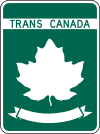
King's Highway 66, commonly referred to as Highway 66, is a provincially maintained highway in the Canadian province of Ontario. Located in the Timiskaming District, the highway begins at Matachewan near a junction with Highway 65. It extends eastward for 107.0 kilometres (66.5 mi) to the Quebec boundary just east of Kearns. At the provincial boundary, the highway continues eastward as Route 117. From Highway 11 (41 kilometres (25 mi) east of Matachewan) at Kenogami Lake eastwards to the Quebec boundary, Highway 66 is designated as part of the Trans-Canada Highway.
Route description

Beginning at the village of Matachewan, where the highway continues west as Highway 566, the route travels 4.6 kilometres (2.9 mi) east to a junction with Highway 65. From there to the community of Kenogami Lake, on Highway 11, the highway passes through a 40 kilometres (25 mi) wilderness, encountering few roads or signs of humanity. Instead the highway winds through rock cuts, muskeg and thick coniferous forests. After intersecting Highway 11, the route continues east through the community of Swastika. It encounters Highway 112 between Swastika and the community of Chaput Hughes, after which the highway enters the town of Kirkland Lake. East of the town, Highway 66 passes through King Kirkland and encounters Highway 672. East of here, the highway returns to a remote setting, passing through the community of Larder Lake, where it encounters Highway 624. For the remaining 17 kilometres (11 mi), the route snakes through the wilderness, passing through the communities of Virginiatown and Kearns between long segments of forest. Immediately east of Kearns, the highway crosses the Ontario–Quebec boundary, where it continues as Quebec Route 117 to Rouyn-Noranda.[3]
The entirety of Highway 66 is located within Timiskaming District in the rugged and remote Canadian Shield. Outside of the communities along the route, there is almost no inhabitation or services. Consequently, traffic volumes drop considerably east of Highway 11.[1]
History

Highway 66 was first assumed by the Department of Highways on September 22, 1937,[2] shortly after its merger with the Department of Northern Development (DND).[4] The DND created the road during the early 1930s, connecting several rail stops. The Kirkland Lake area is the site of several gold deposits that were discovered during the first quarter of the century, and the King's Highway status brought about new improvements to help service the mines. Initially, the route was only 26.2 miles (42.2 km) long, connecting Kirkland Lake with the Ontario–Quebec boundary. On November 16, 1955, the route was extended 25.5 miles (41.0 km) west to Highway 65 near Matachewan.[5] Although several minor realignments to improve the rugged route have been made since then, it did not change significantly between 1956 and 1997. On April 1, 1997, a 1.9 kilometres (1.2 mi) section of the highway, between Goldthorpe Drive and Main Street, was transferred to the town of Kirkland Lake.[6]
Future
Beginning in August 2011, the Ministry of Transportation of Ontario undertook the Virginiatown Relocation Study to determine a new location around the town and bypass the abandoned Kerr Addison Mine.[7] A 3.4-kilometre (2.1 mi) bypass north of Virginiatown, near the eastern end of the highway, is currently tendered for construction in the upcoming future. No timeline for completion has been set yet.[8][9]
Major intersections
The following table lists the major junctions along Highway 66, as noted by the Ministry of Transportation of Ontario.[1] The entire route is located in Timiskaming District.[3]
| Location | km[1] | mi | Destinations | Notes | |||
|---|---|---|---|---|---|---|---|
| Matachewan | 0.0 | 0.0 | |||||
| 4.6 | 2.9 | ||||||
| Kenogami Lake | 44.8 | 27.8 | |||||
| Kirkland Lake | 54.0 | 33.6 | |||||
| 57.1 | 35.5 | Goldthorpe Drive | Highway 66 ends | ||||
| 59.0 | 36.7 | Main Street | Highway 66 resumes; beginning of Kirkland Lake Connecting Link agreement | ||||
| 61.0 | 37.9 | Kirkland Lake city limits; end of Kirkland Lake Connecting Link agreement | |||||
| 73.6 | 45.7 | Highway 672 north | |||||
| Larder Lake | 86.4 | 53.7 | Highway 624 south (Ontario Street) | ||||
| 103.5 | 64.3 | ||||||
| Continues as | |||||||
| 1.000 mi = 1.609 km; 1.000 km = 0.621 mi | |||||||
See also
References
- 1 2 3 4 Ministry of Transportation of Ontario (2008). "Annual Average Daily Traffic (AADT) counts". Retrieved February 13, 2012.
- 1 2 "Appendix 3 - Schedule of Assumptions and Reversions". Annual Report (Report). Department of Highways. March 31, 1938. p. 80.
- 1 2 Mapart (2010). Ontario Back Road Atlas (Map). Peter Heiler Ltd. p. 105. § H17–J18. ISBN 978-1-55198-226-7.
- ↑ "Appendix 3 - Schedule of Assumptions and Reversions". Annual Report (Report). Department of Highways. March 31, 1938. p. 8.
- ↑ "Appendix 3 - Schedule of Assumptions of Sections". Annual Report (Report). Department of Highways. March 31, 1956. p. 205.
- ↑ Highway Transfers List (Report). Ministry of Transportation of Ontario. April 1, 1997. p. 10.
- ↑ http://www.abandoned-mines.org/pdfs/RiskAssessmentWorkshop2008-pdfs/ManagingRiskatKerr-mndm.pdf
- ↑ https://www.raqs.merx.com/public/bulletin/contractView.jsf?id=31900402
- ↑ http://ontruck.org/mto-to-begin-detail-design-and-enviro-study-for-hwy-66/
External links
| British Columbia | ||
|---|---|---|
| Alberta | ||
| Saskatchewan | ||
| Manitoba | ||
| Ontario | ||
| Quebec | ||
| New Brunswick | ||
| Prince Edward Island | ||
| Nova Scotia | ||
| Newfoundland | ||
| ||