Okabena, Minnesota
| Okabena, Minnesota | |
|---|---|
| City | |
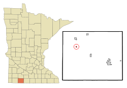 Location of Okabena, Minnesota | |
| Coordinates: 43°44′24″N 95°18′57″W / 43.74000°N 95.31583°W | |
| Country | United States |
| State | Minnesota |
| County | Jackson |
| Government | |
| • Type | Mayor – Council |
| • Mayor | Brent Groen |
| Area[1] | |
| • Total | 0.21 sq mi (0.54 km2) |
| • Land | 0.21 sq mi (0.54 km2) |
| • Water | 0 sq mi (0 km2) |
| Elevation | 1,421 ft (433 m) |
| Population (2010)[2] | |
| • Total | 188 |
| • Estimate (2012[3]) | 188 |
| • Density | 895.2/sq mi (345.6/km2) |
| Time zone | Central (CST) (UTC-6) |
| • Summer (DST) | CDT (UTC-5) |
| ZIP code | 56161 |
| Area code(s) | 507 |
| FIPS code | 27-48184[4] |
| GNIS feature ID | 0657662[5] |
Okabena is a town in Jackson County, Minnesota, United States. The population was 188 at the 2010 census.[6] The community's name is a Dakota term meaning "the nesting place of herons."[7]
History
Okabena was founded in 1879 after the railroad had been extended to that point.[8] A post office has been in operation at Okabena since 1880.[9]
On May 19, 1933, the Okabena Bank was robbed by Bonnie and Clyde. After leaving the bank, they were shot at many times, but escaped on a country road with approximately $2500 (approximately $44,000 in 2013 dollars).[10][11][12]
Geography
According to the United States Census Bureau, the city has a total area of 0.21 square miles (0.54 km2), all land.[1]
The community is located on County Roads 9 and 20 west of South Heron Lake.
Demographics
| Historical population | |||
|---|---|---|---|
| Census | Pop. | %± | |
| 1940 | 210 | — | |
| 1950 | 236 | 12.4% | |
| 1960 | 244 | 3.4% | |
| 1970 | 237 | −2.9% | |
| 1980 | 263 | 11.0% | |
| 1990 | 223 | −15.2% | |
| 2000 | 185 | −17.0% | |
| 2010 | 188 | 1.6% | |
| Est. 2015 | 184 | [13] | −2.1% |
2010 census
As of the census[2] of 2010, there were 188 people, 74 households, and 54 families residing in the city. The population density was 895.2 inhabitants per square mile (345.6/km2). There were 86 housing units at an average density of 409.5 per square mile (158.1/km2). The racial makeup of the city was 92.6% White, 1.1% African American, 1.1% Native American, 0.5% Asian, 3.2% from other races, and 1.6% from two or more races. Hispanic or Latino of any race were 4.8% of the population.
There were 74 households of which 35.1% had children under the age of 18 living with them, 60.8% were married couples living together, 9.5% had a female householder with no husband present, 2.7% had a male householder with no wife present, and 27.0% were non-families. 24.3% of all households were made up of individuals and 13.6% had someone living alone who was 65 years of age or older. The average household size was 2.54 and the average family size was 2.93.
The median age in the city was 37.8 years. 30.3% of residents were under the age of 18; 3.1% were between the ages of 18 and 24; 26.6% were from 25 to 44; 22.9% were from 45 to 64; and 17% were 65 years of age or older. The gender makeup of the city was 50.5% male and 49.5% female.
2000 census
As of the census[4] of 2000, there were 185 people, 76 households, and 49 families residing in the city. The population density was 893.3 people per square mile (340.1/km²). There were 87 housing units at an average density of 420.1 per square mile (160.0/km²). The racial makeup of the city was 100.00% White. Hispanic or Latino of any race were 6.49% of the population.
There were 76 households out of which 28.9% had children under the age of 18 living with them, 52.6% were married couples living together, 7.9% had a female householder with no husband present, and 35.5% were non-families. 32.9% of all households were made up of individuals and 19.7% had someone living alone who was 65 years of age or older. The average household size was 2.43 and the average family size was 3.08.
In the city the population was spread out with 29.2% under the age of 18, 7.6% from 18 to 24, 25.9% from 25 to 44, 15.1% from 45 to 64, and 22.2% who were 65 years of age or older. The median age was 35 years. For every 100 females there were 101.1 males. For every 100 females age 18 and over, there were 98.5 males.
The median income for a household in the city was $32,188, and the median income for a family was $35,500. Males had a median income of $28,438 versus $19,375 for females. The per capita income for the city was $14,332. None of the families and 1.5% of the population were living below the poverty line.
Politics
Okabena is located in Minnesota's 1st congressional district, represented by Mankato educator Tim Walz, a Democrat. At the state level, Okabena is located in Senate District 22, represented by Republican Doug Magnus, and in House District 22B, represented by Republican Rod Hamilton.
References
- 1 2 "US Gazetteer files 2010". United States Census Bureau. Archived from the original on January 24, 2012. Retrieved 2012-11-13.
- 1 2 "American FactFinder". United States Census Bureau. Retrieved 2012-11-13.
- ↑ "Population Estimates". United States Census Bureau. Archived from the original on June 17, 2013. Retrieved 2013-05-28.
- 1 2 "American FactFinder". United States Census Bureau. Archived from the original on September 11, 2013. Retrieved 2008-01-31.
- ↑ "US Board on Geographic Names". United States Geological Survey. 2007-10-25. Retrieved 2008-01-31.
- ↑ "2010 Census Redistricting Data (Public Law 94-171) Summary File". American FactFinder. United States Census Bureau. Archived from the original on July 21, 2011. Retrieved 27 April 2011.
- ↑ "Minnesota Place Names - Township and Village Information". Minnesota Historical Society. Retrieved 30 April 2011.
- ↑ Upham, Warren (1920). Minnesota Geographic Names: Their Origin and Historic Significance. Minnesota Historical Society. p. 262.
- ↑ "Jackson County". Jim Forte Postal History. Retrieved 13 July 2015.
- ↑ Ramsey, Winston G., ed. (2003). On The Trail of Bonnie and Clyde. London: After The Battle Books. ISBN 1-870067-51-7.
- ↑ "On the Trail of Bonnie and Clyde Then and Now"
- ↑ "My Life with Bonnie and Clyde" by Blanche Caldwell Barrow, Esther L. Weiser
- ↑ "Annual Estimates of the Resident Population for Incorporated Places: April 1, 2010 to July 1, 2015". Retrieved July 2, 2016.
- ↑ "Census of Population and Housing". Census.gov. Archived from the original on May 11, 2015. Retrieved June 4, 2015.
External links
Municipalities and communities of Jackson County, Minnesota, United States | ||
|---|---|---|
| Cities | 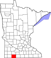 | |
| Townships | ||
| CDP | ||
| Unincorporated communities | ||
Coordinates: 43°44′22″N 95°18′57″W / 43.73944°N 95.31583°W