Jackson, Minnesota
| Jackson, Minnesota | |
|---|---|
| City | |
|
Jackson County Courthouse in Jackson | |
| Motto: "Come Grow With Us" | |
 Location of Jackson within Jackson County and state of Minnesota | |
| Coordinates: 43°37′15″N 94°59′19″W / 43.62083°N 94.98861°WCoordinates: 43°37′15″N 94°59′19″W / 43.62083°N 94.98861°W | |
| Country |
|
| State |
|
| County | Jackson |
| Government | |
| • Type | Mayor – Council |
| • Mayor | Wayne Walter |
| Area[1] | |
| • Total | 4.60 sq mi (11.91 km2) |
| • Land | 4.58 sq mi (11.86 km2) |
| • Water | 0.02 sq mi (0.05 km2) |
| Elevation | 1,316 ft (401 m) |
| Population (2010)[2] | |
| • Total | 3,299 |
| • Estimate (2012[3]) | 3,307 |
| • Density | 720.3/sq mi (278.1/km2) |
| Time zone | Central (CST) (UTC-6) |
| • Summer (DST) | CDT (UTC-5) |
| ZIP code | 56143 |
| Area code(s) | 507 |
| FIPS code | 27-31562 [4] |
| GNIS feature ID | 0645559 [5] |
| Website | cityofjacksonmn.com |

Jackson is a city and county seat of Jackson County, Minnesota, United States.[6] The population was 3,299 at the 2010 census.[7]
History
Jackson was originally called Springfield, and under the latter name was laid out in 1856.[8] A post office called Jackson has been in operation since 1858.[9]
It is speculated that early trappers and explorers were the first to enter the Jackson area. The first white settlers in Jackson were brothers – William, George, and Charles Wood of Indiana, by way of Mankato. In July 1856, they established a trading post and named the proposed town "Springfield" because there was a spring near where they built their cabin, a large one-room log building near the Des Moines River. Forty settlers followed in that summer of 1856. The greater number were of English and Scottish descent, from Webster City, Iowa. Over a dozen log cabins were built by that fall.
The winter of 1856-1857 was one of the most severe that was ever experienced because of its bitter cold, deep snows, and violent storms. Food was scarce as all the white settlers had come too late to raise a crop or plant gardens. Consequently, all provisions had to be hauled from the nearest settlements of Webster City or Mankato.
Several bands of roving Indians visited the white settlers that winter. They were always received kindly, the settlers sharing their supplies. One of these was a gang led by Inkpaduta, a lawless band, who were enemies of all Indians because of their plundering, robberies and outrages. This was the group that in March 1857, after not being extended hospitality at Smithland, Iowa, massacred 40 settlers and took four women hostage in the Okoboji and Spirit Lake area before proceeding to Springfield, Minnesota.
On March 26, 1857, there were 11 able-bodied men in the Springfield settlement. Inkpaduta and his gang came down from the Heron Lake area by way of Gaboo’s camp. They first attacked the Woods’ store where, after killing William and George, they replenished their stock of ammunition and proceeded to attack the other cabins. At the Thomas cabin gathered the greater number of settlers, a determined fight was put up, and they succeeded in standing off the Indians. For the first time since leaving the Smithland area, the Indians encountered men who were not afraid to fight for their lives, and the attempt to wipe out the settlement failed. However, they did kill seven and wounded three others. Terrified of a possible second Indian attack, the beleaguered people who survived left for Fort Dodge.
Just two months after the massacre and when the area was completely depopulated, the Minnesota State Legislature made this county a political division, naming it Jackson County – after the first merchant of St. Paul, MN. The temporary county seat was located at Jackson, the town site of Springfield having been renamed. Resettlement was slow, since settlers still feared the Indians.
In August 1862, the Sioux nation went on the warpath. On August 25, the Belmont community was attacked. Most of the settlers were gathered at one cabin for church. The Indians thought that they had gathered to resist their attack, so they fled before there was much of a fight. However, when they first arrived, they did kill 13 and wounded three. This scared the settlers, so the pioneers took flight for Iowa. For a second time, the county seat was entirely deserted.
Determined not to give up, the settlers soon returned following the Civil War in 1865 and resettled the depopulated Jackson County. They were followed by many others whose homelands were in Europe. A new era began. A stockade was built on what is presently Thomas Hill, manned by the military, which encouraged people to settle in the Jackson community. Homes were built from native timber and some from prairie sod. There were no wagon roads, no bridges, no churches, and only one school that served the community. Despite the terrors of living in a country exposed to Indian attack, numerous disasters, prairie fires, severe blizzards, crop failures, and the grasshopper devastation of 1873, these hardy, courageous pioneers survived and gave us a heritage we can be proud of.
From the birth of Springfield Addition in July, 1856, the pains and suffering of a strong settlement have established a prosperous farm and industrial community known as Jackson.[10]
Geography
According to the United States Census Bureau, the city has a total area of 4.60 square miles (11.91 km2), of which 4.58 square miles (11.86 km2) is land and 0.02 square miles (0.05 km2) is water.[1]
Interstate 90 and U.S. Highway 71 are two of the main routes in the city. Jackson is located near the center of the county of the same name. To the south is the Iowa Lakes region, which comprises Spirit Lake, West Okoboji Lake and several other small lakes.
Demographics
| Historical population | |||
|---|---|---|---|
| Census | Pop. | %± | |
| 1880 | 501 | — | |
| 1890 | 720 | 43.7% | |
| 1900 | 1,756 | 143.9% | |
| 1910 | 1,907 | 8.6% | |
| 1920 | 2,144 | 12.4% | |
| 1930 | 2,206 | 2.9% | |
| 1940 | 2,840 | 28.7% | |
| 1950 | 3,313 | 16.7% | |
| 1960 | 3,370 | 1.7% | |
| 1970 | 3,550 | 5.3% | |
| 1980 | 3,797 | 7.0% | |
| 1990 | 3,559 | −6.3% | |
| 2000 | 3,501 | −1.6% | |
| 2010 | 3,299 | −5.8% | |
| Est. 2015 | 3,234 | [11] | −2.0% |
| U.S. Decennial Census | |||
2010 census
As of the census[2] of 2010, there were 3,299 people, 1,489 households, and 856 families residing in the city. The population density was 720.3 inhabitants per square mile (278.1/km2). There were 1,635 housing units at an average density of 357.0 per square mile (137.8/km2). The racial makeup of the city was 93.3% White, 0.5% African American, 0.4% Native American, 3.4% Asian, 0.8% from other races, and 1.6% from two or more races. Hispanic or Latino of any race were 1.8% of the population.
There were 1,489 households of which 27.2% had children under the age of 18 living with them, 42.6% were married couples living together, 10.3% had a female householder with no husband present, 4.5% had a male householder with no wife present, and 42.5% were non-families. 37.9% of all households were made up of individuals and 16.1% had someone living alone who was 65 years of age or older. The average household size was 2.17 and the average family size was 2.84.
The median age in the city was 40.8 years. 22.7% of residents were under the age of 18; 8.4% were between the ages of 18 and 24; 23.1% were from 25 to 44; 26.4% were from 45 to 64; and 19.3% were 65 years of age or older. The gender makeup of the city was 48.4% male and 51.6% female.
2000 census
As of the census[4] of 2000, there were 3,501 people, 1,487 households, and 887 families residing in the city. The population density was 921.7 people per square mile (355.7/km²). There were 1,659 housing units at an average density of 436.8 per square mile (168.6/km²). The racial makeup of the city was 94.03% White, 0.26% African American, 0.17% Native American, 4.03% Asian, 0.77% from other races, and 0.74% from two or more races. Hispanic or Latino of any race were 1.51% of the population.
There were 1,487 households out of which 27.2% had children under the age of 18 living with them, 49.0% were married couples living together, 7.9% had a female householder with no husband present, and 40.3% were non-families. 36.3% of all households were made up of individuals and 16.5% had someone living alone who was 65 years of age or older. The average household size was 2.24 and the average family size was 2.93.
In the city the population was spread out with 23.3% under the age of 18, 9.5% from 18 to 24, 24.5% from 25 to 44, 20.5% from 45 to 64, and 22.2% who were 65 years of age or older. The median age was 40 years. For every 100 females there were 94.2 males. For every 100 females age 18 and over, there were 89.8 males.
The median income for a household in the city was $33,452, and the median income for a family was $42,553. Males had a median income of $30,503 versus $21,676 for females. The per capita income for the city was $18,444. About 4.6% of families and 11.1% of the population were below the poverty line, including 17.4% of those under age 18 and 9.4% of those age 65 or over.
Historic sites
- Ashley Park – Olson-Slaabakken cabin, Jackson County's oldest structure.
- Fort Belmont – 1873 farmhouse, blacksmith shop, log cabin and stockade, 1902 Delafield Lutheran Church.
- Jackson County Fair Village – 20 historical buildings and is located at the Jackson County Fairgrounds
- Jackson County Historical Society and Museum – west of Jackson at Lakefield, Minnesota, provides a look back at the County’s history.
- Jackson County Courthouse – Constructed in 1908 with murals adorn the Court Room and Rotunda, listed on the National Register of Historic Places
Economy
Though largely a farming community, Jackson has a large industrial park with such businesses as: AGCO,USF Holland, Last Deck, HitchDock, Pioneer, and TS AGCO and Cat Challenger tractors are manufactured in Jackson.
Government
Jackson is located in Minnesota's 1st congressional district, represented by Mankato educator Tim Walz, a Democrat. At the state level, Jackson is located in Senate District 22, represented by Republican Doug Magnus, and in House District 22B, represented by Republican Rod Hamilton.
Transportation
The city-owned Jackson Municipal Airport is located two nautical miles (2.3 mi, 3.7 km) north of Jackson's central business district.[12]
Notable people
- David Ellefson - bassist in Megadeth
- Bjarne Elgar Grottum, Minnesota State Senator who was raised in Jackson.[13]
References
- 1 2 "US Gazetteer files 2010". United States Census Bureau. Archived from the original on January 24, 2012. Retrieved 2012-11-13.
- 1 2 "American FactFinder". United States Census Bureau. Retrieved 2012-11-13.
- ↑ "Population Estimates". United States Census Bureau. Archived from the original on June 17, 2013. Retrieved 2013-05-28.
- 1 2 "American FactFinder". United States Census Bureau. Archived from the original on September 11, 2013. Retrieved 2008-01-31.
- ↑ "US Board on Geographic Names". United States Geological Survey. 2007-10-25. Retrieved 2008-01-31.
- ↑ "Find a County". National Association of Counties. Archived from the original on May 31, 2011. Retrieved 2011-06-07.
- ↑ "2010 Census Redistricting Data (Public Law 94-171) Summary File". American FactFinder. United States Census Bureau. Archived from the original on July 21, 2011. Retrieved 27 April 2011.
- ↑ Upham, Warren (1920). Minnesota Geographic Names: Their Origin and Historic Significance. Minnesota Historical Society. p. 262.
- ↑ "Jackson County". Jim Forte Postal History. Retrieved 13 July 2015.
- ↑ http://www.jacksonmn.com/our-history/
- ↑ "Annual Estimates of the Resident Population for Incorporated Places: April 1, 2010 to July 1, 2015". Retrieved July 2, 2016.
- ↑ FAA Airport Master Record for MJQ (Form 5010 PDF). Federal Aviation Administration. Effective 30 June 2011.
- ↑ "Grottum, Bjarne Elgar "B.E."". Legislators Past and Present. Minnesota Legislative Reference Library. Retrieved 8 June 2012.
External links
| Wikimedia Commons has media related to Jackson, Minnesota. |
Municipalities and communities of Jackson County, Minnesota, United States | ||
|---|---|---|
| Cities | 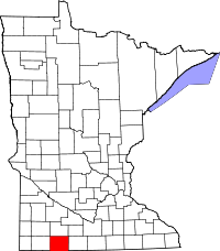 | |
| Townships | ||
| CDP | ||
| Unincorporated communities | ||