Norco, Louisiana
| Norco | |
| Census-designated place | |
| Country | United States |
|---|---|
| State | Louisiana |
| Parish | St. Charles |
| Elevation | 10 ft (3.0 m) |
| Coordinates | 30°00′14″N 90°24′39″W / 30.00389°N 90.41083°WCoordinates: 30°00′14″N 90°24′39″W / 30.00389°N 90.41083°W |
| Area | 3.4 sq mi (8.8 km2) |
| - land | 3.0 sq mi (8 km2) |
| - water | 0.4 sq mi (1 km2), 11.76% |
| Population | 3,579 (2000) |
| Density | 1,198.0/sq mi (462.6/km2) |
| Timezone | CST (UTC-6) |
| - summer (DST) | CDT (UTC-5) |
| Area code | 985 |
 Location of Norco in Louisiana | |
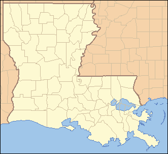
 Location of Louisiana in the United States | |
Norco is a census-designated place (CDP) in St. Charles Parish, Louisiana, United States. The population was 3,579 at the 2000 census. The community is home to a major Shell petroleum refinery. Its name is derived from the New Orleans Refining Company.
Early history
By the late 18th century, French and European colonial settlers had established numerous sugar cane plantations. They imported enslaved Africans as laborers. As sugar cane cultivation was highly labor-intensive, the slave population greatly outnumbered the ethnic Europeans in the colony, a circumstance that continued after the Louisiana Purchase by the United States in 1803.
On 8 January 1811, planters were alarmed by the German Coast Uprising led by Charles Deslondes, a free person of color from Haiti (formerly the French colony of Saint-Domingue). It was the largest slave uprising in US history, though it resulted in few white fatalities. Deslondes and his followers had been influenced by the ideas of the French and Haitian revolutions. In 1809-1810 French-speaking refugees from the Revolution immigrated by the thousands to New Orleans and Louisiana: white planters and their slaves, and free people of color, adding to the French Creole, African and free people of color populations.[1]
Deslondes led followers to the plantation of Col. Manuel André, where they had hoped to get stored arms, but these were moved. They traveled downriver, gathering more slaves for the insurrection as they marched. They were armed simply with hand tools and accompanied their progress by drums. More than 200 men participated in the uprising; they killed two white men on their march toward New Orleans. The alarm was raised, and both militias and regular troops were called out by Gov. William C.C. Claiborne to put down the short-lived revolt. The white militias and troops killed 95 slaves in total, many immediately and others in executions after quick trials.[2]
20th century & beyond
The community of Norco was once called "Sellers," after a wealthy family there. In 1911, the land was purchased by an agent for Shell Oil, and the New Orleans Refining Company (NORCO) was established. The community's name was officially changed from Sellers to Norco sometime after 1926.[3]
Since 1995 members of the African American History Alliance of Louisiana have gathered annually at Norco in January to commemorate the events of the German Coast Uprising, when men of color reached for freedom decades before the American Civil War and emancipation. They have been joined by descendants of the insurgents.[4]
Geography
Norco is located at 30°0′14″N 90°24′39″W / 30.00389°N 90.41083°W (30.003753, -90.410824).[5] The city is situated on the eastern edge of the large Bonnet Carré Spillway, which provides for an outlet from the Mississippi River to Lake Pontchartrain during flooding of the river.
According to the United States Census Bureau, the CDP has a total area of 3.4 square miles (8.8 km2), of which, 3.0 square miles (7.8 km2) of it is land and 0.4 square miles (1.0 km2) of it (12.83%) is water.
Demographics
As of the census[6] of 2000, there were 3,579 people, 1,329 households, and 983 families residing in the CDP. The population density was 1,198.0 people per square mile (462.2/km²). There were 1,420 housing units at an average density of 475.3 per square mile (183.4/km²). The racial makeup of the CDP was 78.68% White, 19.22% African American, 0.42% Native American, 0.28% Asian, 0.34% from other races, and 1.06% from two or more races. Hispanic or Latino of any race were 2.01% of the population.
There were 1,329 households out of which 32.1% had children under the age of 18 living with them, 54.5% were married couples living together, 14.7% had a female householder with no husband present, and 26.0% were non-families. 23.0% of all households were made up of individuals and 11.2% had someone living alone who was 65 years of age or older. The average household size was 2.68 and the average family size was 3.16.
In the CDP the population was spread out with 26.3% under the age of 18, 8.6% from 18 to 24, 29.0% from 25 to 44, 19.1% from 45 to 64, and 17.1% who were 65 years of age or older. The median age was 37 years. For every 100 females there were 93.3 males. For every 100 females age 18 and over, there were 89.2 males.
The median income for a household in the CDP was $37,270, and the median income for a family was $46,446. Males had a median income of $35,369 versus $22,406 for females. The per capita income for the CDP was $17,065. About 8.5% of families and 11.4% of the population were below the poverty line, including 13.8% of those under age 18 and 4.7% of those age 65 or over.
Education
St. Charles Parish Public School System operates public schools, including:
- Norco Elementary K-3 School
- Norco Elementary 4-6 School
- Destrehan High School in Destrehan[7]
Prior to 1969 Mary M. Bethune High School in Norco served area black students; that year it closed, with high school students moved to Destrehan High.[8]
Notable residents
- Damaris Johnson, NFL wide receiver/punt returner for the Philadelphia Eagles and Houston Texans
- Jamall Johnson, NFL and CFL linebacker
- Rondell Mealey, NFL running back for the Green Bay Packers
- Gregory A. Miller, member of the Louisiana House of Representatives from St. Charles Parish, was reared in Norco.[9]
- Ralph R. Miller, member of the Louisiana House from 1968 to 1980 and 1982 to 1992; father of Gregory Miller
- George T. Oubre, state senator from 1968 to 1972 for St. Charles, St. James, and St. John the Baptist parishes; candidate for state attorney general in December 1971, while residing in Norco
- Jeremy Parquet, NFL offensive lineman for the Kansas City Chiefs, St. Louis Rams and Pittsburgh Steelers
- Rusty Rebowe, NFL linebacker for the New Orleans Saints
- Tim Rebowe, Head football coach at Nicholls State University
- Gary Smith, Jr., Louisiana state senator
See also
References
- ↑ Adam Rothman, Slave Country: American Expansion and the Origins of the Deep South, Cambridge: Harvard University Press, 2005, pp. 106-108
- ↑ Adam Rothman, Slave Country: American Expansion and the Origins of the Deep South, Cambridge: Harvard University Press, 2005, p. 111
- ↑ Steve Lerner, Diamond: A Struggle for Environmental Justice in Louisiana's Chemical Corridor, Cambridge, MA: MIT Press, 2005, pp. 24, 228. ISBN 978-0-262-12273-3. Retrieved May 20, 2010.
- ↑ James W. Lowen, Lies Across America: What Our History Sites Get Wrong, New York: Simon & Schuster, 2007, p. 192
- ↑ "US Gazetteer files: 2010, 2000, and 1990". United States Census Bureau. 2011-02-12. Retrieved 2011-04-23.
- ↑ "American FactFinder". United States Census Bureau. Retrieved 2008-01-31.
- ↑ "Destrehan High School" (Archive). AdvancED. p. 4. Retrieved on December 3, 2016. "The school pulls from the five communities which make up the East Bank of St. Charles Parish: Destrehan, Montz, New Sarpy, Norco, and St. Rose."
- ↑ "About Our School." Destrehan High School. Retrieved on December 3, 2016.
- ↑ "Mary Sparacello, St. Charles Parish-based 56th Louisiana House district draws trio of hopefuls, September 28, 2011". New Orleans Times-Picayune. Retrieved August 26, 2013.
External links
| Wikimedia Commons has media related to Norco, Louisiana. |
- Fenceline, PBS documentary about the oil industry in Norco, and how the community is divided over issues around it.
Municipalities and communities of St. Charles Parish, Louisiana, United States | ||
|---|---|---|
| CDPs | 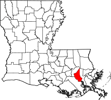 | |
| Other Unincorporated communities | ||
| Footnotes | ‡This populated place also has portions in an adjacent parish or parishes | |