St. Rose, Louisiana
| St. Rose | |
| Saint Rose | |
| CDP | |
| Country | United States |
|---|---|
| State | Louisiana |
| Parish | St. Charles |
| Elevation | 10 ft (3.0 m) |
| Coordinates | 29°57′38″N 90°18′47″W / 29.96056°N 90.31306°WCoordinates: 29°57′38″N 90°18′47″W / 29.96056°N 90.31306°W |
| Area | 5.0 sq mi (12.9 km2) |
| - land | 4.0 sq mi (10 km2) |
| - water | 1.0 sq mi (3 km2), 20% |
| Population | 6,540 (2000) |
| Density | 1,620.1/sq mi (625.5/km2) |
| Timezone | CST (UTC-6) |
| - summer (DST) | CDT (UTC-5) |
| Area code | 504 |
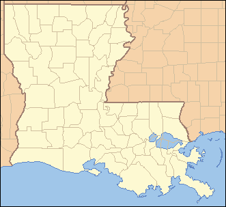 Location of St. Rose in Louisiana | |
 Location of Louisiana in the United States | |
Saint Rose (usually written as St. Rose) is a census-designated place (CDP) in St. Charles Parish, Louisiana, United States. St. Rose is on the east bank of the Mississippi River two miles (3 km) north of the Jefferson Parish border and is part of the Greater New Orleans metropolitan area. The population was 6,540 in the 2000 census.
Geography
St. Rose is located at 29°57′38″N 90°18′47″W / 29.96056°N 90.31306°W (29.960421, -90.313094).[1]
According to the United States Census Bureau, the CDP has a total area of 5.0 square miles (13.0 km²), of which, 4.0 square miles (10.5 km²) of it is land and 1.0 square miles (2.6 km²) of it (19.88%) is water.
Demographics
As of the census[2] of 2000, there were 6,540 people, 2,286 households, and 1,748 families residing in the CDP. The population density was 1,620.1 people per square mile (625.0/km²). There were 2,385 housing units at an average density of 590.8 per square mile (227.9/km²). The racial makeup of the CDP was 55.23% White, 41.51% African American, 0.32% Native American, 0.47% Asian, 0.03% Pacific Islander, 1.19% from other races, and 1.24% from two or more races. Hispanic or Latino of any race were 4.53% of the population.
There were 2,286 households out of which 43.2% had children under the age of 18 living with them, 50.3% were married couples living together, 21.5% had a female householder with no husband present, and 23.5% were non-families. 18.9% of all households were made up of individuals and 4.5% had someone living alone who was 65 years of age or older. The average household size was 2.86 and the average family size was 3.27.
In the CDP the population was spread out with 30.5% under the age of 18, 8.9% from 18 to 24, 34.3% from 25 to 44, 18.8% from 45 to 64, and 7.5% who were 65 years of age or older. The median age was 32 years. For every 100 females there were 94.3 males. For every 100 females age 18 and over, there were 87.4 males.
The median income for a household in the CDP was $34,704, and the median income for a family was $37,772. Males had a median income of $30,972 versus $21,418 for females. The per capita income for the CDP was $14,091. About 9.1% of families and 12.4% of the population were below the poverty line, including 13.7% of those under age 18 and 14.1% of those age 65 or over.
Education
St. Charles Parish Public School System operates public schools, including:
- St. Rose Elementary School (PK-5)
- Albert Cammon Middle School
- Destrehan High School in Destrehan[3]
Notable residents
- Burnell Dent, NFL linebacker for the Green Bay Packers and New York Giants
- Shelley Hennig, Actress and Miss Teen USA 2004
- Jordan Jefferson, NFL quarterback for the Tampa Bay Buccaneers
- Curtis Johnson, Head football coach at Tulane University and NFL assistant coach
- Ed Reed, NFL safety for the Baltimore Ravens, Houston Texans and New York Jets
- Darryl Richard, NFL defensive tackle for the New England Patriots
- Margaret Taylor-Burroughs, Co-founder of the DuSable Museum of African American History in Chicago, IL, was born in St. Rose.
- Gary Tyler, thought to be wrongly convicted of murder in 1974 and sentenced to life at Louisiana State Penitentiary. Released in 2016.
- Josh Victorian, NFL cornerback for the New England Patriots, Pittsburgh Steelers and Houston Texans
- Darius Vinnett, NFL cornerback for the St. Louis Rams and Atlanta Falcons
| Wikimedia Commons has media related to Saint Rose, Louisiana. |
References
- ↑ "US Gazetteer files: 2010, 2000, and 1990". United States Census Bureau. 2011-02-12. Retrieved 2011-04-23.
- ↑ "American FactFinder". United States Census Bureau. Retrieved 2008-01-31.
- ↑ "Destrehan High School" (Archive). AdvancED. p. 4. Retrieved on December 3, 2016. "The school pulls from the five communities which make up the East Bank of St. Charles Parish: Destrehan, Montz, New Sarpy, Norco, and St. Rose."
Municipalities and communities of St. Charles Parish, Louisiana, United States | ||
|---|---|---|
| CDPs | 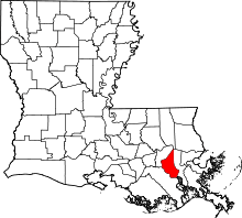 | |
| Other Unincorporated communities | ||
| Footnotes | ‡This populated place also has portions in an adjacent parish or parishes | |