Nidderdale AONB
The Nidderdale AONB is an Area of Outstanding Natural Beauty in North Yorkshire, England, bordering the Yorkshire Dales National Park to the east and south. It comprises most of Nidderdale itself, part of lower Wharfedale, the Washburn valley and part of lower Wensleydale, including Jervaulx Abbey and the side valleys west of the River Ure. It covers a total area of 233 square miles (600 km2).[1] The highest point in the Nidderdale AONB is Great Whernside, 704 metres (2,310 ft) above sea level, on the border with the Yorkshire Dales National Park.
The only town in the AONB is Pateley Bridge in Nidderdale. Otley and Ilkley lie just to the south of the AONB, and Masham and Ripon are just to the east.
History
In 1947, when the Hobhouse Report recommended the creation of the Yorkshire Dales National Park, it proposed that Nidderdale should be excluded and given a different conservation status. Accordingly, Nidderdale was not included in the National Park when it was designated in 1954. In 1963 the then West Riding County Council proposed that Nidderdale should be added to the National Park, but the proposal met with opposition from the district councils which would have lost some of their powers to the county council. The West Riding National Park Committee, and its successor the Yorkshire Dales National Park Committee, did not entirely abandon the idea until 1988, when the alternative AONB designation was proposed.[2]
The eastern boundary of the National Park had been set at East Witton, as recommended by the Hobhouse Report. The section of Wensleydale below East Witton had not been considered for national park status, but was added to the new AONB. Similarly, the new AONB also included the Washburn Valley and the area of lower Wharfedale between the Washburn Valley and the National Park, which had not been considered for national park status. The AONB was designated in 1994 with its current boundaries.[3]
Geography
Nidderdale
The AONB includes all of Nidderdale except a small area in the lower dale around Hampsthwaite. In the lower dale, below Pateley Bridge, attractions include Brimham Rocks and the Coldstones Cut. In the less populated upper dale there are a series of reservoirs, Gouthwaite Reservoir (a nature reserve), Scar House Reservoir and at the very top of the dale Angram Reservoir, dominated by Great Whernside and Little Whernside.
Lower Wharfedale and the Washburn Valley
The southern part of the AONB includes the reservoirs of the Washburn Valley, Lindley Wood, Swinsty, Fewston and Thruscross.
Lower Wensleydale and side valleys
The eastern part of the AONB includes Colsterdale and the valleys of the River Laver and the River Skell. Fountains Abbey and Jervaulx Abbey both lie within the AONB, and Hackfall Wood is on the south bank of the River Ure.
Activities
Walking is a popular activity. Two long-distance trails traverse the AONB, the Six Dales Trail from south to north, and the Nidderdale Way from south east to north west. Upper Nidderdale is a popular area for mountain biking,[4] and caving takes place in the Upper Nidderdale caves. The grouse moors on the higher land offer some of the best shooting in the United Kingdom.[5]
Governance
Like most AONBs, and unlike national parks, the Nidderdale AONB is managed by local authorities. The entire AONB is within North Yorkshire, and almost all of it is within the area of Harrogate Borough Council. Harrogate Borough Council is lead authority for the Nidderdale AONB. Small areas of land to the north are within Richmondshire and Hambleton districts.[6]
AONB policy and programmes are set by the Nidderdale AONB Joint Advisory Committee, consisting of county, district and parish councillors, and representatives of community interest groups.[7] A small team based at Pateley Bridge reports to the JAC.
References
- ↑ Nidderdale AONB website
- ↑ Ray Woolmore (May 2002). "Yorkshire Dales National Park" (PDF). Designation History Series. Natural England. Retrieved 11 May 2015.
- ↑ "Nidderdale Area of Outstanding Natural Beauty". Visit Harrogate. Retrieved 15 May 2015.
- ↑ Nidderdale AONB: Mountain Biking
- ↑ Olivia Edward (2009). "Nidderdale". Geographer magazine.
- ↑ "Nidderdale AONB Management Plan 2014-2019" (PDF). p. 5. Retrieved 15 May 2015.
- ↑ "Nidderdale AONB JAC membership and terms of reference" (PDF). Nidderdale AONB. Retrieved 15 May 2015.
External links
Coordinates: 54°05′12″N 1°45′28″W / 54.086688°N 1.757728°W
| East of England | 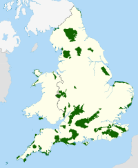 | |
|---|---|---|
| East Midlands | ||
| North East | ||
| North West | ||
| South East | ||
| South West | ||
| West Midlands | ||
| Yorkshire and Humber | ||