Natogyi
| Natogyi | |
|---|---|
 Natogyi Location in Burma | |
| Coordinates: 21°25′N 95°39′E / 21.417°N 95.650°ECoordinates: 21°25′N 95°39′E / 21.417°N 95.650°E | |
| Country |
|
| Division | Mandalay |
| District | Myingyan District |
| Township | Natogyi Township |
| Area | |
| • Total | 481.2 sq mi (1,246.3 km2) |
| Population (2005) | |
| • Religions | Buddhism |
| Time zone | MST (UTC+6.30) |
Natogyi is a town in the Mandalay Region of central Myanmar.
History
c. 1401/02 (Burmese year 763), the town was called "Nwa Dho"(နွားဓိုရ်) as a village (nwa meaning "cow" and dho meaning "herd," for "the village which herds the cow"). Some named the village as Nwa To နွားတိုး (nwa meaning "cow" and to meaning "prosper," because the villager prospered by breeding the cow). There is an assumption that the name was changed from Nwa Dho, to Nwa To, to Natogyi according to the Shin Pin Tha Dohn Oo pagoda's bell inscription from the Myanmar year 1267. It was demarcated by 6 wards, 64 village tracts and 186 villages by order No. 103/49 branch (1) by the Ministry of Home Affairs and Religious Affairs on July 31, 1972.
Location
Natogyi township administration is under the Myingyan district under the Mandalay Regional Division. It is located between the latitude 21° 17' 34" north and 21° 38' 42" north and between longitude 95° 27' 54" east and 95° 58' 32" East. The Map Code is L085995.
Border
Natogyi township is bordered by Myittha Township to the east, Myingyan Township to the west, Ngazon Township to the north and Taungtha Township, Mahlaing Township and Wundwin Township to the south.
Area
The area of township is 481.20 sq miles, 307,968 acres. It is 30 miles long and 3 furlongs from east to west. It is 22 miles wide and 2 furlongs from north to south.
Climate
The township is located in the middle dry zone of the country and the average temperature of the township is 41 °C at the highest and 36.1 °C at the lowest. Rain falls on 32 to 55 days and the rainfall is 21 to 43 inches.
External links
Capital: Mandalay | ||
| Kyaukse District |  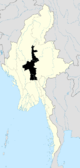 | |
| Mandalay District | ||
| Meiktila District | ||
| Myingyan District | ||
| Nyaung-U District |
| |
| Pyinoolwin District |
| |
| Yamethin District | ||
| Main cities and towns | ||