Patheingyi Township
For the township in Ayeyarwady Region, see Pathein Township.
| Patheingyi Township ပုသိမ်ကြီးမြို့နယ် | |
|---|---|
| Township of Mandalay | |
| Patheingyi Township | |
 Patheingyi Township | |
| Coordinates: 21°58′0″N 96°11′0″E / 21.96667°N 96.18333°ECoordinates: 21°58′0″N 96°11′0″E / 21.96667°N 96.18333°E | |
| Country |
|
| Division | Mandalay |
| City | Mandalay |
| Township | Patheingyi |
| Time zone | MST (UTC6:30) |
| Area code(s) | 2 (mobile: 69, 90)[1] |
Patheingyi Township (Burmese: ပုသိမ်ကြီးမြို့နယ်, pronounced: [pəθèiɴdʑí mjo̰nɛ̀]) is located in the eastern part of Mandalay, Myanmar. The township is bounded by Aungmyethazan township and Chanayethazan township in the west.[2] Incorporated into the Mandalay city's limits, Patheingyi represents the eastward march of Mandalay's urban sprawl. Patheingyi is still largely made up of rice paddy fields but in the past two decades has become home to a number of universities.
Notable places
- Mandalay Tuberculosis Hospital
- Mandalay Technological University
- University of Computer Studies, Mandalay
- University of Culture, Mandalay
- University of Medical Technology, Mandalay
- University of Paramedical Science, Mandalay
- Upper Myanmar TB Center
References
- ↑ "Myanmar Area Codes".
- ↑ "Map of Mandalay". DPS. Retrieved 2009-04-04.
Capital: | |
|
Capital: Mandalay | ||
| Kyaukse District |  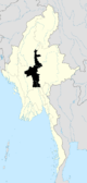 | |
| Mandalay District | ||
| Meiktila District | ||
| Myingyan District | ||
| Nyaung-U District |
| |
| Pyinoolwin District |
| |
| Yamethin District | ||
| Main cities and towns | ||
| States | ||
|---|---|---|
| Regions | ||
| Self-Administered Zones | ||
| Self-Administered Divisions | ||
| Union Territories | ||
This article is issued from Wikipedia - version of the 1/22/2016. The text is available under the Creative Commons Attribution/Share Alike but additional terms may apply for the media files.