National Register of Historic Places listings in Ross County, Ohio
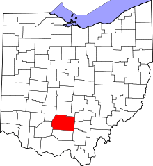
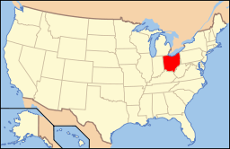
Location of Ross County in Ohio
This is a list of the National Register of Historic Places listings in Ross County, Ohio.
This is intended to be a complete list of the properties and districts on the National Register of Historic Places in Ross County, Ohio, United States. The locations of National Register properties and districts for which the latitude and longitude coordinates are included below, may be seen in a Google map.[1]
There are 43 properties and districts listed on the National Register in the county, including 2 National Historic Landmarks. Another property was once listed but has been removed.
- This National Park Service list is complete through NPS recent listings posted December 2, 2016.[2]
Current listings


Former listing
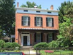
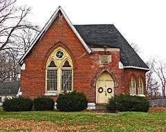
| [3] | Name on the Register | Image | Date listed | Date removed | Location | City or town | Summary |
|---|---|---|---|---|---|---|---|
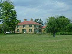
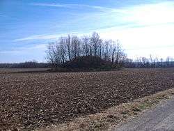
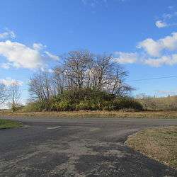
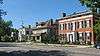
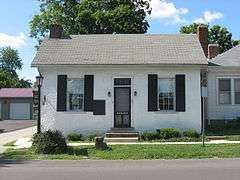
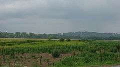
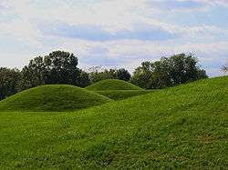
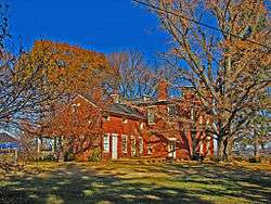
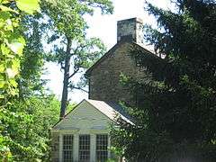
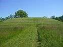
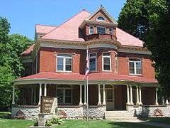
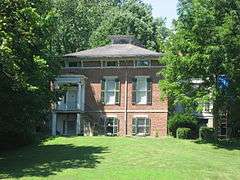
| 1 | Kendrick-Barrett House |  |
(#73001525) | 475 Western Ave. 39°20′03″N 83°00′09″W / 39.3343°N 83.0025°W |
Springfield Township |
See also
| Wikimedia Commons has media related to National Register of Historic Places in Ross County, Ohio. |
References
- ↑ The latitude and longitude information provided in this table was derived originally from the National Register Information System, which has been found to be fairly accurate for about 99% of listings. For about 1% of NRIS original coordinates, experience has shown that one or both coordinates are typos or otherwise extremely far off; some corrections may have been made. A more subtle problem causes many locations to be off by up to 150 yards, depending on location in the country: most NRIS coordinates were derived from tracing out latitude and longitudes off of USGS topographical quadrant maps created under the North American Datum of 1927, which differs from the current, highly accurate WGS84 GPS system used by most on-line maps. Chicago is about right, but NRIS longitudes in Washington are higher by about 4.5 seconds, and are lower by about 2.0 seconds in Maine. Latitudes differ by about 1.0 second in Florida. Some locations in this table may have been corrected to current GPS standards.
- ↑ "National Register of Historic Places: Weekly List Actions". National Park Service, United States Department of the Interior. Retrieved on December 2, 2016.
- 1 2 Numbers represent an ordering by significant words. Various colorings, defined here, differentiate National Historic Landmarks and historic districts from other NRHP buildings, structures, sites or objects.
- ↑ National Park Service (2008-04-24). "National Register Information System". National Register of Historic Places. National Park Service.
- ↑ The eight-digit number below each date is the number assigned to each location in the National Register Information System database, which can be viewed by clicking the number.
- ↑ Location derived from its Federal Register notice; the NRIS lists the site as "Address Restricted"
- ↑ Adena Mound, Ohio Historical Society, 2004. Accessed 2009-10-17.
- 1 2 3 4 5 Location derived from Mills, William C. Archeological Atlas of Ohio. Columbus: Ohio State Archeological and Historical Society, 1914, pages 71-71A and plate 71. The NRIS lists the site as "Address Restricted".
- ↑ Location derived from Ohio Archaeological and Historical Quarterly, vol. 7. Columbus: Ohio State Archaeological and Historical Society, 1899, 137. Accessed 2009-10-19. The NRIS lists the site as "Address Restricted"
- ↑ Squier, E.G., and E.H. Davis. Ancient Monuments of the Mississippi Valley. Washington: Smithsonian, 1848, page 92 and plate 15.
- ↑ Owen, Lorrie K., ed. Dictionary of Ohio Historic Places. Vol. 2. St. Clair Shores: Somerset, 1999, 1214.
- ↑ Case, D. Troy, and Christopher Carr. The Scioto Hopewell and Their Neighbors: Bioarchaeological Documentation and Cultural Understanding. New York: Springer, 2007, Appendix 7.1.
- ↑ Location derived from the "Indian Mound" marked on USGS maps of Frankfort; the NRIS lists the site as "Address Restricted"
- ↑ Location derived from Moorehead, Warren King. Primitive Man in Ohio. New York: Knickerbocker, 1892, 145. Accessed 2009-10-20. The NRIS lists the site as "Address Restricted".
- ↑ Location derived from this National Park Service document; the NRIS lists the site as "Address Restricted"
- ↑ Location derived from this National Park Service webpage; the NRIS lists the site as "Address Restricted"
- ↑ Location derived from Proceedings of the Academy of Natural Sciences of Philadelphia, Academy of Natural Sciences of Philadelphia, 1894, 314. Accessed 2009-10-19. The NRIS lists the site as "Address Restricted"
- ↑ Location derived from DeLorme. Ohio Atlas & Gazetteer. 7th ed. Yarmouth: DeLorme, 2004, 77. ISBN 0-89933-281-1. The NRIS lists the site as "Address Restricted".

Municipalities and communities of Ross County, Ohio, United States | ||
|---|---|---|
| City | | |
| Villages | ||
| Townships | ||
| CDPs | ||
| Unincorporated communities | ||
| Ghost town | ||
| Footnotes | ‡This populated place also has portions in an adjacent county or counties | |
This article is issued from Wikipedia - version of the 10/23/2016. The text is available under the Creative Commons Attribution/Share Alike but additional terms may apply for the media files.