| [3] |
Name on the Register |
Image |
Date listed[4] |
Location |
City or town |
Description |
|---|
| 1 |
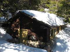
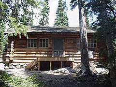
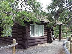
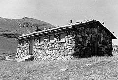
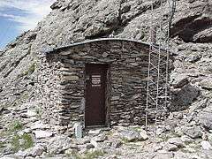
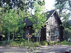
Bear Lake Comfort Station |
|
000000001988-01-29-0000January 29, 1988
(#87001137) |
Bear Lake
40°18′44″N 105°38′42″W / 40.312222°N 105.645°W / 40.312222; -105.645 (Bear Lake Comfort Station) |
Estes Park |
|
| 2 |
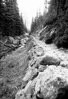
Dutchtown |
Upload image |
000000001988-01-29-0000January 29, 1988
(#76002292) |
Ditch Rd.
40°26′16″N 105°52′55″W / 40.437778°N 105.881944°W / 40.437778; -105.881944 (Dutchtown) |
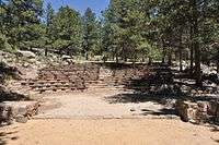
Grand Lake |
|
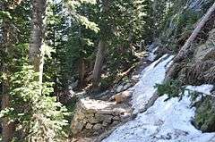
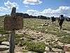
| 3 |
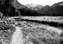
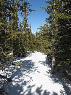
East Inlet Trail |
|
000000002005-02-28-0000February 28, 2005
(#05000073) |
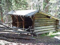
Rocky Mountain National Park
39°54′37″N 105°44′30″W / 39.910278°N 105.741667°W / 39.910278; -105.741667 (East Inlet Trail) |
Estes Park |
|
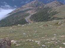
| 4 |
East Longs Peak Trail-Longs Peak Trail-Keyhole Route-Shelf Trail |
|
000000002007-07-10-0000July 10, 2007
(#07000740) |
West of State Highway 7
40°16′20″N 105°36′2″W / 40.27222°N 105.60056°W / 40.27222; -105.60056 (East Longs Peak Trail-Longs Peak Trail-Keyhole Route-Shelf Trail)[5]
Coordinates missing |
Allenspark |
|
| 5 |
Fall River Entrance Historic District |
|
000000001988-01-29-0000January 29, 1988
(#87001139) |
Fall River Entrance
40°24′11″N 105°35′13″W / 40.40312°N 105.58707°W / 40.40312; -105.58707 (Fall River Entrance Historic District) |
Estes Park |
|
| 6 |
Fall River Pass Ranger Station |
|
000000001988-01-29-0000January 29, 1988
(#87001140) |
Fall River Pass
40°26′27″N 105°45′13″W / 40.440833°N 105.753611°W / 40.440833; -105.753611 (Fall River Pass Ranger Station) |
Estes Park |
|
| 7 |
Fall River Pump House and Catchment Basin |
|
000000002006-08-30-0000August 30, 2006
(#06000735) |
Near the top of Fall River Road in Rocky Mountain National Park
40°26′15″N 105°44′50″W / 40.4375°N 105.747222°W / 40.4375; -105.747222 (Fall River Pump House and Catchment Basin) |
Estes Park |
|
| 8 |
Fall River Road |
|
000000001987-07-20-0000July 20, 1987
(#87001129) |
Fall River Rd.
40°25′47″N 105°42′43″W / 40.429722°N 105.711944°W / 40.429722; -105.711944 (Fall River Road) |
Estes Park |
|
| 9 |
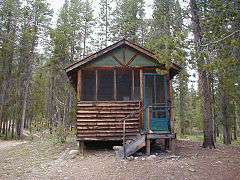
Fern Lake Patrol Cabin |
|
000000001988-01-29-0000January 29, 1988
(#87001142) |
Fern Lake
40°20′17″N 105°40′34″W / 40.338056°N 105.676111°W / 40.338056; -105.676111 (Fern Lake Patrol Cabin) |
Estes Park |
|
| 10 |
Fern Lake Trail |
|
000000002005-02-28-0000February 28, 2005
(#05000074) |
Rocky Mountain National Park
40°20′34″N 105°39′48″W / 40.342778°N 105.663333°W / 40.342778; -105.663333 (Fern Lake Trail) |
Estes Park |
|
| 11 |
Flattop Mountain Trail |
|
000000002007-09-27-0000September 27, 2007
(#07000999) |
Rocky Mountain National Park
40°18′50″N 105°40′42″W / 40.31389°N 105.67833°W / 40.31389; -105.67833 (Flattop Mountain Trail)[6]
Coordinates missing |
Estes Park |
|
| 12 |
Gem Lake Trail |
|
000000002008-01-29-0000January 29, 2008
(#07001473) |
North of Devils Gulch Rd. to Gem Lake
40°24′40″N 105°30′13″W / 40.41111°N 105.50361°W / 40.41111; -105.50361 (Gem Lake Trail)[7]
Coordinates missing |
Estes Park |
|
| 13 |
Glacier Basin Campground Ranger Station |
|
000000001987-07-20-0000July 20, 1987
(#87001143) |
Glacier Basin
40°19′48″N 105°35′40″W / 40.33°N 105.594444°W / 40.33; -105.594444 (Glacier Basin Campground Ranger Station) |
Estes Park |
|
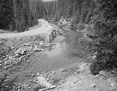
| 14 |
Grand River Ditch |
|
000000001976-09-29-0000September 29, 1976
(#76000218) |
North of Grand Lake
40°25′10″N 105°52′12″W / 40.419444°N 105.87°W / 40.419444; -105.87 (Grand River Ditch) |
Grand Lake |
|
| 15 |
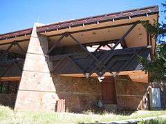
Holzwarth Historic District |
|
000000001977-12-02-0000December 2, 1977
(#77000112) |
North of Grand Lake on Trail Ridge Road
40°22′13″N 105°51′28″W / 40.370278°N 105.857778°W / 40.370278; -105.857778 (Holzwarth Historic District) |
Grand Lake |
|
| 16 |
Lake Haiyaha Trail |
|
000000002008-03-05-0000March 5, 2008
(#08000125) |
Roughly along Bear, Nymph, and Dream Lakes, then up Chaos Canyon
40°18′17″N 105°39′44″W / 40.30472°N 105.66222°W / 40.30472; -105.66222 (Flattop Mountain Trail)[8]
Coordinates missing |
Estes Park |
|
| 17 |
Leiffer House |
Upload image |
000000001978-08-02-0000August 2, 1978
(#78000278) |
South of Estes Park off State Highway 7
40°16′34″N 105°32′42″W / 40.276111°N 105.545°W / 40.276111; -105.545 (Leiffer House) |
Estes Park |
|
| 18 |
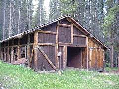
Little Buckaroo Ranch Barn |
|
000000002009-07-08-0000July 8, 2009
(#09000490) |
20631 Trail Ridge Road
40°21′22″N 105°51′23″W / 40.3562°N 105.8564°W / 40.3562; -105.8564 (Little Buckaroo Ranch Barn) |
Grand Lake |
|
| 19 |
Lost Lake Trail |
Upload image |
000000002008-03-05-0000March 5, 2008
(#08000126) |
Roughly along the North Fork of the Big Thompson River
40°29′56″N 105°33′2″W / 40.49889°N 105.55056°W / 40.49889; -105.55056 (East Longs Peak Trail-Longs Peak Trail-Keyhole Route-Shelf Trail)[9]
Coordinates missing |
Estes Park |
|
| 20 |
Lulu City Site |
|
000000001977-09-14-0000September 14, 1977
(#77001562) |
North of Grand Lake on Trail Ridge Rd.
40°26′30″N 105°50′50″W / 40.441667°N 105.847222°W / 40.441667; -105.847222 (Lulu City Site) |
Grand Lake |
|
| 21 |
McGraw Ranch |
|
000000001998-09-17-0000September 17, 1998
(#98001163) |
McGraw Ranch Rd.
40°25′53″N 105°30′06″W / 40.431389°N 105.501667°W / 40.431389; -105.501667 (McGraw Ranch) |
Estes Park |
|
| 22 |
Milner Pass Road Camp Mess Hall and House |
|
000000001987-07-20-0000July 20, 1987
(#87001130) |
Milner Pass Rd.
40°25′02″N 105°48′57″W / 40.417222°N 105.815833°W / 40.417222; -105.815833 (Milner Pass Road Camp Mess Hall and House) |
Estes Park |
|
| 23 |
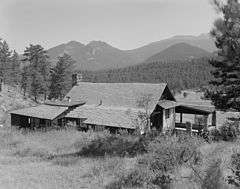
Moraine Lodge |
|
000000001976-10-08-0000October 8, 1976
(#76000206) |
West of Estes Park off U.S. Route 36 on Bear Lake Rd.
40°21′31″N 105°34′59″W / 40.358611°N 105.583056°W / 40.358611; -105.583056 (Moraine Lodge) |
Estes Park |
|
| 24 |
Moraine Park Museum and Amphitheater |
|
000000002005-06-15-0000June 15, 2005
(76000206 #Lodge 76000206) |
Rocky Mountain National Park
40°21′31″N 105°35′02″W / 40.3586°N 105.5839°W / 40.3586; -105.5839 (Moraine Park Museum and Amphitheater) |
Estes Park |
|
| 25 |
North Inlet Trail |
|
000000002008-03-05-0000March 5, 2008
(#08000127) |
Roughly along North Inlet and Hallett Creek to Flattop Mountain
40°15′50″N 105°47′22″W / 40.26389°N 105.78944°W / 40.26389; -105.78944 (North Inlet Trail)[10]
Coordinates missing |
Estes Park and Grand Lake |
|
| 26 |
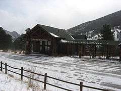
Rocky Mountain National Park Administration Building |
|
000000002001-01-03-0000January 3, 2001
(#01000069) |
U.S. Route 36
Coordinates missing |
Estes Park |
|
| 27 |
Rocky Mountain National Park Utility Area Historic District |
|
000000001982-03-18-0000March 18, 1982
(#82001717) |
Beaver Meadows Entrance Rd.
40°21′50″N 105°33′38″W / 40.363889°N 105.560556°W / 40.363889; -105.560556 (Rocky Mountain National Park Utility Area Historic District) |
Estes Park |
|
| 28 |
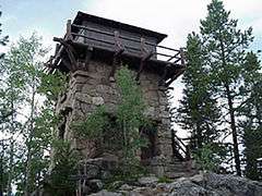
Shadow Mountain Lookout |
|
000000001978-08-02-0000August 2, 1978
(#78000279) |
Southeast of Grand Lake in Rocky Mountain National Park
40°13′50″N 105°48′52″W / 40.230556°N 105.814444°W / 40.230556; -105.814444 (Shadow Mountain Lookout) |
Grand Lake |
|
| 29 |
Shadow Mountain Trail |
Upload image |
000000002008-03-05-0000March 5, 2008
(#08000124) |
Eastern side of Shadow Mountain Lake
40°13′40″N 105°49′8″W / 40.22778°N 105.81889°W / 40.22778; -105.81889 (Shadow Mountain Trail)[11]
Coordinates missing |
Grand Lake |
|
| 30 |
Snogo Snow Plow |
|
000000002006-10-04-0000October 4, 2006
(#06000934) |
Rocky Mountain National Park
40°21′51″N 105°33′34″W / 40.364167°N 105.559444°W / 40.364167; -105.559444 (Snogo Snow Plow) |
Estes Park |
|
| 31 |
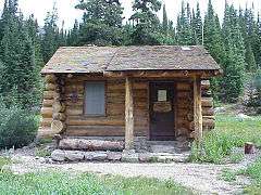
Thunder Lake Patrol Cabin |
|
000000001988-01-29-0000January 29, 1988
(#87001124) |
Thunder Lake
40°13′20″N 105°38′39″W / 40.222222°N 105.644167°W / 40.222222; -105.644167 (Thunder Lake Patrol Cabin) |
Estes Park |
|
| 32 |
Thunder Lake Trail-Bluebird Lake Trail |
Upload image |
000000002008-01-29-0000January 29, 2008
(#07001472) |
Roughly along the North St. Vrain Creek, west of Wild Basin Ranger Station
Coordinates missing |
Allenspark |
|
| 33 |
Timber Creek Campground Comfort Station No. 245 |
|
000000001988-01-29-0000January 29, 1988
(#87001131) |
Timber Creek Campground
40°22′50″N 105°51′05″W / 40.380556°N 105.851389°W / 40.380556; -105.851389 (Timber Creek Campground Comfort Station No. 245) |
Estes Park |
|
| 34 |
Timber Creek Campground Comfort Station No. 247 |
|
000000001988-01-29-0000January 29, 1988
(#87001131) |
Timber Creek Campground
40°22′42″N 105°51′05″W / 40.378333°N 105.851389°W / 40.378333; -105.851389 (Timber Creek Campground Comfort Station No. 247) |
Estes Park |
|
| 35 |
Timber Creek Road Camp Barn |
|
000000001987-07-30-0000July 30, 1987
(#87001134) |
Approximately 200 yards south of Columbine Lake Rd., 450 yards west of the Kawuneeche Visitor Center
40°22′45″N 105°50′53″W / 40.379167°N 105.848056°W / 40.379167; -105.848056 (Timber Creek Road Camp Barn) |
Estes Park |
|
| 36 |
Timberline Cabin |
|
000000001988-01-29-0000January 29, 1988
(#87001136) |
Fall River Rd.
40°26′30″N 105°44′37″W / 40.441667°N 105.743611°W / 40.441667; -105.743611 (Timberline Cabin) |
Estes Park |
Demolished.[12]
|
| 37 |
Tonahutu Creek Trail |
|
000000002008-03-05-0000March 5, 2008
(#08000130) |
Roughly along Tonahutu Creek to Flattop Mountain
40°19′10″N 105°46′32″W / 40.31944°N 105.77556°W / 40.31944; -105.77556 (Tonahutu Creek Trail)[13]
Coordinates missing |
Estes Park and Grand Lake |
|
| 38 |
Trail Ridge Road |
|
000000001984-11-14-0000November 14, 1984
(#84000242) |
Rocky Mountain National Park
40°21′30″N 105°45′47″W / 40.358333°N 105.763056°W / 40.358333; -105.763056 (Trail Ridge Road) |
Estes Park and Grand Lake |
|
| 39 |
Twin Sisters Lookout |
|
000000001992-12-24-0000December 24, 1992
(#92001670) |
On the Twin Sisters Peaks in Rocky Mountain National Park
40°17′21″N 105°31′03″W / 40.289167°N 105.5175°W / 40.289167; -105.5175 (Twin Sisters Lookout) |
Estes Park |
|
| 40 |
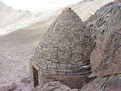
Agnes Vaille Shelter |
|
000000001992-12-24-0000December 24, 1992
(#92001669) |
Northwest of Longs Peak along the East Longs Peak Trail in Rocky Mountain National Park
40°15′38″N 105°37′13″W / 40.260556°N 105.620278°W / 40.260556; -105.620278 (Agnes Vaille Shelter) |
Estes Park |
|
| 41 |
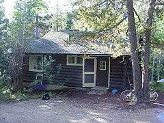
William Allen White Cabins |
|
000000001973-10-25-0000October 25, 1973
(#73001944) |
West of Estes Park of Moraine Park Visitor Center in Rocky Mountain National Park
40°21′22″N 105°34′55″W / 40.356111°N 105.581944°W / 40.356111; -105.581944 (William Allen White Cabins) |
Estes Park |
|
| 42 |
Wild Basin House |
|
000000001988-01-29-0000January 29, 1988
(#87001125) |
Wild Basin
40°12′29″N 105°33′56″W / 40.208056°N 105.565556°W / 40.208056; -105.565556 (Wild Basin House) |
Estes Park |
|
| 43 |
Wild Basin Ranger Station and House |
|
000000001988-01-29-0000January 29, 1988
(#87001125) |
Wild Basin
40°12′32″N 105°33′55″W / 40.208889°N 105.565278°W / 40.208889; -105.565278 (Wild Basin Ranger Station and House) |
Estes Park |
|
| 44 |
Beatrice Willard Alpine Tundra Research Plots |
|
000000002007-10-25-0000October 25, 2007
(#07001101) |
U.S. Route 34 at Rock Cut and Forest Canyon
40°23′43″N 105°42′40″W / 40.3953°N 105.7111°W / 40.3953; -105.7111 (Beatrice Willard Alpine Tundra Research Plots) |
Estes Park |
|
| 45 |
Willow Park Patrol Cabin |
|
000000001987-07-20-0000July 20, 1987
(#87001144) |
Fall River Rd.
40°25′59″N 105°44′01″W / 40.433056°N 105.733611°W / 40.433056; -105.733611 (Willow Park Patrol Cabin) |
Estes Park |
|
| 46 |
Willow Park Stable |
|
000000001987-07-20-0000July 20, 1987
(#87001145) |
Fall River Pass
40°26′01″N 105°43′59″W / 40.433611°N 105.733056°W / 40.433611; -105.733056 (Willow Park Stable) |
Estes Park |
|
| 47 |
Ypsilon Lake Trail |
|
000000002008-03-05-0000March 5, 2008
(#08000131) |
Along a ridge between Ciquita Creek and the Roaring River
Coordinates missing |
Estes Park |
|