Napavine, Washington
| Napavine, Washington | |
|---|---|
| City | |
| Nickname(s): The City on Top of the Hill | |
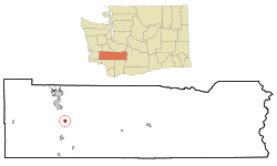 Location of Napavine, Washington | |
| Coordinates: 46°34′45″N 122°54′39″W / 46.57917°N 122.91083°WCoordinates: 46°34′45″N 122°54′39″W / 46.57917°N 122.91083°W | |
| Country | United States |
| State | Washington |
| County | Lewis |
| Incorporated | 1913 |
| Government | |
| • Mayor | John Sayers |
| Area[1] | |
| • Total | 2.39 sq mi (6.19 km2) |
| • Land | 2.38 sq mi (6.16 km2) |
| • Water | 0.01 sq mi (0.03 km2) |
| Elevation | 459 ft (140 m) |
| Population (2010)[2] | |
| • Total | 1,988 |
| • Estimate (2015)[3] | 1,789 |
| • Density | 742.0/sq mi (286.5/km2) |
| Time zone | Pacific (PST) (UTC-8) |
| • Summer (DST) | PDT (UTC-7) |
| ZIP code | 98565 |
| Area code(s) | 360 |
| FIPS code | 53-47980 |
| GNIS feature ID | 1506926[4] |
| Website | www.cityofnapavine.com |
Napavine is a city in Lewis County, Washington, United States. The population was 1,988 at the 2010 census.
History
Napavine was officially incorporated as a town on November 21, 1913. Settlers began arriving in the Cowlitz area in the early 1850s. In 1883 Scottish immigrant James Urquhart laid out the town naming it Napavine from the Indian word "Napavoon" meaning "small prairie".[5]
Economy
Napavine primarily serves as a bedroom community for the Centralia/Chehalis and Olympia areas.
Geography
Napavine is located at 46°34′45″N 122°54′39″W / 46.579284°N 122.910935°W (46.579284, -122.910935).[6]
According to the United States Census Bureau, the city has a total area of 2.39 square miles (6.19 km2), of which, 2.38 square miles (6.16 km2) is land and 0.01 square miles (0.03 km2) is water.[1] The large hill that Napavine is sitting on is about 400 feet above sea level .
Demographics
| Historical population | |||
|---|---|---|---|
| Census | Pop. | %± | |
| 1920 | 340 | — | |
| 1930 | 181 | −46.8% | |
| 1940 | 220 | 21.5% | |
| 1950 | 242 | 10.0% | |
| 1960 | 314 | 29.8% | |
| 1970 | 377 | 20.1% | |
| 1980 | 611 | 62.1% | |
| 1990 | 745 | 21.9% | |
| 2000 | 1,361 | 82.7% | |
| 2010 | 1,988 | 46.1% | |
| Est. 2015 | 1,789 | [7] | −10.0% |
| U.S. Decennial Census[8] 2015 Estimate[3] | |||
2010 census
As of the census[2] of 2010, there were 1,988 people, 609 households, and 770 families residing in the city. The population density was 742.0 inhabitants per square mile (286.5/km2). There were 662 housing units at an average density of 278.2 per square mile (107.4/km2). The racial makeup of the city was 97.0% White, 0.2% African American, 0.7% Native American, 0.8% Asian, 0.1% Pacific Islander, 2.1% from other races, and 5.2% from two or more races. Hispanic or Latino of any race were 1.0% of the population.
There were 609 households of which 63.0% had children under the age of 18 living with them, 67.0% were married couples living together, 13.8% had a female householder with no husband present, 6.4% had a male householder with no wife present, and 22.8% were non-families. 19.0% of all households were made up of individuals and 8% had someone living alone who was 65 years of age or older. The average household size was 5.90 and the average family size was 5.29.
The median age in the city was 32.9 years. 30.8% of residents were under the age of 18; 8.6% were between the ages of 18 and 24; 26.5% were from 25 to 44; 22.3% were from 45 to 64; and 11.7% were 65 years of age or older. The gender makeup of the city was 48.6% male and 51.4% female.
2000 census
As of the census of 2000, there were 1,361 people, 444 households, and 349 families residing in the city. The population density was 1,702.5 people per square mile (656.9/km2). There were 474 housing units at an average density of 592.9 per square mile (228.8/km2). The racial makeup of the city was 93.02% White, 0.15% African American, 1.54% Native American, 0.15% Asian, 0.29% Pacific Islander, 3.31% from other races, and 1.54% from two or more races. Hispanic or Latino of any race were 5.73% of the population.
There were 444 households out of which 47.7% had children under the age of 18 living with them, 57.2% were married couples living together, 16.2% had a female householder with no husband present, and 21.2% were non-families. 16.4% of all households were made up of individuals and 6.1% had someone living alone who was 65 years of age or older. The average household size was 3.05 and the average family size was 3.45.
In the city the population was spread out with 37.0% under the age of 18, 7.0% from 18 to 24, 30.3% from 25 to 44, 17.0% from 45 to 64, and 8.7% who were 65 years of age or older. The median age was 29 years. For every 100 females there were 94.4 males. For every 100 females age 18 and over, there were 91.7 males.
The median income for a household in the city was $40,966, and the median income for a family was $41,250. Males had a median income of $38,750 versus $26,103 for females. The per capita income for the city was $16,275. About 12.7% of families and 13.0% of the population were below the poverty line, including 15.8% of those under age 18 and 11.0% of those age 65 or over.
Politics
Napavine is the most heavily Republican incorporated area in Lewis County, and among the most Republican in western Washington State. The results for the 2004 U.S. Presidential Election were as follows:
- George W. Bush (Republican) - 457 (92.54%)
- John Kerry (Democrat) - 167 (6.51%)
- Other candidates - 6 (0.65%)
In January 2008, Nick Bozarth became the youngest mayor in the history of Napavine and possibly in all of Washington state at 22 years of age. Bozarth banned city workers from taking extended lunch breaks and removed a controversial police chief. Bozarth chose not to run for re-election, citing that public servants should not be long term office holders.[9]
Schools
Napavine School district is the public school district in the city of Napavine. Its high school Napavine Vally high school has a 2B/1A athletics classification and plays in the Washington Interscholastic Activities Association (WIAA) Southwest Washington District 4. Napavine also is home to the Napavine Christian Academy owned by the Baptist church.
References
- 1 2 "US Gazetteer files 2010". United States Census Bureau. Retrieved 2012-12-19.
- 1 2 "American FactFinder". United States Census Bureau. Retrieved 2012-12-19.
- 1 2 "Population Estimates". United States Census Bureau. Retrieved June 29, 2016.
- ↑ "Napavine". Geographic Names Information System. United States Geological Survey.
- ↑ ""History of the Pacific Northwest Vol. II, pg 611-12, 1889, North Pacific History Company
- ↑ "US Gazetteer files: 2010, 2000, and 1990". United States Census Bureau. 2011-02-12. Retrieved 2011-04-23.
- ↑ "Annual Estimates of the Resident Population for Incorporated Places: April 1, 2010 to July 1, 2015". Retrieved July 2, 2016.
- ↑ "U.S. Decennial Census". Census.gov. Retrieved June 7, 2013.
- ↑ ""Copyright © 2008 The Seattle Times Company
Municipalities and communities of Lewis County, Washington, United States | ||
|---|---|---|
| Cities | 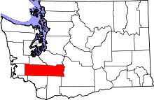 | |
| Town | ||
| CDPs | ||
| Other unincorporated communities | ||
| Ghost towns | ||