Fords Prairie, Washington
| Fords Prairie, Washington | |
|---|---|
| CDP | |
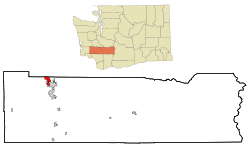 Location of Fords Prairie, Washington | |
| Coordinates: 46°44′29″N 122°59′48″W / 46.74139°N 122.99667°WCoordinates: 46°44′29″N 122°59′48″W / 46.74139°N 122.99667°W | |
| Country | United States |
| State | Washington |
| County | Lewis |
| Area | |
| • Total | 4.0 sq mi (10.2 km2) |
| • Land | 3.9 sq mi (10.1 km2) |
| • Water | 0.0 sq mi (0.1 km2) |
| Elevation | 177 ft (54 m) |
| Population (2010) | |
| • Total | 1,959 |
| • Density | 502.0/sq mi (193.8/km2) |
| Time zone | Pacific (PST) (UTC-8) |
| • Summer (DST) | PDT (UTC-7) |
| ZIP code | 98531 |
| Area code(s) | 360 |
| FIPS code | 53-24565[1] |
| GNIS feature ID | 1504952[2] |
Fords Prairie is a census-designated place (CDP) in Lewis County, Washington, United States. The population was 1,959 at the 2010 census.
History
Fords Prairie was named after Judge Sidney S. Ford, Sr. and his wife Nancy who were among the earliest white pioneers who settled north of the Columbia River in 1846 in what was then a part of Oregon Territory. Their 640 acre Ford Donation Land Claim abutting the Chehalis River was the center of what became known as Fords Prairie which became an important travelling stop between the Columbia River and the Puget Sound.[3]
Geography
Fords Prairie is located at 46°44′29″N 122°59′48″W / 46.74139°N 122.99667°W (46.741303, -122.996572).[4]
According to the United States Census Bureau, the CDP has a total area of 4.0 square miles (10.2 km²), of which, 3.9 square miles (10.1 km²) of it is land and 0.1 square miles (0.1 km²) of it (1.27%) is water.
Demographics
| Historical population | |||
|---|---|---|---|
| Census | Pop. | %± | |
| 1960 | 1,404 | — | |
| 1970 | 2,250 | 60.3% | |
| 1980 | 2,582 | 14.8% | |
| 1990 | 2,480 | −4.0% | |
| 2000 | 1,961 | −20.9% | |
| 2010 | 1,959 | −0.1% | |
| U.S. Decennial Census | |||
As of the census[1] of 2000, there were 1,961 people, 785 households, and 588 families residing in the CDP. The population density was 502.0 people per square mile (193.6/km²). There were 820 housing units at an average density of 209.9/sq mi (81.0/km²). The racial makeup of the CDP was 93.83% White, 0.05% African American, 1.07% Native American, 1.53% Asian, 0.31% Pacific Islander, 1.43% from other races, and 1.78% from two or more races. Hispanic or Latino of any race were 3.62% of the population.
There were 785 households out of which 26.0% had children under the age of 18 living with them, 61.7% were married couples living together, 10.4% had a female householder with no husband present, and 25.0% were non-families. 19.6% of all households were made up of individuals and 10.1% had someone living alone who was 65 years of age or older. The average household size was 2.49 and the average family size was 2.83.
In the CDP the population was spread out with 21.5% under the age of 18, 8.8% from 18 to 24, 20.7% from 25 to 44, 29.3% from 45 to 64, and 19.8% who were 65 years of age or older. The median age was 44 years. For every 100 females there were 92.3 males. For every 100 females age 18 and over, there were 93.0 males.
The median income for a household in the CDP was $42,927, and the median income for a family was $47,829. Males had a median income of $34,073 versus $26,344 for females. The per capita income for the CDP was $21,610. About 4.2% of families and 7.2% of the population were below the poverty line, including 7.9% of those under age 18 and 7.0% of those age 65 or over.
Politics
Fords Prairie is a heavily Republican area, like most of rural Lewis County is. The results for the 2004 U.S. Presidential Election were as follows:
- George W. Bush (Republican) - 434 (67.08%)
- John F. Kerry (Democrat) - 199 (30.76%)
- Ralph Nader (Independent) - 9 (1.39%)
- Other candidates - 8 (0.77%)
Note that this information is based on the Fords Prairie precinct only. As this is an unincorporated area, there are no defined bounds, and the precinct may be incongruous with the census boundaries.
References
- 1 2 "American FactFinder". United States Census Bureau. Retrieved 2008-01-31.
- ↑ "Fords Prairie". Geographic Names Information System. United States Geological Survey.
- ↑ Herndon Smith (1942). “Centralia: The First Fifty Years”. Gorham Printing.
- ↑ "US Gazetteer files: 2010, 2000, and 1990". United States Census Bureau. 2011-02-12. Retrieved 2011-04-23.
Municipalities and communities of Lewis County, Washington, United States | ||
|---|---|---|
| Cities | 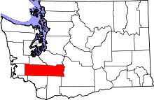 | |
| Town | ||
| CDPs | ||
| Other unincorporated communities | ||
| Ghost towns | ||