Muruq'u (Chuquisaca)
For the mountain in the Potosí Department, Bolivia, see Muruq'u.
| Muruq'u | |
|---|---|
 Muruq'u Location within Bolivia | |
| Highest point | |
| Elevation | 4,206 m (13,799 ft) [1] |
| Coordinates | 20°01′51″S 64°45′54″W / 20.03083°S 64.76500°WCoordinates: 20°01′51″S 64°45′54″W / 20.03083°S 64.76500°W |
| Geography | |
| Location |
Bolivia, Chuquisaca Department |
| Parent range | Andes |
Muruq'u (Quechua for ball (of yarn, wool),[2] also spelled Morokho) is a 4,206 m (13,799 ft) high mountain in the Bolivian Andes. It is located in the Chuquisaca Department, Nor Cinti Province, San Lucas Municipality, east of the village of Canchas Blancas. It lies northwest of Kunturiri.[1][3]
References
- 1 2 Bolivian IGM map 1:50,000 Comunidad Canchas Blancas 6633-IV
- ↑ Teofilo Laime Ajacopa, Diccionario Bilingüe Iskay simipi yuyayk'ancha, La Paz, 2007 (Quechua-Spanish dictionary)
- ↑ "San Lucas". INE, Bolivia. Retrieved April 25, 2016.
Capital: Sucre | ||
| Provinces | 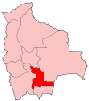 | |
| Municipalities and seats |
| |
This article is issued from Wikipedia - version of the 4/25/2016. The text is available under the Creative Commons Attribution/Share Alike but additional terms may apply for the media files.