Mount Carroll Township, Carroll County, Illinois
| Mount Carroll Township | |
|---|---|
| Township | |
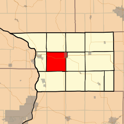 Location in Carroll County | |
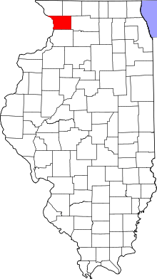 Carroll County's location in Illinois | |
| Coordinates: 42°04′10″N 90°01′52″W / 42.06944°N 90.03111°WCoordinates: 42°04′10″N 90°01′52″W / 42.06944°N 90.03111°W | |
| Country | United States |
| State | Illinois |
| County | Carroll |
| Government | |
| • Supervisor | Cheri Jo Piper |
| Area | |
| • Total | 37.61 sq mi (97.4 km2) |
| • Land | 37.53 sq mi (97.2 km2) |
| • Water | 0.07 sq mi (0.2 km2) 0.19% |
| Elevation | 807 ft (246 m) |
| Population (2010) | |
| • Total | 2,279 |
| • Density | 60.7/sq mi (23.4/km2) |
| Time zone | CST (UTC-6) |
| • Summer (DST) | CDT (UTC-5) |
| ZIP codes | 61053, 61074, 61285 |
| GNIS feature ID | 0429402 |
Mount Carroll Township is one of twelve townships in Carroll County, Illinois, USA. As of the 2010 census, its population was 2,279 and it contained 1,101 housing units.[1]
Geography
According to the 2010 census, the township has a total area of 37.61 square miles (97.4 km2), of which 37.53 square miles (97.2 km2) (or 99.79%) is land and 0.07 square miles (0.18 km2) (or 0.19%) is water.[1]
Cities
- Mount Carroll (west three-quarters)
Unincorporated towns
(This list is based on USGS data and may include former settlements.)
Cemeteries
The township contains these three cemeteries: Center Hill, Oak Hill and Wacker.
Major highways
School districts
- West Carroll Community Unit School District 314
Political districts
- Illinois' 16th congressional district
- State House District 71
- State Senate District 36
Notable residents
See also: Mount Carroll, Illinois
Notable people from the rural portion of Mount Carroll Township include First Lady of Illinois Bina Deneen (1868-1950), who was born and raised there.
References
- "Mount Carroll Township, Carroll County, Illinois". Geographic Names Information System. United States Geological Survey. Retrieved 2010-01-04.
- United States Census Bureau 2007 TIGER/Line Shapefiles
- United States National Atlas
- 1 2 "Population, Housing Units, Area, and Density: 2010 - County -- County Subdivision and Place -- 2010 Census Summary File 1". United States Census. Retrieved 2013-05-28.
External links
 |
Washington Township | Woodland Township | Freedom Township | |
| Savanna Township | |
Salem Township | ||
| ||||
| | ||||
| York Township | Fairhaven Township |
Municipalities and communities of Carroll County, Illinois, United States | ||
|---|---|---|
| Cities | ||
| Villages | ||
| Townships | ||
| Unincorporated communities | ||
| Ghost town | ||
| Footnotes | ‡This populated place also has portions in an adjacent county or counties | |
This article is issued from Wikipedia - version of the 12/5/2013. The text is available under the Creative Commons Attribution/Share Alike but additional terms may apply for the media files.