Mosquito Lake, Alaska
| Mosquito Lake, Alaska | |
|---|---|
| CDP | |
 Location of Mosquito Lake, Alaska | |
| Coordinates: 59°25′40″N 136°9′48″W / 59.42778°N 136.16333°W | |
| Country | United States |
| State | Alaska |
| Borough | Haines |
| Government | |
| • Borough mayor | Janice Hill[1] |
| • State senator | Dennis Egan (D) |
| • State rep. | Sam Kito III (D) |
| Area | |
| • Total | 79.0 sq mi (204.7 km2) |
| • Land | 78.8 sq mi (204.2 km2) |
| • Water | 0.2 sq mi (0.5 km2) |
| Elevation | 305 ft (93 m) |
| Population (2000) | |
| • Total | 221 |
| • Density | 2.8/sq mi (1.1/km2) |
| Time zone | Alaska (AKST) (UTC-9) |
| • Summer (DST) | AKDT (UTC-8) |
| Area code(s) | 907 |
| FIPS code | 02-50800 |
| GNIS feature ID | 1866963 |
Mosquito Lake is a census-designated place (CDP) in Haines Borough, Alaska, United States. At the 2000 census the population was 221.
Geography
Mosquito Lake is located at 59°25′40″N 136°9′48″W / 59.42778°N 136.16333°W (59.427723, -136.163435).[2]
According to the United States Census Bureau, the CDP has a total area of 79.0 square miles (204.7 km²), of which, 78.8 square miles (204.2 km²) of it is land and 0.2 square miles (0.5 km²) of it (0.27%) is water.
Demographics
As of the census[3] of 2000, there were 221 people, 86 households, and 55 families residing in the CDP. The population density was 2.8 people per square mile (1.1/km²). There were 126 housing units at an average density of 1.6/sq mi (0.6/km²). The racial makeup of the CDP was 91.40% White, 5.43% Native American, and 3.17% from two or more races.
There were 86 households out of which 30.2% had children under the age of 18 living with them, 53.5% were married couples living together, 1.2% had a male householder with no husband present, and 34.9% were non-families. 23.3% of all households were made up of individuals and 3.5% had someone living alone who was 65 years of age or older. The average household size was 2.57 and the average family size was 3.14.
In the CDP the population was spread out with 28.1% under the age of 18, 4.5% from 18 to 24, 23.1% from 25 to 44, 39.8% from 45 to 64, and 4.5% who were 65 years of age or older. The median age was 41 years. For every 100 females there were 125.5 males. For every 100 females age 18 and over, there were 130.4 males.
The median income for a household in the CDP was $34,688, and the median income for a family was $37,500. Males had a median income of $42,917 versus $35,000 for females. The per capita income for the CDP was $16,415. About 30.0% of families and 33.9% of the population were below the poverty line, including 62.3% of those under the age of eighteen and none of those sixty five or over.
References
- ↑ 2015 Alaska Municipal Officials Directory. Juneau: Alaska Municipal League. 2015. p. 7.
- ↑ "US Gazetteer files: 2010, 2000, and 1990". United States Census Bureau. 2011-02-12. Retrieved 2011-04-23.
- ↑ "American FactFinder". United States Census Bureau. Retrieved 2008-01-31.
Coordinates: 59°25′40″N 136°09′48″W / 59.427723°N 136.163435°W
Municipalities and communities of Haines Borough, Alaska, United States | ||
|---|---|---|
| CDPs | 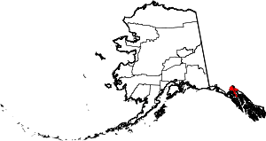 | |
| Footnotes | ‡This populated place also has portions in adjacent boroughs or census areas | |