Monroe County, Alabama
| Monroe County, Alabama | |
|---|---|
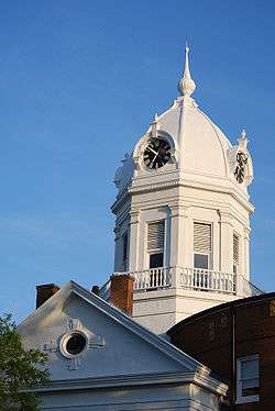 The Old Monroe County Courthouse in Monroeville | |
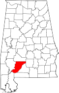 Location in the U.S. state of Alabama | |
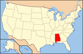 Alabama's location in the U.S. | |
| Founded | June 29, 1815 |
| Named for | James Monroe |
| Seat | Monroeville |
| Largest city | Monroeville |
| Area | |
| • Total | 1,034 sq mi (2,678 km2) |
| • Land | 1,026 sq mi (2,657 km2) |
| • Water | 8.7 sq mi (23 km2), 0.8% |
| Population (est.) | |
| • (2015) | 21,673 |
| • Density | 22/sq mi (8.6/km²) |
| Congressional district | 1st |
| Time zone | Central: UTC-6/-5 |
| Website |
www |
|
Footnotes:
| |
Monroe County is a county of the U.S. state of Alabama. As of the 2010 census, the population was 23,068.[1] Its county seat is Monroeville.[2] Its name is in honor of James Monroe, fifth President of the United States.[3] It is a dry county, in which the sale of alcoholic beverages is restricted or prohibited, but Frisco City and Monroeville are wet cities.
History
For thousands of years the area was inhabited by indigenous peoples. In historic times, it was primarily the territory of the Creek peoples, who became known to European-American settlers as one of the Five Civilized Tribes of the Southeast.
Monroe County was established by European Americans on June 29, 1815. It is known as the county older than the state, which was admitted to the Union in 1819. Most of the original European-American settlers were of English descent and came from the states of Virginia, Georgia and the Carolinas.[4] The prominent Upper Creek chief, Red Eagle (also known as William Weatherford) of the prominent Wind Clan, settled here after the Creek War (1813-1814), where he established a successful plantation. He was of Creek and European descent, and had adopted chattel slavery as a planter and horse breeder. Most of the Creek people were removed from Alabama to Indian Territory (now Oklahoma) in the 1830s.
The area was settled by European Americans, primarily of English and Scots-Irish descent. It was largely developed as cotton plantations in the antebellum years. Planters moving from the Upper South sometimes brought slave workers with them, or purchased more from traders and markets after acquiring land.
In the period after the Reconstruction era and into the early 20th century, white Democrats worked to restore and maintain white supremacy in the state. Tensions were severe as the state legislature passed a new constitution that disfranchised most blacks and many poor whites, excluding them from the political system. They also passed laws for segregation and other forms of Jim Crow. Attacks against blacks were varied, with physical terrorism accomplished through lynchings, mostly of black men, and often attended by crowds of whites in a public display of power. Monroe had a total of 18 lynchings from 1877 to 1950, the second-highest number of any county in Alabama.[5]
The county seat, Monroeville, is the home of two notable 20th-century authors, Truman Capote and Nelle Harper Lee, who were childhood neighbors. The novelist Mark Childress and journalist Cynthia Tucker are also Monroe County natives. In 1997 the Alabama legislature designated Monroeville and Monroe County the "Literary Capital of Alabama."
The county is near the Gulf Coast and has twice been declared a disaster area due to extensive hurricane damage: in September 1979 due to Hurricane Frederic, and in September 2004 due to Hurricane Ivan.
Geography
According to the U.S. Census Bureau, the county has a total area of 1,034 square miles (2,680 km2), of which 1,026 square miles (2,660 km2) is land and 8.7 square miles (23 km2) (0.8%) is water.[6]
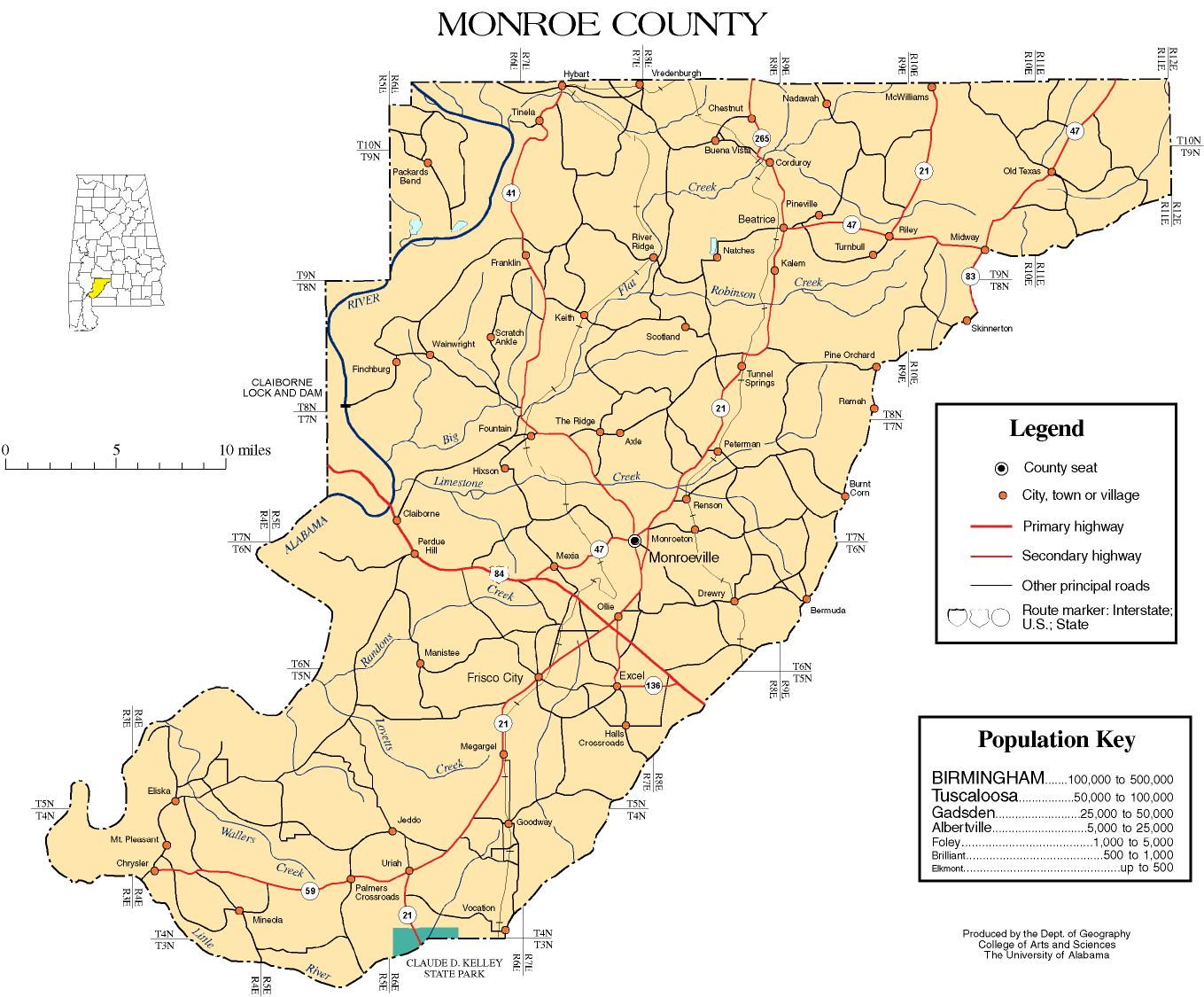
Major highways
 U.S. Highway 84
 State Route 21
 State Route 41
 State Route 47
 State Route 59
 State Route 83
 State Route 136
Adjacent counties
- Wilcox County (north)
- Butler County (east-northeast)
- Conecuh County (east)
- Escambia County (southeast)
- Baldwin County (southwest)
- Clarke County (west)
Demographics
| Historical population | |||
|---|---|---|---|
| Census | Pop. | %± | |
| 1820 | 8,838 | — | |
| 1830 | 8,782 | −0.6% | |
| 1840 | 10,680 | 21.6% | |
| 1850 | 12,013 | 12.5% | |
| 1860 | 15,667 | 30.4% | |
| 1870 | 14,214 | −9.3% | |
| 1880 | 17,091 | 20.2% | |
| 1890 | 18,990 | 11.1% | |
| 1900 | 23,666 | 24.6% | |
| 1910 | 27,155 | 14.7% | |
| 1920 | 28,884 | 6.4% | |
| 1930 | 30,070 | 4.1% | |
| 1940 | 29,465 | −2.0% | |
| 1950 | 25,732 | −12.7% | |
| 1960 | 22,372 | −13.1% | |
| 1970 | 20,883 | −6.7% | |
| 1980 | 22,651 | 8.5% | |
| 1990 | 23,968 | 5.8% | |
| 2000 | 24,324 | 1.5% | |
| 2010 | 23,068 | −5.2% | |
| Est. 2015 | 21,673 | [7] | −6.0% |
| U.S. Decennial Census[8] 1790–1960[9] 1900–1990[10] 1990–2000[11] 2010–2015[1] | |||
2010
Whereas according to the 2010 census Bureau:
- 55.1% White
- 41.7% Black
- 1.1% Native American
- 0.3% Asian
- 0.0% Native Hawaiian or Pacific Islander
- 1.4% Two or more races
- 1.0% Hispanic or Latino (of any race)
2000
As of the census[12] of 2000, there were 24,324 people, 9,383 households, and 6,774 families residing in the county. The population density was 24 people per square mile (9/km2). There were 11,343 housing units at an average density of 11 per square mile (4/km2). The racial makeup of the county was 57.75% White, 40.07% Black or African American, 0.97% Native American, 0.29% Asian, 0.01% Pacific Islander, 0.13% from other races, and 0.79% from two or more races. 0.78% of the population were Hispanic or Latino of any race.
There were 9,383 households out of which 35.60% had children under the age of 18 living with them, 52.30% were married couples living together, 16.10% had a female householder with no husband present, and 27.80% were non-families. 25.70% of all households were made up of individuals and 11.10% had someone living alone who was 65 years of age or older. The average household size was 2.57 and the average family size was 3.09.
In the county the population was spread out with 28.30% under the age of 18, 8.60% from 18 to 24, 26.80% from 25 to 44, 22.50% from 45 to 64, and 13.80% who were 65 years of age or older. The median age was 35 years. For every 100 females there were 90.80 males. For every 100 females age 18 and over, there were 86.40 males.
The median income for a household in the county was $29,093, and the median income for a family was $34,569. Males had a median income of $31,096 versus $18,767 for females. The per capita income for the county was $14,862. About 18.20% of families and 21.30% of the population were below the poverty line, including 27.00% of those under age 18 and 21.40% of those age 65 or over.
Government
| Year | GOP | DNC | Others |
|---|---|---|---|
| 2016 | 56.4% 5,771 | 42.2% 4,310 | 1.4% 4,310 |
| 2012 | 53.7% 5,730 | 45.8% 4,897 | 0.5% 53 |
| 2008 | 54.9% 6,175 | 44.6% 5,025 | 0.5% 52 |
| 2004 | 61.2% 5,831 | 38.4% 3,666 | 0.4% 37 |
| 2000 | 57.6% 5,153 | 41.8% 3,741 | 0.6% 57 |
Communities
City
- Monroeville (county seat)
Towns
Census-designated places
Unincorporated communities
Ghost town
Places of interest
Monroe County is home to several attractions, such as the Alabama River Museum, the Monroe County Heritage Museum, and the Courthouse Museum which hosts the annual stage production of To Kill a Mockingbird. The county also contains Claude Kelly State Park.
See also
- National Register of Historic Places listings in Monroe County, Alabama
- Properties on the Alabama Register of Landmarks and Heritage in Monroe County, Alabama
References
- 1 2 "State & County QuickFacts". United States Census Bureau. Retrieved May 16, 2014.
- ↑ "Find a County". National Association of Counties. Retrieved 2011-06-07.
- ↑ Gannett, Henry (1905). The Origin of Certain Place Names in the United States. U.S. Government Printing Office. p. 212.
- ↑ http://www.encyclopediaofalabama.org/face/Article.jsp?id=h-1203
- ↑ "Supplement: Lynchings by County/ Alabama: Monroe", 2nd edition, from Lynching in America: Confronting the Legacy of Racial Terror, 2015, Equal Justice Institute, Montgomery, Alabama
- ↑ "2010 Census Gazetteer Files". United States Census Bureau. August 22, 2012. Retrieved August 22, 2015.
- ↑ "County Totals Dataset: Population, Population Change and Estimated Components of Population Change: April 1, 2010 to July 1, 2015". Retrieved July 2, 2016.
- ↑ "U.S. Decennial Census". United States Census Bureau. Retrieved August 22, 2015.
- ↑ "Historical Census Browser". University of Virginia Library. Retrieved August 22, 2015.
- ↑ Forstall, Richard L., ed. (March 24, 1995). "Population of Counties by Decennial Census: 1900 to 1990". United States Census Bureau. Retrieved August 22, 2015.
- ↑ "Census 2000 PHC-T-4. Ranking Tables for Counties: 1990 and 2000" (PDF). United States Census Bureau. April 2, 2001. Retrieved August 22, 2015.
- ↑ "American FactFinder". United States Census Bureau. Retrieved 2011-05-14.
- ↑ "Dave Leip's Atlas of U.S. Presidential Elections". Retrieved November 21, 2016.
External links
- Monroeville / Monroe County Chamber of Commerce
- Coastal Gateway Regional Economic Development Alliance
- Monroe County Museum
- Monroe County map of roads/towns (map © 2007 Univ. of Alabama).
- South Alabama Community Website
- The Monroe Journal
Municipalities and communities of Monroe County, Alabama, United States | ||
|---|---|---|
| City | | |
| Towns | ||
| CDPs | ||
| Unincorporated communities | ||
| Ghost town | ||
Coordinates: 31°34′15″N 87°22′11″W / 31.57083°N 87.36972°W