Winston County, Alabama
| Winston County, Alabama | |
|---|---|
 Winston County courthouse in Double Springs | |
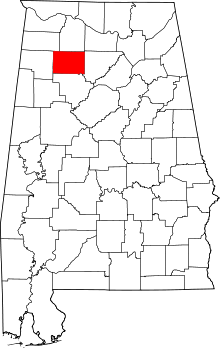 Location in the U.S. state of Alabama | |
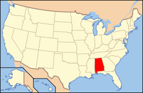 Alabama's location in the U.S. | |
| Founded | February 12, 1850[1] |
| Named for | John A. Winston |
| Seat | Double Springs |
| Largest city | Haleyville |
| Area | |
| • Total | 632 sq mi (1,637 km2) |
| • Land | 613 sq mi (1,588 km2) |
| • Water | 19 sq mi (49 km2), 3.0% |
| Population (est.) | |
| • (2015) | 23,877 |
| • Density | 40/sq mi (15/km²) |
| Congressional district | 4th |
| Time zone | Central: UTC-6/-5 |
| Website |
www |
|
Footnotes:
| |
Winston County is a county of the U.S. state of Alabama. As of the 2010 census, the population was 24,484.[2] Its county seat is Double Springs.[3] Known as Hancock County before 1858,[1] The county is named in honor of John A. Winston, the 15th Governor of Alabama.
History
Winston County was established under the name Hancock County on February 12, 1850, from territory that was formerly part of Walker County (a county directly to the south of Winston County).[1] It was originally named for John Hancock, Governor of Massachusetts and famous signer of the American Declaration of Independence, with its county seat at Houston. On January 22, 1858, the county was renamed Winston County to honor Alabama Gov. John A. Winston.
During the American Civil War, Winston County gained attention for its opposition to secession, a sentiment so strong that the county is sometimes referred to as the Republic of Winston. The county today plays on its reputation as the "Free State of Winston" to attract tourists. The county's opposition to the Confederacy is briefly mentioned in the novels To Kill a Mockingbird and Addie Pray.
In 1883 the county seat was moved from Houston to Double Springs to be near the center of the county, since Cullman County was created from the eastern part of Winston County.[4]
The civil-rights judge Frank Minis Johnson of the U.S. Court of Appeals for the Eleventh Circuit was born in Delmar, in Winston County.
National Register of Historic Places
Winston County has four sites listed on the National Register of Historic Places: Archeological Site No. 1WI50, Feldman's Department Store, the Houston Jail, and the Winston County Courthouse.[5]
Geography
According to the U.S. Census Bureau, the county has a total area of 631 square miles (1,630 km2), of which 613 square miles (1,590 km2) is land and 1.9 square miles (4.9 km2) (3.0%) is water.[6]
Adjacent counties
- Lawrence County (north)
- Cullman County (east)
- Walker County (south)
- Marion County (west)
- Franklin County (northwest)
National protected area
Demographics
| Historical population | |||
|---|---|---|---|
| Census | Pop. | %± | |
| 1850 | 1,542 | — | |
| 1860 | 3,576 | 131.9% | |
| 1870 | 4,155 | 16.2% | |
| 1880 | 4,253 | 2.4% | |
| 1890 | 6,552 | 54.1% | |
| 1900 | 9,554 | 45.8% | |
| 1910 | 12,855 | 34.6% | |
| 1920 | 14,378 | 11.8% | |
| 1930 | 15,596 | 8.5% | |
| 1940 | 18,746 | 20.2% | |
| 1950 | 18,250 | −2.6% | |
| 1960 | 14,858 | −18.6% | |
| 1970 | 16,654 | 12.1% | |
| 1980 | 21,953 | 31.8% | |
| 1990 | 22,053 | 0.5% | |
| 2000 | 24,843 | 12.7% | |
| 2010 | 24,484 | −1.4% | |
| Est. 2015 | 23,877 | [7] | −2.5% |
| U.S. Decennial Census[8] 1790–1960[9] 1900–1990[10] 1990–2000[11] 2010–2015[2] | |||
2010 census
As of the census[12] of 2010, there were 24,484 people, 10,163 households, and 7,074 families residing in the county. The population density was 40 people per square mile (15/km2). There were 13,469 housing units at an average density of 22 per square mile (8.5/km2). The racial makeup of the county was 95.6% White, 0.5% Black or African American, 0.7% Native American, 0.2% Asian, 0.1% Pacific Islander, 1.5% from other races, and 1.4% from two or more races. Nearly 2.6% of the population were Hispanic or Latino of any race.
There were 10,163 households, out of which 26.2% had children under the age of 18 living with them, 54.2% were married couples living together, 10.9% had a female householder with no husband present, and 30.4% were non-families. Nearly 27.1% of all households were made up of individuals, and 12.2% had someone living alone who was 65 years of age or older. The average household size was 2.38, and the average family size was 2.86.
In the county, the population was spread out with 21.6% under the age of 18, 7.4% from 18 to 24, 23.6% from 25 to 44, 29.6% from 45 to 64, and 17.7% who were 65 years of age or older. The median age was 43.1 years. For every 100 females, there were 96.5 males. For every 100 females age 18 and over, there were 100.8 males.
The median income for a household in the county was $33,685, and the median income for a family was $39,784. Males had a median income of $38,074 versus $23,301 for females. The per capita income for the county was $18,055. 15.4% of the population and 20.6% of families were below the poverty line. 31.4% of those under the age of 18 and 14.4% of those 65 and older were living below the poverty line.
2000 Census
As of the census[13] of 2000, there were 24,843 people, 10,107 households, and 7,287 families residing in the county. The population density was 40 people per square mile (16/km2). There were 12,502 housing units at an average density of 20 per square mile (8/km2). The racial makeup of the county was 97.32% White, 0.038% Black or African American, 0.46% Native American, 0.13% Asian, 0.01% Pacific Islander, 0.90% from other races, and 0.81% from two or more races. Nearly 1.5% of the population were Hispanic or Latino of any race.
There were 10,107 households, out of which 31.80% had children under the age of 18 living with them, 59.6% were married couples living together, 9.10% had a female householder with no husband present, and 27.9% were non-families. Nearly 25.6% of all households were made up of individuals, and 11.4% had someone living alone who was 65 years of age or older. The average household size was 2.43, and the average family size was 2.89.
In the county, the population was spread out with 23.7% under the age of 18, 7.90% from 18 to 24, 28.7% from 25 to 44, 25.5% from 45 to 64, and 14.2% who were 65 years of age or older. The median age was 38 years. For every 100 females, there were 96 males. For every 100 females age 18 and over, there were 93.5 males.
The median income for a household in the county was $28,435, and the median income for a family was $32,628. Males had a median income of $26,206 versus $17,760 for females. The per capita income for the county was $15,738. 17.1% of the population and 12.9% of families were below the poverty line. 21.8% of those under the age of 18 and 23% of those 65 and older were living below the poverty line.
Religion
As of the census of 2010:[14]
- Southern Baptist Convention (11,113)
- The United Methodist Church (1,117)
- Churches of Christ (978)
- Church of God (Cleveland) (784)
- Assemblies of God (295)
- Catholic Church (223)
Government and Politics
Unlike nearly every other county In the Deep South, and in keeping with its history from the American Civil War, Winston County has always been a bastion of support for the Republican Party, even as the Democratic Party utterly dominated Alabama state politics from the end of Reconstruction until the passage of the Civil Rights Act of 1964.[15] In 1912 Winston County joined three other Alabama counties in voting for the Bull Moose Party candidacy of Theodore Roosevelt.[16]
| Year | GOP | DNC | Others |
|---|---|---|---|
| 2016 | 89.5% 9,225 | 8.5% 871 | 2.0% 211 |
| 2012 | 85.6% 8,310 | 13.2% 1,286 | 1.2% 116 |
| 2008 | 80.8% 8,103 | 17.5% 1,757 | 1.7% 171 |
| 2004 | 78.0% 8,130 | 21.5% 2,236 | 0.5% 57 |
| 2000 | 68.8% 6,413 | 28.9% 2,692 | 2.3% 213 |
Transportation
Major highways
 U.S. Highway 278
 State Route 5
 State Route 13
 State Route 33
 State Route 129
 State Route 195
 State Route 243
Rail
Communities
City
- Haleyville (partly in Marion County)
Towns
- Addison
- Arley
- Double Springs (county seat)
- Lynn
- Natural Bridge
- Nauvoo (partly in Walker County)
Unincorporated communities
Ghost towns
See also
- National Register of Historic Places listings in Winston County, Alabama
- Properties on the Alabama Register of Landmarks and Heritage in Winston County, Alabama
Notes
- 1 2 3 "ACES Winston County Office" (links/history), Alabama Cooperative Extension System (ACES), 2007, webpage: ACES-Winston.
- 1 2 "State & County QuickFacts". United States Census Bureau. Retrieved May 17, 2014.
- ↑ "Find a County". National Association of Counties. Retrieved 2011-06-07.
- ↑ Owen, Thomas McAdory. History of Alabama and Dictionary of Alabama Biography. Chicago: S. J. Clarke Publishing Co., 1921
- ↑ National Park Service (2010-07-09). "National Register Information System". National Register of Historic Places. National Park Service.
- ↑ "2010 Census Gazetteer Files". United States Census Bureau. August 22, 2012. Retrieved August 22, 2015.
- ↑ "County Totals Dataset: Population, Population Change and Estimated Components of Population Change: April 1, 2010 to July 1, 2015". Retrieved July 2, 2016.
- ↑ "U.S. Decennial Census". United States Census Bureau. Retrieved August 22, 2015.
- ↑ "Historical Census Browser". University of Virginia Library. Retrieved August 22, 2015.
- ↑ Forstall, Richard L., ed. (March 24, 1995). "Population of Counties by Decennial Census: 1900 to 1990". United States Census Bureau. Retrieved August 22, 2015.
- ↑ "Census 2000 PHC-T-4. Ranking Tables for Counties: 1990 and 2000" (PDF). United States Census Bureau. April 2, 2001. Retrieved August 22, 2015.
- ↑ "American FactFinder". United States Census Bureau. Retrieved 2015-08-19.
- ↑ "American FactFinder". United States Census Bureau. Retrieved 2011-05-14.
- ↑ "Winston County, Alabama". The Association of Religion. Retrieved March 22, 2015.
- ↑ In 1936, for example, Winston County was alone in Alabama in voting for the Republican Presidential ticket. See 1936 election map by county.
- ↑ 1912 election map by county.
- ↑ "Dave Leip's Atlas of U.S. Presidential Elections". Retrieved November 21, 2016.
External links
| Wikimedia Commons has media related to Winston County, Alabama. |
- Winston County is covered by the Northwest Alabamian Newspaper.
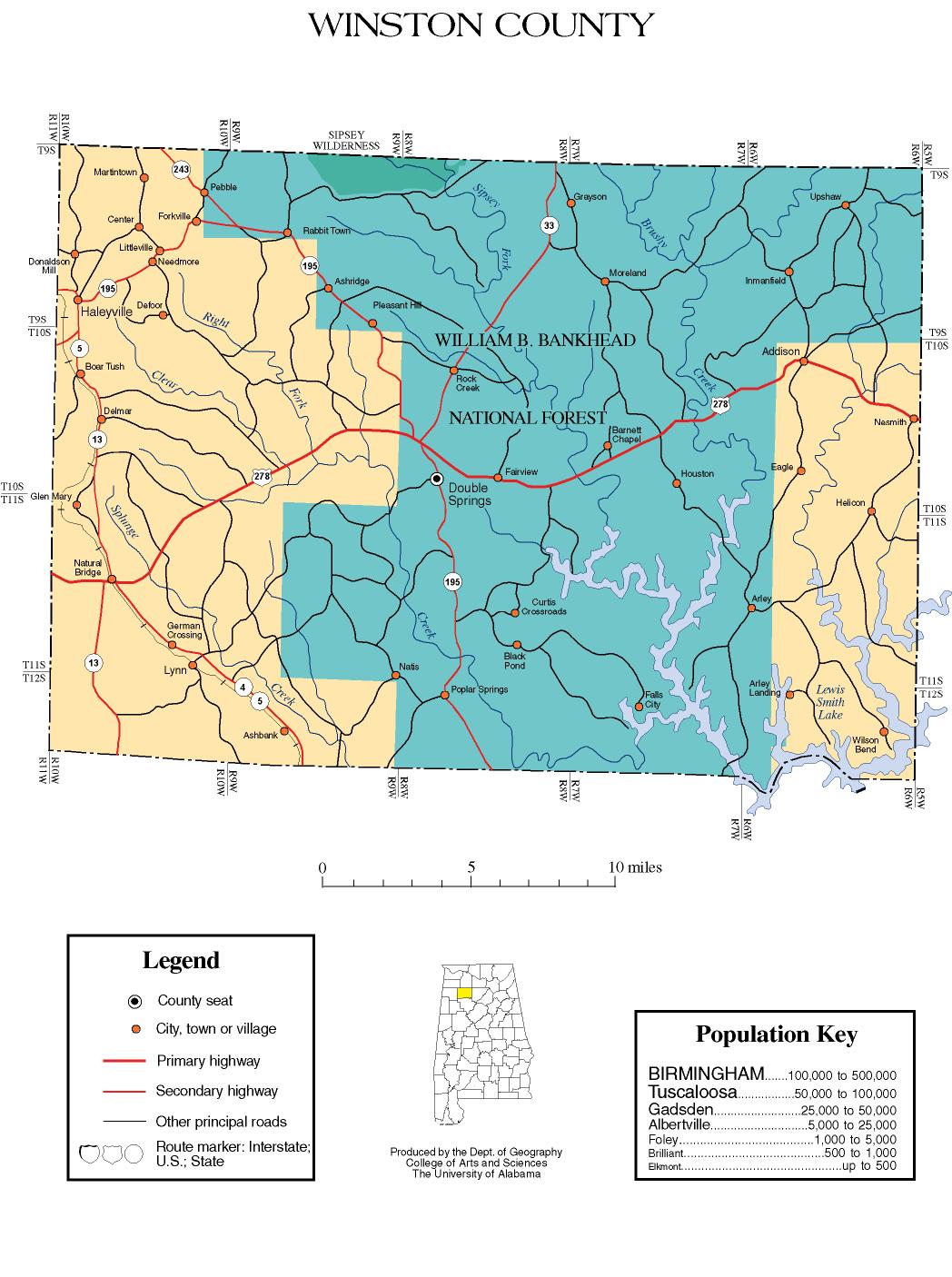
- Winston County map of roads/towns (map © 2007 Univ. of Alabama).
- Winston County, Alabama: The Free State of Winston
- Winston County article in the Encyclopedia of Alabama
 |
Franklin County | Lawrence County | | |
| Marion County | |
Cullman County | ||
| ||||
| | ||||
| Walker County |
Municipalities and communities of Winston County, Alabama, United States | ||
|---|---|---|
| City | | |
| Towns | ||
| Unincorporated communities | ||
| Ghost town | ||
| Footnotes | ‡This populated place also has portions in an adjacent county or counties | |
Coordinates: 34°08′57″N 87°22′29″W / 34.14917°N 87.37472°W