Mohave Valley, Arizona
| Mohave Valley | |
|---|---|
| Census-designated place | |
 | |
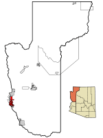 Location in Mohave County and the state of Arizona | |
 Mohave Valley Location in the United States | |
| Coordinates: 34°57′25″N 114°35′5″W / 34.95694°N 114.58472°WCoordinates: 34°57′25″N 114°35′5″W / 34.95694°N 114.58472°W | |
| Country | United States |
| State | Arizona |
| County | Mohave |
| Area | |
| • Total | 45.3 sq mi (117.3 km2) |
| • Land | 45.3 sq mi (117.2 km2) |
| • Water | 0.2 sq mi (0.4 km2) |
| Elevation | 523 ft (159 m) |
| Population (2000) | |
| • Total | 13,694 |
| • Density | 302.6/sq mi (116.8/km2) |
| Time zone | MST (UTC-7) |
| ZIP codes | 86440, 86446 |
| Area code(s) | 928 |
| FIPS code | 04-47400 |
| GNIS feature ID | 1866989 |
Mohave Valley ('Amat' 'Analy Uuhwely[1] in Mojave) is a census-designated place (CDP) in Mohave County, Arizona, United States. The population was 13,694 at the 2000 census. It is geographically connected to Needles, California, Fort Mohave, Arizona, and Bullhead City, Arizona.
History
The first recorded European to come through Mohave Valley was Melchor Díaz. He documented his travels in northwestern Mohave County in 1540.[2] He recounts meeting a large population of natives who referred to themselves as the Pipa Aha Macav, meaning "People by the River".[3] From "Aha Macav" came the shortened name "Mojave" (also spelled "Mohave"). While Mohave Valley and Mohave County use the modern English spelling, the tribe retains the traditional Spanish spelling "Mojave". Both are correct, and both are pronounced "Moh-hah-vee".[4][5]
Geography
Mohave Valley is located at 34°57′25″N 114°35′5″W / 34.95694°N 114.58472°W (34.956929, -114.584613).[6]
According to the United States Census Bureau, the CDP has a total area of 45.4 square miles (118 km2), of which, 45.3 square miles (117 km2) of it is land and 0.2 square miles (0.52 km2) of it (0.35%) is water.
Demographics
As of the census[8] of 2000, there were 13,694 people, 5,217 households, and 3,850 families residing in the CDP. The population density was 302.6 people per square mile (116.8/km²). There were 6,672 housing units at an average density of 147.4/sq mi (56.9/km²). The racial makeup of the CDP was 90.79% White, 0.45% Black or African American, 2.34% Native American, 0.94% Asian, 0.12% Pacific Islander, 3.26% from other races, and 2.10% from two or more races. 11.98% of the population were Hispanic or Latino of any race.
There were 5,217 households out of which 29.6% had children under the age of 18 living with them, 59.4% were married couples living together, 9.1% had a female householder with no husband present, and 26.2% were non-families. 19.0% of all households were made up of individuals and 8.1% had someone living alone who was 65 years of age or older. The average household size was 2.61 and the average family size was 2.94.
In the CDP the population was spread out with 24.6% under the age of 18, 5.7% from 18 to 24, 25.8% from 25 to 44, 27.4% from 45 to 64, and 16.5% who were 65 years of age or older. The median age was 41 years. For every 100 females there were 101.9 males. For every 100 females age 18 and over, there were 100.9 males.
The median income for a household in the CDP was $34,321, and the median income for a family was $38,897. Males had a median income of $29,719 versus $21,271 for females. The per capita income for the CDP was $16,287. About 7.9% of families and 11.0% of the population were below the poverty line, including 15.5% of those under age 18 and 6.1% of those age 65 or over.
Agriculture
Agriculture constitutes a major portion of Mohave Valley's economy. Main crops are cotton and alfalfa.[9]
Education
Children from Mohave Valley attend Mohave Valley Elementary School District.
High school students attend River Valley High School in the Colorado River Union High School District and also have the option to attend the Academy of Building Industries Public Charter High School located in Fort Mohave, Arizona, or the Aha Macav High School on the Fort Mojave Indian Reservation.[10]
See also
- Bullhead City, Arizona
- Laughlin/Bullhead International Airport
- Laughlin, Nevada
- Mohave people
- Fort Mohave, Arizona
- Needles, California
- Oatman, Arizona
References
- ↑ Munro, P et al. A Mojave Dictionary Los Angeles: UCLA, 1992
- ↑ "New Mexico Office of the State Historian : Diaz, Melchior". Newmexicohistory.org. Retrieved 2012-01-06.
- ↑ "About Us | Fort Mojave Indian Tribe". Mojaveindiantribe.com. 2010-12-05. Retrieved 2012-01-06.
- ↑ "Mojave | Define Mojave at Dictionary.com". Dictionary.reference.com. Retrieved 2012-01-06.
- ↑ "Mojave Indian". Mojave Indian. 2003-05-02. Retrieved 2012-01-06.
- ↑ "US Gazetteer files: 2010, 2000, and 1990". United States Census Bureau. 2011-02-12. Retrieved 2011-04-23.
- ↑ "CENSUS OF POPULATION AND HOUSING (1790-2000)". U.S. Census Bureau. Retrieved 2010-07-17.
- ↑ "American FactFinder". United States Census Bureau. Retrieved 2008-01-31.
- ↑ "Arizona State and County Data" (PDF). 2007 Census of Agriculture. United States Department of Agriculture. pp. 252–253. Retrieved 15 February 2012.
- ↑ http://mojaveindiantribe.com/aha-macav-high-school/
External links
| Wikimedia Commons has media related to Mohave Valley, Arizona. |
