Arizona Village, Arizona
| Arizona Village, Arizona | |
|---|---|
| CDP | |
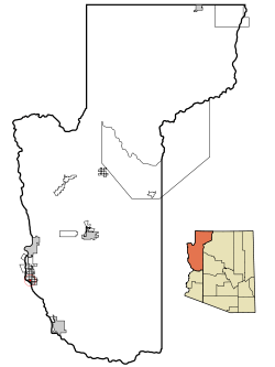 Location in Mohave County and the state of Arizona | |
| Coordinates: 34°51′13″N 114°35′3″W / 34.85361°N 114.58417°WCoordinates: 34°51′13″N 114°35′3″W / 34.85361°N 114.58417°W | |
| Country | United States |
| State | Arizona |
| County | Mohave |
| Area | |
| • Total | 1 sq mi (2.6 km2) |
| • Land | 1.0 sq mi (2.7 km2) |
| • Water | 0.0 sq mi (0.0 km2) |
| Elevation | 463 ft (141 m) |
| Population (2000) | |
| • Total | 351 |
| • Density | 337.1/sq mi (130.2/km2) |
| Time zone | MST (UTC-7) |
| FIPS code | 04-03915 |
| GNIS feature ID | 1853155 |
Arizona Village is a census-designated place (CDP) in Mohave County, Arizona, United States. The population was 351 at the 2000 census.
Geography
Arizona Village is located at 34°51′13″N 114°35′3″W / 34.85361°N 114.58417°W (34.853606, -114.584038).[1]
According to the United States Census Bureau, the CDP has a total area of 1.0 square mile (2.6 km2), all of it land.
Demographics
As of the census[2] of 2000, there were 351 people, 83 households, and 77 families residing in the CDP. The population density was 337.1 people per square mile (130.3/km²). There were 93 housing units at an average density of 89.3/sq mi (34.5/km²). The racial makeup of the CDP was 7.41% White, 0.28% Black or African American, 89.46% Native American, 1.99% from other races, and 0.85% from two or more races. 24.22% of the population were Hispanic or Latino of any race.
There were 83 households out of which 68.7% had children under the age of 18 living with them, 30.1% were married couples living together, 48.2% had a female householder with no husband present, and 7.2% were non-families. 7.2% of all households were made up of individuals and none had someone living alone who was 65 years of age or older. The average household size was 4.23 and the average family size was 4.25.
In the CDP the population was spread out with 48.7% under the age of 18, 12.8% from 18 to 24, 26.5% from 25 to 44, 10.3% from 45 to 64, and 1.7% who were 65 years of age or older. The median age was 19 years. For every 100 females there were 80.9 males. For every 100 females age 18 and over, there were 87.5 males.
The median income for a household in the CDP was $26,406, and the median income for a family was $23,571. Males had a median income of $26,875 versus $21,667 for females. The per capita income for the CDP was $9,591. About 23.0% of families and 22.4% of the population were below the poverty line, including 22.5% of those under age 18 and 50.0% of those age 65 or over.
Education
The area is zoned to the Mohave Valley Elementary School District.
High school students attend River Valley High School in the Colorado River Union High School District.
References
- ↑ "US Gazetteer files: 2010, 2000, and 1990". United States Census Bureau. 2011-02-12. Retrieved 2011-04-23.
- ↑ "American FactFinder". United States Census Bureau. Archived from the original on 2013-09-11. Retrieved 2008-01-31.
