Moculta, South Australia
| Moculta South Australia | |||||||||||||
|---|---|---|---|---|---|---|---|---|---|---|---|---|---|
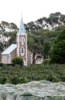 Gnadenberg Church and the Hill of Grace wineyard | |||||||||||||
 Moculta | |||||||||||||
| Coordinates | 34°28′12″S 139°07′01″E / 34.4699°S 139.1169°ECoordinates: 34°28′12″S 139°07′01″E / 34.4699°S 139.1169°E | ||||||||||||
| Established | 1842 | ||||||||||||
| Postcode(s) | 5353 | ||||||||||||
| Location | 12 km (7 mi) NE of Angaston | ||||||||||||
| LGA(s) | Barossa Council | ||||||||||||
| State electorate(s) | Schubert | ||||||||||||
| Federal Division(s) | Barker | ||||||||||||
| |||||||||||||
Moculta is a settlement in South Australia.[1] At the 2006 census, Moculta had a population of 299.[2]
The earliest settlers in the area were English, Scottish and Irish migrants. German migrants also came to the area from 1853. They built both the Gruenberg (1859) and Gnadenberg Lutheran churches. The township of Moculta itself was surveyed in 1865 and occupied soon after.[3]
The locality of Grünberg was renamed to Karalta as a consequence of the move to rename "names of enemy origin" during World War I, but has been named back to the anglicised Gruenberg since then. It is now included in Moculta and Penrice[4] Gnadenberg is also now included in Moculta.[5]
Gallery
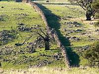 A dry stone wall at Mt Karinya near Moculta, South Australia.
 A dry stone wall at Mt Karinya near Moculta, South Australia.
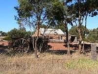 The restored cottage of the Rosenzweig's at Moculta, built circa 1859 with farm equipment in the foreground.
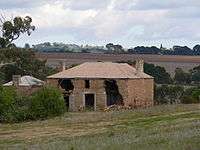 The ruins of the Shannon family's farmhouse at Moculta. The farmer who owns the property bulldozed what was left after the National Trust [SA] listed it as one of the "ten most significant places at risk in South Australia" in 2008. The steeple of the Gruenberg Lutheran church can be seen in the background.
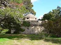 The Shannon family mausoleum outside of Moculta, South Australia.
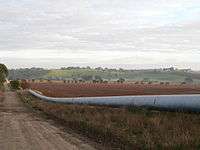 The Swan Reach to Stockwell Pipeline at Moculta, South Australia.
References
| Wikimedia Commons has media related to Moculta, South Australia. |
- ↑ "2905.0 - Statistical Geography: Volume 2 -- Census Geographic Areas, Australia, 2006". Australian Bureau of Statistics. Retrieved 8 December 2009.
- ↑ Australian Bureau of Statistics (25 October 2007). "Moculta (State Suburb)". 2006 Census QuickStats. Retrieved 6 October 2011.
- ↑ "Moculta". Flinders Ranges Research. Retrieved 9 February 2015.
- ↑ "Placename Details: Gruenberg". Department of Planning, Transport and Infrastructure, Government of South Australia. 2 November 2012. SA0028183. Retrieved 10 January 2015.
Previously spelt as Grunberg. Gruenberg is German meaning green hill. Name altered to Karalta. Gruenberg reinstated. Not to be used as an address and is now incorporated in the bounded localities of Moculta and Penrice.
- ↑ "Placename Details: Gnadenberg". Department of Planning, Transport and Infrastructure, Government of South Australia. 22 August 2006. SA0004793. Retrieved 10 January 2015.
This article is issued from Wikipedia - version of the 4/26/2016. The text is available under the Creative Commons Attribution/Share Alike but additional terms may apply for the media files.