Mount Crawford (South Australia)
| Mount Crawford | |
|---|---|
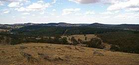 Mount Crawford (centre right) from Tower Hill, looking east | |
| Highest point | |
| Elevation | 526 m (1,726 ft) [1] |
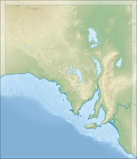
| Coordinates | 34°41′51.8″S 138°58′1.056″E / 34.697722°S 138.96696000°ECoordinates: 34°41′51.8″S 138°58′1.056″E / 34.697722°S 138.96696000°E |
| Geography | |
 Mount Crawford | |
Mount Crawford is a hill in South Australia approximately 15 kilometres (9.3 mi) north of Birdwood in the Mount Lofty Ranges.
History
The Indigenous name for Mount Crawford was Teetáka.[2] The mount was given its present name in 1839 by Charles Sturt after James Coutts Crawford (1817–1889).[3] Crawford had a Royal Navy background. He and his drovers arrived overland from NSW in April 1839 with 700 cattle, setting up a hut and cattle run at the base of the mount.[4][5] Crawford soon moved on to be a pioneer of Wellington, New Zealand.[6]
In February 1840 Crawford's hutkeeper, an old soldier, was bailed up by bushrangers Curran, Hughes, and Fox, who robbed him of his arms and rations. Curran and Hughes were executed by hanging at Adelaide on 16 March 1840 for an armed robbery committed earlier near Gawler.[7]
The pioneer families during the first decades of closer settlement included surnames such as Coleman, Hammat, Rankine, Polden, Murray, Warren, and Whyte. The subsequent history was one of mining and pastoralism, until being largely replaced by forestry and recreation activities.[8]
An alluvial goldrush occurred in the area in the late nineteenth century, and fossicking still goes on in the area today.[9]
Mount Crawford Forest
Mount Crawford also refers to the Mount Crawford Forest which is a grouping of several government forest lands in the area, the largest encompassing the area around Mount Crawford - others are to the west at Mount Gawler and south around Cudlee Creek and Kangaroo Creek Dam. The Barossa Valley is directly to the north. The forest headquarters and an information centre are located near Mount Crawford. Most of the timber grown are pine trees, though there are some native eucalypt plantations. The Heysen Trail passes through the forests.[1][10] The forests are also popularly used for recreational purposes, with school fairs and camps being held there, along with a rally car race.
See also
References
- 1 2 "Mount Crawford Forest Region" (PDF). Forestry SA. Retrieved 15 June 2014.
- ↑ Hossfeld, P.S. : The Aborigines of South Australia: Native occupation of the Eden Valley and Angaston Districts. From Transactions of the Royal Society of South Australia, No 50: p 293
- ↑ Recollections of travel in Australia and New Zealand, by James Coutts Crawford, London 1880, page 17.
- ↑ The Diary of James Coutts Crawford: Extracts on Aborigines and Adelaide, 1839 & 1841. South Australiana, March 1965.
- ↑ Register newspaper, 13 July 1839, p 2.
- ↑ Rosier, L (22 June 2007). "Crawford, James Coutts 1817 - 1889". Dictionary of New Zealand Biography. Retrieved 5 December 2010.
- ↑ Inman: first commander of the South Australia Police, by Max Slee. Seaview Press 2010, pp.145-154.
- ↑ History of Mount Crawford district, 1839-1969 / Sheila Gordon, David Manser
- ↑ "'The latest gold discovery '". South Australian Register. 12 January 1872. p. 5. Retrieved 15 June 2014.
- ↑ "Mount Lofty Ranges Forests - (Mount Crawford, Kuitpo, Second Valley)". Forestry SA. Retrieved 15 June 2014.