Mayer, Minnesota
| Mayer, Minnesota | |
|---|---|
| City | |
 | |
| Motto: "A Rising Community" | |
 Location of the city of Mayer within Carver County, Minnesota | |
| Coordinates: 44°53′7″N 93°53′24″W / 44.88528°N 93.89000°W | |
| Country | United States |
| State | Minnesota |
| County | Carver |
| Area[1] | |
| • Total | 1.42 sq mi (3.68 km2) |
| • Land | 1.39 sq mi (3.60 km2) |
| • Water | 0.03 sq mi (0.08 km2) |
| Elevation | 961 ft (293 m) |
| Population (2010)[2] | |
| • Total | 1,749 |
| • Estimate (2012[3]) | 1,773 |
| • Density | 1,258.3/sq mi (485.8/km2) |
| Time zone | Central (CST) (UTC-6) |
| • Summer (DST) | CDT (UTC-5) |
| ZIP code | 55360 |
| Area code(s) | 952 |
| FIPS code | 27-41138[4] |
| GNIS feature ID | 0647629[5] |
| Website | www.cityofmayer.com |
Mayer is a city in Carver County, Minnesota, along the South Fork of the Crow River. The population was 1,749 at the 2010 census.[6]
History
A post office was first established Helvetia in 1875, and the name was changed to Mayer in 1888.[7] The name Mayer was given it by railroad officials.[8]
Geography
According to the United States Census Bureau, the city has a total area of 1.42 square miles (3.68 km2), of which, 1.39 square miles (3.60 km2) is land and 0.03 square miles (0.08 km2) is water.[1]
Minnesota State Highway 25 serves as a main route in Mayer. State Highway 7 is in close proximity to the city.
Demographics
| Historical population | |||
|---|---|---|---|
| Census | Pop. | %± | |
| 1910 | 161 | — | |
| 1920 | 144 | −10.6% | |
| 1930 | 138 | −4.2% | |
| 1940 | 146 | 5.8% | |
| 1950 | 153 | 4.8% | |
| 1960 | 179 | 17.0% | |
| 1970 | 325 | 81.6% | |
| 1980 | 388 | 19.4% | |
| 1990 | 471 | 21.4% | |
| 2000 | 554 | 17.6% | |
| 2010 | 1,749 | 215.7% | |
| Est. 2015 | 1,903 | [9] | 8.8% |

2010 census
As of the census[2] of 2010, there were 1,749 people, 589 households, and 471 families residing in the city. The population density was 1,258.3 inhabitants per square mile (485.8/km2). There were 619 housing units at an average density of 445.3 per square mile (171.9/km2). The racial makeup of the city was 95.2% White, 1.1% African American, 0.1% Native American, 1.7% Asian, 0.3% from other races, and 1.5% from two or more races. Hispanic or Latino of any race were 1.3% of the population.
There were 589 households of which 50.4% had children under the age of 18 living with them, 70.8% were married couples living together, 4.6% had a female householder with no husband present, 4.6% had a male householder with no wife present, and 20.0% were non-families. 13.9% of all households were made up of individuals and 3.5% had someone living alone who was 65 years of age or older. The average household size was 2.96 and the average family size was 3.30.
The median age in the city was 30.4 years. 32.9% of residents were under the age of 18; 4.9% were between the ages of 18 and 24; 39.2% were from 25 to 44; 17.1% were from 45 to 64; and 5.8% were 65 years of age or older. The gender makeup of the city was 52.0% male and 48.0% female.
2000 census
As of the census[4] of 2000, there were 554 people, 200 households, and 147 families residing in the city. The population density was 572.0 people per square mile (220.5/km²). There were 205 housing units at an average density of 211.7 per square mile (81.6/km²). The racial makeup of the city was 98.56% White, 0.90% Asian, 0.54% from other races. Hispanic or Latino of any race were 2.17% of the population.
There were 199 households out of which 35.2% had children under the age of 18 living with them, 66.8% were married couples living together, 5.0% had a female householder with no husband present, and 26.1% were non-families. 20.1% of all households were made up of individuals and 10.6% had someone living alone who was 65 years of age or older. The average household size was 2.78 and the average family size was 3.26.
In the city the population was spread out with 27.1% under the age of 18, 7.9% from 18 to 24, 31.2% from 25 to 44, 22.4% from 45 to 64, and 11.4% who were 65 years of age or older. The median age was 35 years. For every 100 females there were 105.2 males. For every 100 females age 18 and over, there were 101.0 males.
The median income for a household in the city was $48,125, and the median income for a family was $55,000. Males had a median income of $34,375 versus $26,458 for females. The per capita income for the city was $18,547. None of the families and 2.0% of the population were living below the poverty line, including no under eighteens and 7.8% of those over 64.
Mayer Blazers
The city of Mayer is the Home of the Mayer Blazers. Ball playing in Mayer has a history that goes back nearly 100 years, and has always been strongly supported by the community.
On April 10, 1906, the village council passed a motion to rent four lots owned by the village called Thomas Slough, to be used for ball purposes. Council support of the game continued in 1914.
The Mayer Baseball Club was organized in the Depression years of the early 1930s. In 1934, the city council, with the encouragement of the community, purchased three-plus acres of land from the Haueters. This land was located between Zion Lutheran School, and the Mayer Public School buildings. The Mayer Baseball team started league play in 1935.
Since 1943, the Mayer Blazers have made seven state tournament appearances. In 1945, Mayer took home second place honors in the Class A state tournament. Their strongest state tournament showing came in 1973, when they finished third.
In 1976, Clarence Guetzkow was elected to the Minnesota Amateur Baseball Hall of Fame in recognition of his tireless allegiance to Mayer Baseball, the Crow River Valley League, and Minnesota Amateur Baseball as a whole.
References
- 1 2 "US Gazetteer files 2010". United States Census Bureau. Archived from the original on July 14, 2012. Retrieved 2012-11-13.
- 1 2 "American FactFinder". United States Census Bureau. Retrieved 2012-11-13.
- ↑ "Population Estimates". United States Census Bureau. Archived from the original on June 17, 2013. Retrieved 2013-05-28.
- 1 2 "American FactFinder". United States Census Bureau. Archived from the original on September 11, 2013. Retrieved 2008-01-31.
- ↑ "US Board on Geographic Names". United States Geological Survey. 2007-10-25. Retrieved 2008-01-31.
- ↑ "2010 Census Redistricting Data (Public Law 94-171) Summary File". American FactFinder. United States Census Bureau. Archived from the original on July 21, 2011. Retrieved 27 April 2011.
- ↑ U.S. Geological Survey Geographic Names Information System: Mayer Post Office
- ↑ Upham, Warren (1920). Minnesota Geographic Names: Their Origin and Historic Significance. Minnesota Historical Society. p. 83.
- ↑ "Annual Estimates of the Resident Population for Incorporated Places: April 1, 2010 to July 1, 2015". Retrieved July 2, 2016.
- ↑ "Census of Population and Housing". Census.gov. Archived from the original on May 11, 2015. Retrieved June 4, 2015.
Municipalities and communities of Carver County, Minnesota, United States | ||
|---|---|---|
| Cities | 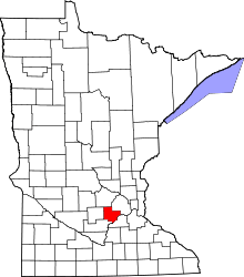 | |
| Townships | ||
| Unincorporated communities | ||
| Ghost town | ||
| Footnotes | ‡This populated place also has portions in an adjacent county or counties | |
Coordinates: 44°53′06″N 93°53′16″W / 44.88500°N 93.88778°W