Hamburg, Minnesota
| Hamburg, Minnesota | |
|---|---|
| City | |
 Location of the city of Hamburg within Carver County, Minnesota | |
| Coordinates: 44°44′1″N 93°57′59″W / 44.73361°N 93.96639°W | |
| Country | United States |
| State | Minnesota |
| County | Carver |
| Area[1] | |
| • Total | 0.23 sq mi (0.60 km2) |
| • Land | 0.23 sq mi (0.60 km2) |
| • Water | 0 sq mi (0 km2) |
| Elevation | 1,010 ft (308 m) |
| Population (2010)[2] | |
| • Total | 513 |
| • Estimate (2012[3]) | 517 |
| • Density | 2,230.4/sq mi (861.2/km2) |
| Time zone | Central (CST) (UTC-6) |
| • Summer (DST) | CDT (UTC-5) |
| ZIP code | 55339 |
| Area code(s) | 952 |
| FIPS code | 27-26666[4] |
| GNIS feature ID | 0644598[5] |
| Website | www.cityofhamburgmn.com |

Hamburg is a city in Carver County, Minnesota, United States. The population was 513 at the 2010 census.[6]

History
A post office has been in operation in Hamburg since 1881.[7] The city was named after Hamburg, in Germany.[8]
Geography
According to the United States Census Bureau, the city has a total area of 0.23 square miles (0.60 km2), all of it land.[1]
County Road 50 serves as a main route in Hamburg. Minnesota State Highways 5 and 25 are in close proximity to the city.
Demographics
| Historical population | |||
|---|---|---|---|
| Census | Pop. | %± | |
| 1900 | 136 | — | |
| 1910 | 153 | 12.5% | |
| 1920 | 153 | 0.0% | |
| 1930 | 195 | 27.5% | |
| 1940 | 198 | 1.5% | |
| 1950 | 184 | −7.1% | |
| 1960 | 288 | 56.5% | |
| 1970 | 405 | 40.6% | |
| 1980 | 475 | 17.3% | |
| 1990 | 492 | 3.6% | |
| 2000 | 538 | 9.3% | |
| 2010 | 513 | −4.6% | |
| Est. 2015 | 520 | [9] | 1.4% |
2010 census
As of the census[2] of 2010, there were 513 people, 201 households, and 134 families residing in the city. The population density was 2,230.4 inhabitants per square mile (861.2/km2). There were 222 housing units at an average density of 965.2 per square mile (372.7/km2). The racial makeup of the city was 94.9% White, 0.2% Native American, 0.2% Asian, 0.2% Pacific Islander, and 4.5% from other races. Hispanic or Latino of any race were 7.0% of the population.
There were 201 households of which 31.3% had children under the age of 18 living with them, 56.2% were married couples living together, 6.0% had a female householder with no husband present, 4.5% had a male householder with no wife present, and 33.3% were non-families. 24.4% of all households were made up of individuals and 9% had someone living alone who was 65 years of age or older. The average household size was 2.55 and the average family size was 3.09.
The median age in the city was 38.3 years. 24% of residents were under the age of 18; 8.3% were between the ages of 18 and 24; 28.1% were from 25 to 44; 26.1% were from 45 to 64; and 13.5% were 65 years of age or older. The gender makeup of the city was 52.2% male and 47.8% female.
2000 census
As of the census[4] of 2000, there were 538 people, 206 households, and 159 families residing in the city. The population density was 2,697.0 people per square mile (1,038.6/km²). There were 209 housing units at an average density of 1,047.7 per square mile (403.5/km²). The racial makeup of the city was 98.51% White, 0.19% African American, 0.19% Native American, 0.19% Pacific Islander, 0.74% from other races, and 0.19% from two or more races. Hispanic or Latino of any race were 2.42% of the population.
There were 206 households out of which 35.0% had children under the age of 18 living with them, 66.5% were married couples living together, 7.8% had a female householder with no husband present, and 22.8% were non-families. 19.9% of all households were made up of individuals and 9.2% had someone living alone who was 65 years of age or older. The average household size was 2.61 and the average family size was 2.99.
In the city the population was spread out with 24.9% under the age of 18, 8.2% from 18 to 24, 29.0% from 25 to 44, 22.5% from 45 to 64, and 15.4% who were 65 years of age or older. The median age was 37 years. For every 100 females there were 100.0 males. For every 100 females age 18 and over, there were 102.0 males.
The median income for a household in the city was $47,578, and the median income for a family was $50,673. Males had a median income of $37,250 versus $28,542 for females. The per capita income for the city was $21,221. About 4.8% of families and 5.6% of the population were below the poverty line, including 3.5% of those under age 18 and 15.6% of those age 65 or over.
Notable people
- Buck Zumhofe, professional wrestler
References
- 1 2 "US Gazetteer files 2010". United States Census Bureau. Retrieved 2012-11-13.
- 1 2 "American FactFinder". United States Census Bureau. Retrieved 2012-11-13.
- ↑ "Population Estimates". United States Census Bureau. Retrieved 2013-05-28.
- 1 2 "American FactFinder". United States Census Bureau. Retrieved 2008-01-31.
- ↑ "US Board on Geographic Names". United States Geological Survey. 2007-10-25. Retrieved 2008-01-31.
- ↑ "2010 Census Redistricting Data (Public Law 94-171) Summary File". American FactFinder. United States Census Bureau. Retrieved 27 April 2011.
- ↑ U.S. Geological Survey Geographic Names Information System: Hamburg Post Office
- ↑ Upham, Warren (1920). Minnesota Geographic Names: Their Origin and Historic Significance. Minnesota Historical Society. p. 83.
- ↑ "Annual Estimates of the Resident Population for Incorporated Places: April 1, 2010 to July 1, 2015". Retrieved July 2, 2016.
- ↑ "Census of Population and Housing". Census.gov. Retrieved June 4, 2015.
Municipalities and communities of Carver County, Minnesota, United States | ||
|---|---|---|
| Cities | 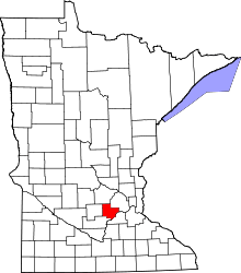 | |
| Townships | ||
| Unincorporated communities | ||
| Ghost town | ||
| Footnotes | ‡This populated place also has portions in an adjacent county or counties | |
Coordinates: 44°44′00″N 93°58′02″W / 44.73333°N 93.96722°W