Mattole
|
Mattole River in Humbodlt County | |
| Regions with significant populations | |
|---|---|
|
| |
| Languages | |
| English, historically Mattole |

The Mattole, including the Bear River Indians, are a group of Native Americans in California. Their traditional lands were along the Mattole and Bear Rivers near Cape Mendocino in Humboldt County, California.[1] A notable difference between the Mattole and other indigenous peoples of California is that the men traditionally had facial tattoos (on the forehead), while other local groups traditionally restricted facial tattooing to women.[2]
Name
Their Wailaki name was Tul'bush, meaning "foreigners." The Bear River Indians called themselves and the Mattole "Ni'ekeni'".[3]
Language
The Mattole spoke the Mattole language, an Athapaskan language that may have been closely related to that of their Eel River neighbors to the east.[4] According to linguist Victor Golla, the last surviving person who could speak the Mattole language died in the 1950s.[5]
Territory
Historically, the Mattole lived along the Mattole River in the valley of Humboldt County, northwestern California. The Mattole lived in the area for a few centuries, but carbon dating revealed that many native tribes have inhabited the land for over 6000 years.[6] Earliest accounts say that the Mattole have been in the region of the Bear River tribe since the 16th century.[7] From the mid-16th to the 19th centuries, the Mattole resided at the coast near the mouth of the river.[8]
The Mattole were only permanent residents of a particular area through the winter months. For the most part, however, the Mattole people traveled in single family bands, traveling as necessary according to food abundance and better climate conditions[6]—an easy feat with California's many microclimates.
Aboriginal Bear River villages included Tcalko', Chilsheck, Chilenche, Selsche'ech, Tlanko, Estakana, and Sehtla.
Geography
In the 1850s, Euro-American settlers started ranching and agricultural traditions on the land. This would inhibit contraction of disease and decrease the native Mattole tradition of relying on river resources.[9] Post World War II: Logging of Douglas fir became an increased practice for this period of building construction and the tax value of standing trees rose as well.[9] Since logging increased, more debris settled in the Mattole river, further damaging it.
From 1947 to 1988, the old-growth coniferous forest in the watershed was decreased by 90 percent. Because of the increased industrialism of this time period, road building led to a network of roads. The basin streams became destabilized. Forest practices, like the skidding of logs downstream channels became normal practice.[9] The streams and forestry along the Mattole were damaged as a result.
Logging boomed from 1955 to 1964 and two historically large floods greatly changed the structure of the Mattole streams. After the floods of 1964, sediment yields averaged 16,370 tons per square mile of watershed area, approximately .25 inches per year averaged across the watershed’s area.[9] At this time the erosion rates in the Mattole River were approximately 0.001 inches per year.[9] Erosion increases dirt and debris in the river, hindering waterflow and devastating the survival of the river’s living organisms.
The best spawning habitat areas for salmonid species were damaged in 1970 when the chain development of residential housing began. Large landowners divided their land into 40 to 200-acre squares for this development. As a result, the developments caused the transportation of sediment to slow and eventually fill great spawning habitat stream channels.[9]
Restoration
A 1959 survey from the U.S. Fish and Wildlife Service reported Mattole spawning runs were 10,000 Chinook salmon and 4,000 coho salmon. Later in 1964, a survey from the California Department of Fish and Game reported Mattole spawning runs were 10,000 Chinook salmon and 4,000 coho salmon.[9] During the 1980s, reports showed the Chinook salmon run fell to 3,000.[9] This number dropped even lower in 1990 and 1991, when Chinook salmon run fell to 100 and coho salmon fell to approximately 100 as well. The American Fisheries Society classified the species as “high risk for extinction”.[9]
1980: The Mattole Salmon Group (MSG) was formed by local residents. Their aim is to restore the native salmon populations.[10] The MSG created gravel-lined “hatchboxes” to substitute for the lost spawning habitat areas. Adult spawners were held until they had their eggs and these were incubated in the hatchboxes. This process jumped the survival rate of “egg-to-fry” from 15 percent to 80 percent.[9]
In 1981, local residents and activists began the Mattole salmon project by Freeman House.[11] They began incubating salmon eggs, clearing logjams and obstacles for fish migration and plant trees to sustain the riverbanks. They will choose to take care of the salmon before they work on their homesteads.[11]
Freeman House released the first Mattole Restoration Newsletter was issued in 1983. It’s concepts encouraged residents to fight for fine timber, abundant fish, productive grasslands, and rich and varied plant and animal communities.[9]
In 1983, the Mattole Restoration Council (MRC) was formed. Their purpose being to combine the restoration efforts with landowners and residents.[9] They issued “Elements of Recovery,” a catalog of prescriptions and erosional sources in 1987. It mapped and categorized areas of tributary drainage and erosional features on the watershed. This project revealed the number of roads, including both active and abandoned roads in the Mattole basin. Techniques and expertise for this project were developed at Redwood National Park.[9] In 1991, MRC’s Douglas fir reforestation project showed a survival rate of 70 to 80 percent. This increased shade, aiding in the hatching of eggs which require a cool temperature.[9]
Rock wing and small wing deflectors were installed and protected about 400 yards of the riverbank from 1977 to 1984. Of the structures, six created wide scour pools from 3 to 6 feet deep, with shade from overhead riparian vegetation.[9]
Headwater Channel Species
From the early 1960s to 1999, the Southern torrent salamander was encountered in undisturbed slow-flowing water.[12]
In 1997, timber harvesting limited the ancient pacific tailed frogs in the headwater channels causing the species become endangered.[12]
In 2005, the pacific tailed frogs could be found in small population sizes along old-growth forests.[12] Their small populations are scattered along the river, because of heightened water temperatures. These temperature highs are above the level for egg development during the summer when these frogs oviposit under stream substrates.[12] The pacific tailed frogs are also endangered, because they have morphological adaptations and biophysical constraints with temperatures so they’re ecologically dependent.[12]
Reptiles of Mattole River
In 2005, Foothill yellow-legged frog were commonly encountered in all channels of the river. Their tadpoles are found increasingly at temperatures above 13 degrees Celsius.[12] The adults are often found in open sun, basking on “gravel bars, boulders and cobbles,” because they are “heliotherms” (their body temperature warms by sun’s rays). Their eggs are deposited in shallow water in open sunlight near their cobbles and boulders. Rough-skinned newts can be found in headwater channels or terrestrial habitats.[12]
In 2010, Western fence lizards are found along alluvial channels of the river. This number increases as the water temperature and the level of sediment increases. They stay near the warmer climates because their invertebrate prey is more accessible here.[12]
Way of Life
The Mattole’s main food source has always been salmon. Salmon was a main food source because the Mattole were located along the Mattole river, which was abundant with Salmon. This also meant that the Mattole did not travel far from the river because that would mean abandoning their food source.[13]
From the beginning of the tribe’s 16th-century arrival in what is now Humboldt County, Mattole villages were essentially collective groups of families settling in close proximity over winter months.[6] For the most part however, the Mattole people would travel in single family bands where necessary according to food abundance and better climate conditions,[6] an easy feat with California’s many microclimates. As warmer seasons set in the Mattole Valley, the Mattole would separate into their primary familial groups, becoming gatherers of vegetation more—so than hunters as they would in colder months.[6] As James Roscoe observed, "the simple family was by far the single most important social unit in Mattole society." [6]
Tribes dealt with politics by electing tribesmen according to wealth and problem-solving skills rather than through bloodlines; These “chiefs,” as they were later named, weren’t complete rulers, but leaders of a democracy who made suggestions that would be taken into account by the rest of the tribe and decided upon through popular vote.[6]
Among the Mattole, conduct toward waves is prescribed: That water watches you and has a definite attitude, favorable or otherwise towards you. Do not speak just before a wave breaks. Do not speak to passing rough water in a stream. Do not look at water very long for any one time, unless you have been to this spot ten times or more. Then the water there is used to you and does not mind if you're looking at it. Older men can talk in the presence of the water because they have been about so long that the water knows them. Until the water at any spot does know you, however, it becomes very rough if you talk in its presence or look at it too long.
Post-contact history
In the mid- to late-19th century, tensions rose between white settlers and the Native Americans. In 1856 the Mendocino reservation was established for the Indian tribes. It ranged from Mendocino county to Bear River.[6] When the white settlers began establishing their homes in the Mattole valley in 1857, there was much conflict among the Indian tribes. The white settlers argued that the reservation was claiming lands that it should not be. The Mattole felt threatened because the white settlers were moving into their area and taking their women. The white settlers and Indian tribes—including the Mattole, were ruthlessly killing each other. Prison camps housed many Mattole and other Native Americans. On September 4, 1858, amidst the constant fighting, the Mattole Valley Treaty of Peace was established.[14]
Although the treaty seemed to be keeping the peace among both groups, it eventually became useless in 1859 when the reservation was no longer considered a reservation and more white settlers were coming in.[6]
Population
Estimates for the pre-contact populations of most native groups in California have varied substantially. (See Population of Native California.) Alfred L. Kroeber put the 1770 population of the Mattole at 500.[15] Sherburne F. Cook estimated the combined populations of the Mattole, Whilkut, Nongatl, Sinkyone, Lassik, and Kato at 4,700, at least 50% higher than Kroeber's figure for the same groups.[16] Martin A. Baumhoff estimated the aboriginal Mattole-Bear River population as 2,476.[17]
The Mattole federal reservation, the Rohnerville Rancheria, located south of Eureka, reported a population of 29 in the 2000 census.
The most recent US Census Bureau tabulation in 2010 reported that there were 14 members.[18]
Tribe today
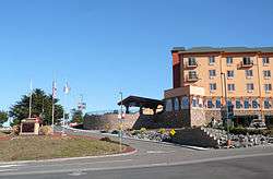
The Bear River Band of the Rohnerville Rancheria is now organized as a federally recognized tribe. It is located Humboldt County, California.[19] The Bear River Band of Rohnerville Rancheria currently has 525 Enrolled Tribal Citizens, and enrollment into the Bear River Band is based on lineal descent and residency of the rancheria.[20] The Bear River Band is governed by a Tribal Council, compromised by seven members who are elected to terms to terms to four years. The current Chairman is William Sand and the current Vice Chairman is Dakota McGinnis.[21] The tribe publishes the Bear River Bulletin newspaper for its members and also provides various services for the wellbeing of its members such as, social services, housing, economic development, and even day care.[22] The tribe operates the Bear River Casino, also in Loleta.[23]
The Bear River Band is continuously trying to protect their cultural resources and ancestral territory. The Tribal Historic Officer (THPO) is in charge of the Tribal Historic Preservation Plans, which “emphasize the importance of the oral tradition, as well as consulting Tribal elders and spiritual leaders with special knowledge of the Tribe's traditions. They also have given emphasis to the importance of protecting 'traditional cultural properties,' places that are eligible for inclusion on the National Register of Historic Places because of their association with cultural practices and beliefs that are: (1) rooted in the history of the community; and, (2) are important to maintaining the continuity of that community's traditional beliefs and practices”.[24]
See also
References
- ↑ Powers, Stephen (1976) [1877]. Tribes of California. Intro. and Annotations by Robert Heizer. Berkeley and Los Angeles, CA USA: University of California Press. p. 107. ISBN 0-520-03172-5.
- ↑ Powers, Stephen (1976) [1877]. Tribes of California. Intro. and Annotations by Robert Heizer. Berkeley and Los Angeles, CA USA: University of California Press. p. 109. ISBN 0-520-03172-5.
- ↑ John R. Swanton (1953). The Indian Tribes of North America - California. Bureau of American Ethnology Bulletin. 145. Retrieved 2012-09-04.
- ↑ Powers, Stephen (1976) [1877]. Tribes of California. Intro. and Annotations by Robert Heizer. Berkeley and Los Angeles, CA USA: University of California Press. p. 108. ISBN 0-520-03172-5.
- ↑ Golla, Victor. 2011. California Indian Languages. University of California Press, 2011. Sociolinguistic description of aboriginal languages of California.
- 1 2 3 4 5 6 7 8 9 Cooskey, Laura. "So... What Happened to the Natives Here?" Pdf. Accessed 18 May 2014.
- ↑ Bussel, Gordon. "The Mattole." Accessed February 16, 2014.
- ↑ California Coastal Commission. 1987. "California Coastal Resource Guide." State of California.
- 1 2 3 4 5 6 7 8 9 10 11 12 13 14 15 Buran, C. (2001). Efforts to restore the Mattole River and its watershed. Restoration and Reclamation Review, 7(4)
- ↑ http://www.mattolesalmon.org/index.php/the-mattole-watershed/93
- 1 2 Zuckerman, S. (1988). Restoration ecology: Living according to nature. Nation, 247(10), 340-342. Retrieved from http://search.ebscohost.com.libaccess.sjlibrary.org/login.aspx?direct=true&db=aph&AN=8800018601&site=ehost-live
- 1 2 3 4 5 6 7 8 Welsh Jr., H. H., Hodgson, G. R., & Lind, A. J. (2005). Ecogeography of the herpetofauna of a northern california watershed: Linking species patterns to landscape processes. Ecography, 28(4), 521-536. doi:10.1111/j.0906-7590.2005.04024.x
- ↑ Bussel, Gordon. n.d. The Mattole. http://www.mattolehistory.org/The_Mattole.pdf (accessed February 16, 2014).
- ↑ Bledsoe, Anthony Jennings. 1885. Indian Wars of the Northwest: A California Sketch. Bacon and Company. Print.
- ↑ Kroeber, A. L. 1925. Handbook of the Indians of California. Bureau of American Ethnology Bulletin No. 78. Washington, D.C. Page 883.
- ↑ Cook, Sherburne F. 1976a. The Conflict between the California Indian and White Civilization. University of California Press, Berkeley.
- ↑ Baumhoff, Martin A. 1958. "California Athabascan Groups". Anthropological Records 16:157-238. University of California, Berkeley.
- ↑ US Census Bureau. (2013) Table 19. American Indian and Alaska Native Population by Tribe for California: 2010. U.S. Census Bureau, Census 2010, special tabulation
- ↑ "Geographic Names Information Systems". Retrieved 19 May 2014.
- ↑ "Bear River Band". Retrieved 19 May 2014.
- ↑ "Council". Retrieved 19 May 2014.
- ↑ "Departments". Retrieved 19 May 2014.
- ↑ Bear River Casino. 500 Nations. (retrieved 24 Feb 2009)
- ↑ "Tribal Historic Preservation Programs". Retrieved 19 May 2014.
External links
- Mattole language overview at the Survey of California and Other Indian Languages
|