María Elena
| María Elena | |||||
|---|---|---|---|---|---|
| City and Commune | |||||
| |||||
| Coordinates: 22°10′S 69°25′W / 22.167°S 69.417°WCoordinates: 22°10′S 69°25′W / 22.167°S 69.417°W | |||||
| Country |
| ||||
| Region |
| ||||
| Province | Tocopilla | ||||
| Settled | approx. 1920 | ||||
| Government[1][2] | |||||
| • Type | Municipality | ||||
| • Alcalde | Jorge Godoy Bolvarán (PS) | ||||
| Area[3] | |||||
| • Total | 12,197.2 km2 (4,709.4 sq mi) | ||||
| Elevation | 1,155 m (3,789 ft) | ||||
| Population (2012)[3] | |||||
| • Total | 4,543 | ||||
| • Density | 0.37/km2 (0.96/sq mi) | ||||
| • Urban | 7,412 | ||||
| • Rural | 118 | ||||
| Sex[3] | |||||
| • Male | 7,298 | ||||
| • Female | 3,232 | ||||
| Time zone | CLT (UTC−4) | ||||
| • Summer (DST) | CLST (UTC−3) | ||||
| Area code(s) | 56 + 55 | ||||
| Website | Municipality of María Elena | ||||

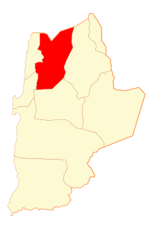
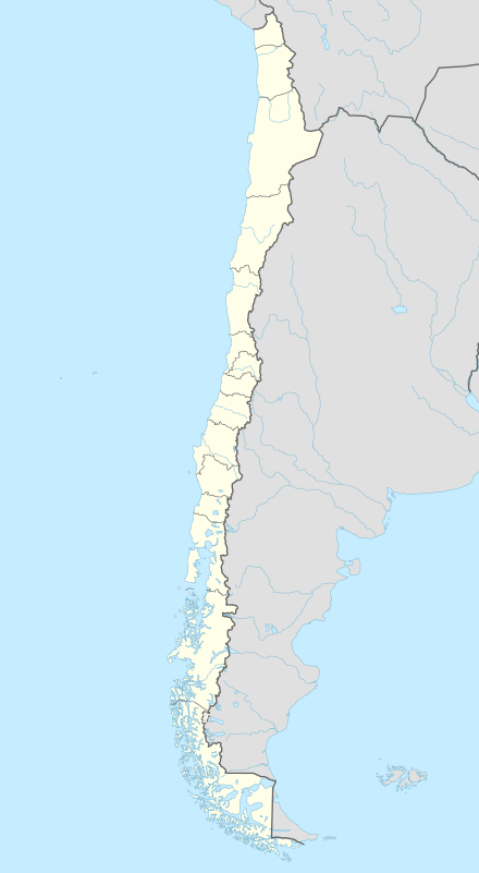
María Elena is a Chilean city and commune in Tocopilla Province, Antofagasta Region. According to the 2012 census, the commune population was 4,593 and has an area of 12,197.2 km2 (4,709 sq mi).[3]
History
Maria Elena is named after Mary Ellen Comdon, wife of the first saltpeter refinery office (oficina salitre) manager, Elias Cappelens. Originally, the name of the office was "Coya Norte". Situated on land purchased from the Treasury in 1924, the plant was inaugurated in 1926 with the sodium nitrate extraction system patented by the Guggenheim Brothers, which replaced the Shanks system. Its layout was made on the basis of the flag of the United Kingdom. Together with the former refinery at Pedro de Valdivia built in 1931, they were the largest saltpeter refineries with a combined output of over one million tons per year.
In 1965 both were taken over by the state, through Sociedad Química y Minera (SQM or "Chemistry and Mining Society", which was privatized in 1980. This privatization explains why most people's land and buildings are owned by SQM and not the Chilean state.
In 1996, it became the only active mining community in the country after the closure of the saltpeter office at Pedro de Valdivia. After the closure of the latter office, many workers and their families were relocated to Maria Elena.
On November 14, 2007, the 7.7 Mw Tocopilla earthquake with an epicenter 80 km (50 mi) north of Maria Elena, devastated the area. Almost all the town's old houses collapsed or were rendered uninhabitable, and the local hospital almost completely collapsed with no loss of life or injuries[4]
Demographics
According to the 2002 census of the National Statistics Institute María Elena had 7,530 inhabitants; of these, 7,412 (98.4%) lived in urban areas and 118 (1.6%) in rural areas. At that time, there were 4,298 men and 3,232 women. By 2002, the population had fallen 44.9% (124,130 persons) since the 1992 census of 13,660.[3]
The commune of María Elena is composed of six census districts.
| Census district | 1992 Census | 2002 Census | ||||||
|---|---|---|---|---|---|---|---|---|
| # | District | Area (km2) | Total | Urban | Rural | Total | Urban | Rural |
| 1 | Quillagua | 4,014.7 | 103 | 0 | 103 | 127 | 0 | 127 |
| 2 | Rica Aventura | 1,480.0 | 0 | 0 | 0 | 0 | 0 | 0 |
| 3 | Toco | 1,937.5 | 11 | 0 | 11 | 4 | 0 | 4 |
| 4 | María Elena | 1,475.0 | 7,413 | 7,412 | 1 | 2,556 | 2,553 | 3 |
| 5 | Francisco Vergara | 805.0 | 1 | 0 | 1 | 1 | 0 | 1 |
| 6 | Pedro de Valdivia | 2,485.0 | 2 | 0 | 2 | 1 | 0 | 1 |
| Total | 12,197.2 | 7,530 | 7,412 | 118 | 2,689 | 2,553 | 136 | |
Source: INE 2007 report, "Territorial division of Chile"[5]
Administration
As a commune, María Elena is a third-level administrative division of Chile administered by a municipal council, headed by an alcalde who is directly elected every four years. The 2008-2012 alcalde is Jorge Godoy Bolvarán (PS), and the council has the following members:[1][2]
- Carlos Hidalgo Marfull
- Nelson Avendaño Véliz
- Jaqueline Godoy Soto
- Jorge Ramirez Plaza
- Carlos Ardiles Aceituno
- Andrés Concha F.
Within the electoral divisions of Chile, María Elena is represented in the Chamber of Deputies by Marcos Espinosa (PRSD) and Felipe Ward (UDI) as part of the 3rd electoral district, (together with Tocopilla, Calama, Ollagüe and San Pedro de Atacama). The commune is represented in the Senate by Carlos Cantero Ojeda (Ind.) and José Antonio Gómez (PRSD) as part of the 2nd senatorial constituency (Antofagasta Region).
See also
References
- 1 2 "Municipality of María Elena" (in Spanish). Retrieved 27 January 2011.
- 1 2 "Asociación Chilena de Municipalidades" (in Spanish). Retrieved 27 January 2011.
- 1 2 3 4 5 (Spanish) Instituto Nacional de Estadísticas
- ↑ "El hospital se vino abajo" (in Spanish). 15 November 2007. Retrieved 27 October 2010.
- ↑ "Territorial division of Chile" (PDF). Retrieved 11 September 2010.
External links
- (Spanish) Municipality of María Elena
